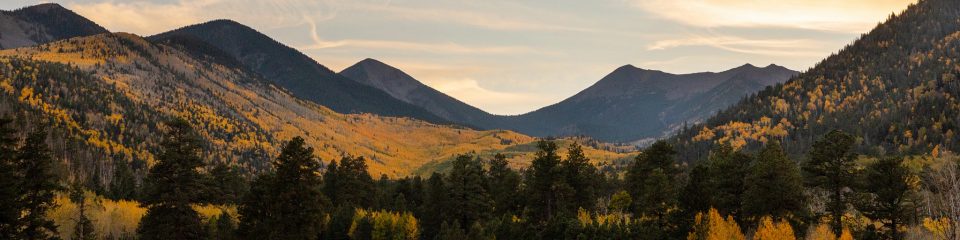
School of Earth & Sustainability
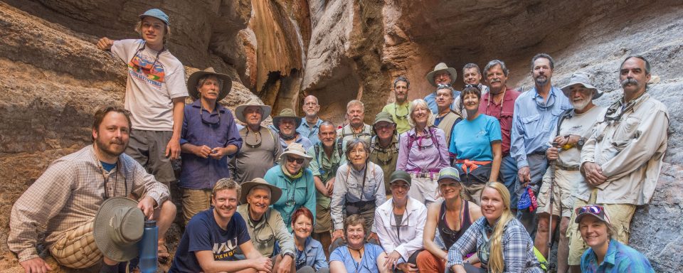
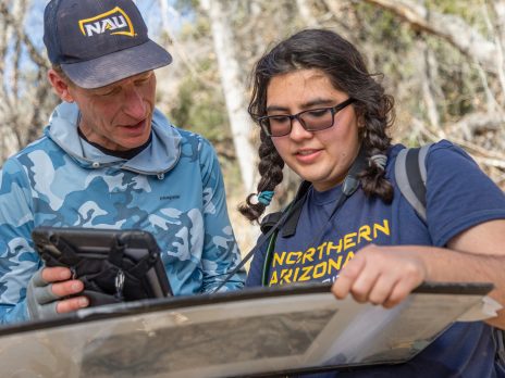
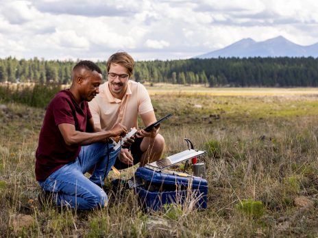
Integrating physical, biological, and social perspectives on our changing earth: At Northern Arizona University, we train undergraduate and graduate students to be leading researchers and practitioners in geology, environmental sciences, and sustainability, often collaborating across disciplinary boundaries. Our students spend time learning in the field, working on cutting-edge research, and collaborating with agencies.
Explore our degrees
We offer undergraduate degrees and minors in Geology, Environmental Sciences, and Environmental & Sustainability Studies, as well as a minor in Climate Science.
We offer Master’s programs in Geology, Environmental Sciences & Policy, and Climate Science & Solutions, and a PhD program in Earth Sciences & Environmental Sustainability.
Explore our professional certificates
Explore research across the School

SES Statement on Diversity, Equity, and Inclusion
In SES, we value diversity in race and ethnicity; gender identity, expression, and sexual orientation; socio-economic and cultural background; religious beliefs; physical abilities; ages; nationalities; and life experiences. Our community is committed to nurturing an environment where people of all backgrounds and identities are welcomed and treated with equity and respect. We are committed to removing institutional barriers and entrenched dynamics that often prevent participation from underrepresented groups in STEM fields, and to take every opportunity to highlight and make visible the existing contributions of a wider diversity of people to our disciplines. In doing so we seek to improve diversity, equity, and inclusion in our School. Our efforts include a broad array of initiatives and goals, which are listed in our full Statement on Diversity, Equity, and Inclusion.
SES in the news
For more news (with photos!) about our faculty, students, and alumni, see our News page.
The latest:
Listen to a KNAU story on life in Antarctica by NAU SES student Clare Gibson
Join us for an expert panel at the Annual Student Water Symposium on the Freshwater Challenge, April 11
PhD student Phoenix Eskridge-Aldama contributes to urban planning for climate change adaptation
NAU launches new professional certificate in GHG accounting
Recent publications
| Faculty | Year | Publication |
|---|---|---|
| Aslan | 2023 | N Otto, M Brunson, C Aslan. 2023. Disturbance and Invasive Plant Occurrence along High-Elevation Boundaries Surrounding California Protected Areas, Natural Areas Journal 43 (1), 72-77. |
| Biggs | 2023 | Y Gao, Y Liu, Y Luo, D Biggs, W Zhao, SG Clark. 2023. Tracking Chinese newspaper coverage of elephant ivory through topic modeling, Conservation Biology . |
| Biggs | 2023 | H Cheung, YP Feng, A Hinsley, TM Lee, HP Possingham, SN Smith, et al.. 2023. Understanding China's political will for sustainability and conservation gains, People and Nature . |
| Erb | 2023 | Z Jiang, CM Brierley, J Bader, P Braconnot, MP Erb, PO Hopcroft, D Jiang, et al.. 2023. No consistent simulated trends in the Atlantic Meridional Overturning Circulation for the past 6,000 years, Authorea Preprints . |
| Kaufman | 2023 | PG Albano, Q Hua, DS Kaufman, M Zuschin. 2023. Young death assemblages with limited time-averaging in rocky and Posidonia oceanica habitats in the Mediterranean Sea, Geological Society, London, Special Publications 529 (1), SP529-2022-224. |
| Radonic | 2023 | L Radonic, A Zuniga-Teran. 2023. When Governing Urban Waters Differently: Five Tenets for Socio-Environmental Justice in Urban Climate Adaptation Interventions, Sustainability 15 (2), 1598. |
| Radonic | 2023 | L Goralnik, L Radonic, V Garcia Polanco, A Hammon. 2023. Growing Community: Factors of Inclusion for Refugee and Immigrant Urban Gardeners, Land 12 (1), 68. |
| Aslan | 2022 | LM McCabe, CE Aslan, NS Cobb. 2022. Decreased bee emergence along an elevation gradient: Implications for climate change revealed by a transplant experiment, Ecology 103 (2), e03598. |
| Aslan | 2022 | CT Liang, AB Shiels, WP Haines, ME Sandor, CE Aslan. 2022. Invasive predators affect community‐wide pollinator visitation, Ecological Applications 32 (2), e2522. |
| Aslan | 2022 | CE Aslan, S Veloz, RS Epanchin-Niell, MW Brunson, BA Sikes. 2022. Integrating Social and Ecological Predictors to Understand Variation within Ecosystems: A Case Study of the Great Smoky Mountains National Park PACE, Natural Areas Journal 42 (4), 284-292. |
| Aslan | 2022 | S Sterner, C Aslan, R Best, T Chaudhry. 2022. Forest management effects on vegetation regeneration after a high severity wildfire: A case study in the southern Cascade range, Forest Ecology and Management 520, 120394. |
| Aslan | 2022 | B Tiffany, T Chaudhry, RW Hofstetter, C Aslan. 2022. The Impact of Administrative Partitioning on the Regional Effectiveness of Forest Pest Management in Protected Area-Centered Ecosystems, Forests 13 (3), 395. |
| Aslan | 2022 | RD Moseley, AB Shiels, A Aue, WP Haines, CE Aslan, CT Liang. 2022. Hawaiian hoary bat responses to habitat, season, and non‐native insectivore suppression, The Journal of Wildlife Management 86 (2), e22164. |
| Aslan | 2022 | CE Aslan, L Zachmann, RS Epanchin-Niell, MW Brunson, S Veloz, et al.. 2022. Soil characteristics and bare ground cover differ among jurisdictions and disturbance histories in Western US protected area-centered ecosystems, Frontiers in Ecology and Evolution 10, 1053548. |
| Aslan | 2022 | C Aslan, S Souther. 2022. The interaction between administrative jurisdiction and disturbance on public lands: Emerging socioecological feedbacks and dynamics, Journal of Environmental Management 319, 115682. |
| Aslan | 2022 | S Souther, M Sample, G Conley, C Aslan. 2022. Demographic Analysis of the Endangered Plant Pectis imberbis Highlights Tradeoffs between Deer Browse and Interspecific Competition, Natural Areas Journal 42 (3), 230-241. |
| Aslan | 2022 | CE Aslan, KA Haubensak, KC Grady. 2022. Effective and feasible mechanisms to support native invertebrate pollinators in agricultural landscapes: A meta‐analysis, Ecosphere 13 (3), e3982. |
| Best | 2022 | HF Cooper, RJ Best, LV Andrews, JPM Corbin, I Garthwaite, KC Grady, et al.. 2022. Evidence of climate‐driven selection on tree traits and trait plasticity across the climatic range of a riparian foundation species, Molecular Ecology 31 (19), 5024-5040. |
| Best | 2022 | M Eisenring, RJ Best, MR Zierden, HF Cooper, M Norstrem, TG Whitham, et al.. 2022. Genetic divergence along a climate gradient shapes chemical plasticity of a foundation tree species to both changing climate and herbivore damage, Global Change Biology . |
| Best | 2022 | S Sterner, C Aslan, R Best, T Chaudhry. 2022. Forest management effects on vegetation regeneration after a high severity wildfire: A case study in the southern Cascade range, Forest Ecology and Management 520, 120394. |
| Best | 2022 | CS Bodine, D Buscombe, RJ Best, JA Redner, AJ Kaeser. 2022. PING‐Mapper: Open‐Source Software for Automated Benthic Imaging and Mapping Using Recreation‐Grade Sonar, Earth and Space Science 9 (9), e2022EA002469. |
| Biggs | 2022 | A Braczkowski, R Schenk, D Samarasinghe, D Biggs, A Richardson, et al.. 2022. Leopard and spotted hyena densities in the Lake Mburo National Park, southwestern Uganda, PeerJ 10, e12307. |
| Biggs | 2022 | NL Hammond, A Dickman, D Biggs. 2022. Examining attention given to threats to elephant conservation on social media, Conservation Science and Practice 4 (10), e12785. |
| Biggs | 2022 | KS Pereira, L Gibson, D Biggs, D Samarasinghe, AR Braczkowski. 2022. Individual Identification of Large Felids in Field Studies: Common Methods, Challenges, and Implications for Conservation Science, Frontiers in Ecology and Evolution 350. |
| Biggs | 2022 | SG Wilson, D Biggs, S Kark. 2022. Protecting an icon: Javan rhinoceros frontline management and conservation, Oryx 56 (1), 101-107. |
| Biggs | 2022 | D Biggs, AJ Peel, C Astaras, A Braczkowski, H Cheung, CY Choi, et al.. 2022. Governance Principles for the Wildlife Trade to Reduce Spillover and Pandemic Risk, Available at SSRN 4304582. |
| Biggs | 2022 | SH Cheng, JE Robinson, SLA Öckerman, NA Cox, A Olsson, D Biggs, et al.. 2022. What is the current state of knowledge and distribution of evidence on established policies and programs to regulate international wildlife trade? A systematic map protocol, SocArXiv . |
| Dickson | 2022 | L Comte, JD Olden, S Lischka, BG Dickson. 2022. Multi-scale threat assessment of riverine ecosystems in the Colorado River Basin, Ecological Indicators 138, 108840. |
| Dickson | 2022 | CA Starbuck, BG Dickson, CL Chambers. 2022. Informing wind energy development: Land cover and topography predict occupancy for Arizona bats, Plos one 17 (6), e0268573. |
| Erb | 2022 | CC Routson, MP Erb, NP McKay. 2022. High latitude modulation of the Holocene North American monsoon, Geophysical Research Letters 49 (16), e2022GL099772. |
| Erb | 2022 | MP Erb, NP McKay, N Steiger, S Dee, C Hancock, RF Ivanovic, et al.. 2022. Reconstructing Holocene temperatures in time and space using paleoclimate data assimilation, Climate of the Past 18 (12), 2599-2629. |
| Fegyveresi | 2022 | J Gille-Petzoldt, K Gohl, G Uenzelmann-Neben, J Grützner, JP Klages, et al.. 2022. West Antarctic Ice Sheet Dynamics in the Amundsen Sea Sector since the Late Miocene—Tying IODP Expedition 379 Results to Seismic Data, Frontiers in Earth Science 10 (976703). |
| Fegyveresi | 2022 | J Fegyveresi. 2022. Carbon Sequestration Through Ponderosa Pine Reforestation, The Earth Scientist 39 (2), 44. |
| Gaherty | 2022 | ZC Eilon, JB Gaherty, L Zhang, J Russell, S McPeak, J Phillips, et al.. 2022. The Pacific OBS research into convecting asthenosphere (ORCA) experiment, Seismological Research Letters 93 (1), 477-493. |
| Gaherty | 2022 | JB Russell, JB Gaherty, HF Mark, G Hirth, LN Hansen, D Lizarralde, et al.. 2022. Seismological Evidence for Girdled Olivine Lattice‐Preferred Orientation in Oceanic Lithosphere and Implications for Mantle Deformation Processes During Seafloor Spreading, Geochemistry, Geophysics, Geosystems 23 (10), e2022GC010542. |
| Gaherty | 2022 | ZC Eilon, L Zhang, JB Gaherty, DW Forsyth, JB Russell. 2022. Sub‐Lithospheric Small‐Scale Convection Tomographically Imaged Beneath the Pacific Plate, Geophysical Research Letters 49 (18), e2022GL100351. |
| Gaherty | 2022 | CJW Carchedi, JB Gaherty, SC Webb, DJ Shillington. 2022. Investigating Short‐Period Lake‐Generated Microseisms Using a Broadband Array of Onshore and Lake‐Bottom Seismometers, Seismological Society of America 93 (3), 1585-1600. |
| Gaherty | 2022 | JB Russell, JB Gaherty, H Mark, G Hirth, L Hansen, D Lizarralde, et al.. 2022. Seismological evidence for grain-size sensitive olivine deformation during mid-ocean ridge spreading, Authorea Preprints . |
| Gaherty | 2022 | HA Janiszewski, Z Eilon, JB Russell, B Brunsvik, JB Gaherty, SG Mosher, et al.. 2022. Broad-band ocean bottom seismometer noise properties, Geophysical Journal International 233 (1), 297-315. |
| Gaherty | 2022 | J Byrnes, J Gaherty, E Hopper. 2022. Seismic Architecture of the Lithosphere-Asthenosphere System in the Western United States from a Joint Inversion of Body-and Surface-wave Observations: Distribution of Partial …, EarthArXiv . |
| Hoisch | 2022 | SR Mulligan, ML Wells, TD Hoisch, A Salamat, C Childs, O Tschauner, et al.. 2022. Deviation between quartz‐in‐garnet elastic geobarometry and equilibrium‐based pressure–temperature modelling in Barrovian metamorphic rocks, Journal of Metamorphic Geology 40 (6), 1067-1086. |
| Huntzinger | 2022 | Z Hu, S Piao, AK Knapp, X Wang, S Peng, W Yuan, S Running, J Mao, et al.. 2022. Decoupling of greenness and gross primary productivity as aridity decreases, Remote Sensing of Environment 279, 113120. |
| Huntzinger | 2022 | MA Xenopoulos, A Desai, D Huntzinger, A Bastos, S Fawcett, D Sahagian, et al.. 2022. Statement of Contribution to Diversity, Equity, and Inclusion for JGR: Biogeosciences, Journal of Geophysical Research: Biogeosciences 127 (2), e2022JG006791. |
| Huntzinger | 2022 | JB Fisher, M Sikka, GL Block, CR Schwalm, NC Parazoo, HR Kolus, et al.. 2022. The terrestrial biosphere model farm, Journal of Advances in Modeling Earth Systems 14 (2), e2021MS002676. |
| Huntzinger | 2022 | Z Chen, S Miller, J Liu, DK Henze, DN Huntzinger, KC Wells. 2022. Exploring the environmental drivers of global terrestrial CO2 fluxes inferred from OCO-2 and a geostatistical inverse model, Authorea Preprints . |
| Huntzinger | 2022 | MA Xenopoulos, AR Desai, D Huntzinger. 2022. Past to Present: an Update to the Aims and Scope of JGR: Biogeosciences, Journal of Geophysical Research (Biogeosciences) 127 (6), e07021. |
| Huntzinger | 2022 | AR Desai, MA Xenopoulos, D Huntzinger. 2022. Letter of appreciation to our 2021 reviewers, Journal of Geophysical Research: Biogeosciences 127 (4), e2022JG006815. |
| Huntzinger | 2022 | B Poulter, A Bastos, JG Canadell, P Ciais, D Huntzinger, RA Houghton, et al.. 2022. Bottom-up approaches for estimating terrestrial GHG budgets: Bookkeeping, process-based modeling, and data-driven methods, Balancing Greenhouse Gas Budgets 59-85. |
| Joyal | 2022 | K Guetz, T Joyal, B Dickson, D Perry. 2022. Prioritizing dams for removal to advance restoration and conservation efforts in the western United States, Restoration Ecology 30 (5), e13583. |
| Kaufman | 2022 | K Agiadi, M Azzarone, Q Hua, DS Kaufman, D Thivaiou, PG Albano. 2022. The taphonomic clock in fish otoliths, Paleobiology 48 (1), 154-170. |
| Kaufman | 2022 | EE Berg, DS Kaufman, RS Anderson, GC Wiles, TV Lowell, EAD Mitchell, et al.. 2022. Late-Glacial and Holocene Lake-Level Fluctuations on the Kenai Lowland, Reconstructed from Satellite-Fen Peat Deposits and Ice-Shoved Ramparts, Kenai Peninsula, Alaska, Quaternary 5 (2), 23. |
| Kaufman | 2022 | PG Albano, A Sabbatini, J Lattanzio, JF Päßler, J Steger, Q Hua, et al.. 2022. Alleged Lessepsian foraminifera prove native and suggest Pleistocene range expansions into the Mediterranean Sea, Marine ecology progress series 700, 65-78. |
| Kaufman | 2022 | R Neukom, N Steiger, D Kaufman, M Grosjean. 2022. Inconsistent comparison of temperature reconstructions over the Common Era, Dendrochronologia 74, 125965. |
| Kaufman | 2022 | E Broadman, DS Kaufman, RS Anderson, S Bogle, M Ford, D Fortin, et al.. 2022. Reconstructing postglacial hydrologic and environmental change in the eastern Kenai Peninsula lowlands using proxy data and mass balance modeling, Quaternary Research 107, 1-26. |
| Kaufman | 2022 | DS Kaufman, NP McKay. 2022. Past and future warming–direct comparison on multi-century timescales, Climate of the Past 18 (4), 911-917. |
| Kaufman | 2022 | DW Chamberlin, VR Shervette, DS Kaufman, JE Bright, WF Patterson III. 2022. Can Amino Acid Racemization Be Utilized for Fish Age Validation?, Canadian Journal of Fisheries and Aquatic Sciences . |
| Kaufman | 2022 | E Millman, L Wheeler, K Billups, D Kaufman, KEH Penkman. 2022. Testing the effect of oxidizing pre-treatments on amino acids in benthic and planktic foraminifera tests, Quaternary Geochronology 73, 101401. |
| Kaufman | 2022 | G West, DS Kaufman, M Jakobsson, M O'Regan. 2022. Amino acid racemization in Neogloboquadrina pachyderma and Cibicidoides wuellerstorfi from the Arctic Ocean and its implications for age models, Geochronology Discussions 1-24. |
| Kaufman | 2022 | T Chauhan, HP Sejrup, BO Hjelstuen, DS Kaufman, I Baig, BTI Reinardy. 2022. Chronology of Early to Mid-Pleistocene sediments in the northern North Sea: New evidence from amino acid and strontium isotope analyses, Quaternary Geochronology 71, 101336. |
| Kaufman | 2022 | D Lunt, A Haywood, D Kaufman. 2022. The Pliocene in the IPCC: AR6 and thoughts on AR7I, GC C10-Pliocene. |
| Kaufman | 2022 | LJ Davies, BJL Jensen, DS Kaufman. 2022. Late Holocene cryptotephra and a provisional 15 000-year Bayesian age model for Cascade Lake, Alaska, Geochronology 4 (1), 121-141. |
| Kaufman | 2022 | SR Durham, GP Dietl, Q Hua, JC Handley, D Kaufman, CP Clark. 2022. Age variability and time averaging in oyster reef death assemblages, bioRxiv 2022.11. 05.515182. |
| McKay | 2022 | JK Pearman, SA Wood, MJ Vandergoes, J Atalah, S Waters, J Adamson, et al.. 2022. A bacterial index to estimate lake trophic level: National scale validation, Science of the Total Environment 812, 152385. |
| McKay | 2022 | DM Thompson, JL Conroy, BL Konecky, S Stevenson, KL DeLong, et al.. 2022. Identifying Hydro‐Sensitive Coral δ18O Records for Improved High‐Resolution Temperature and Salinity Reconstructions, Geophysical Research Letters 49 (9), e2021GL096153. |
| McKay | 2022 | CC Routson, MP Erb, NP McKay. 2022. High latitude modulation of the Holocene North American monsoon, Geophysical Research Letters 49 (16), e2022GL099772. |
| McKay | 2022 | E Broadman, DS Kaufman, RS Anderson, S Bogle, M Ford, D Fortin, et al.. 2022. Reconstructing postglacial hydrologic and environmental change in the eastern Kenai Peninsula lowlands using proxy data and mass balance modeling, Quaternary Research 107, 1-26. |
| McKay | 2022 | DS Kaufman, NP McKay. 2022. Past and future warming–direct comparison on multi-century timescales, Climate of the Past 18 (4), 911-917. |
| McKay | 2022 | MP Erb, NP McKay, N Steiger, S Dee, C Hancock, RF Ivanovic, et al.. 2022. Reconstructing Holocene temperatures in time and space using paleoclimate data assimilation, Climate of the Past 18 (12), 2599-2629. |
| McKay | 2022 | RM Walter, HR Sayani, T Felis, KM Cobb, NJ Abram, AK Arzey, et al.. 2022. The CoralHydro2k Database: a global, actively curated compilation of coral δ18O and Sr / Ca proxy records of tropical ocean hydrology and temperature for the …, Earth System Science Data Discussions 1-56. |
| McKay | 2022 | S Manety, D Khider, C Heiser, N McKay, J Emile-Geay, C Routson. 2022. PaleoRec: A sequential recommender system for the annotation of paleoclimate datasets, Environmental Data Science 1, e4. |
| Mueller | 2022 | RA Fitch, JM Mueller, R Ruiz, W Rousse. 2022. Recreation matters: Estimating millennials’ preferences for native American cultural tourism, Sustainability 14 (18), 11513. |
| Mueller | 2022 | JM Mueller, JB Loomis, L Richardson, RA Fitch. 2022. Valuing impacts of proximity to Saguaro National Park on house prices, Applied Economic Perspectives and Policy 44 (3), 1359-1372. |
| Mueller | 2022 | AB Soder, JM Mueller, AE Springer, KE LaPine. 2022. Geospatial Analysis of Nonmarket Values to Prioritize Forest Restoration, Land 11 (9), 1387. |
| Nielsen | 2022 | Z Pearson, A Skiba, K McSweeney, E Nielsen, J Piccorelli. 2022. Acknowledging Cocaine Capital in Central American Development, Journal of Illicit Economies and Development 4 (2). |
| Nielsen | 2022 | ER Cowan, KE Grimm, EJ Davis, EA Nielsen, AEM Waltz. 2022. New Hands in US Public Lands Management: The Role and Influence of Nonagency Partners in Forest Service Stewardship Agreements, Journal of Forestry 120 (3), 302-315. |
| Parnell | 2022 | KM Donovan, AE Springer, BW Tobin, RA Parnell. 2022. Karst Spring processes and storage implications in high elevation, semiarid southwestern United States, Threats to Springs in a Changing World: Science and Policies for Protection … . |
| Perry | 2022 | K Guetz, T Joyal, B Dickson, D Perry. 2022. Prioritizing dams for removal to advance restoration and conservation efforts in the western United States, Restoration Ecology 30 (5), e13583. |
| Perry | 2022 | P Li, M Shen, DM Perry, C Li, M Zhao, P Yang. 2022. A comparative study on the spatial distribution characteristics and the driving factors of protected river systems between China and the United States of America, Ecological Indicators 135, 108505. |
| Perry | 2022 | M Zhao, C Li, DM Perry, Y Zhang, Y He, P Li. 2022. Connectivity Index-Based Identification of Priority Area of River Protected Areas in Sichuan Province, Southwest China, Land 11 (4), 490. |
| Porter | 2022 | JP Craddock, DH Malone, A Konstantinou, J Spruell, R Porter. 2022. this volume, Calcite twinning strains associated with Laramide uplifts, Wyoming Province, Tectonic Evolution of the Sevier-Laramide Hinterland, Thrust Belt, and … . |
| Porter | 2022 | E Bell Jr, N Schmerr, R Porter, J Bleacher, K Young, MH Huang, V Lekic, et al.. 2022. Active seismic exploration along a human lunar mission traverse analogue in the San Francisco volcanic field, The Leading Edge 41 (10), 690-699. |
| Porter | 2022 | E Bell, N Schmerr, J Bleacher, R Porter, K Young. 2022. Active Source Seismic Investigation of the San Francisco Volcanic Field Along Simulated Lunar Traverses, LPI Contributions 2678, 2079. |
| Ranjan | 2022 | CB Wardropper, LA Esman, SC Harden, YJ Masuda, P Ranjan, C Weigel, et al.. 2022. Applying a “fail‐fast” approach to conservation in US agriculture, Conservation Science and Practice, e e0619. |
| Ranjan | 2022 | SP Church, CB Wardropper, E Usher, LF Bean, A Gilbert, FR Eanes, et al.. 2022. How does co-produced research influence adaptive capacity? Lessons from a cross-case comparison, Socio-Ecological Practice Research 4 (3), 205-219. |
| Ranjan | 2022 | P Ranjan, JG Arbuckle, SP Church, FR Eanes, K Floress, Y Gao, et al.. 2022. Understanding the relationship between land tenure and conservation behavior: Recommendations for social science research, Land Use Policy 120, 106161. |
| Ranjan | 2022 | J Lu, P Ranjan, K Floress, JG Arbuckle, SP Church, FR Eanes, Y Gao, et al.. 2022. A meta-analysis of agricultural conservation intentions, behaviors, and practices: Insights from 35 years of quantitative literature in the United States, Journal of Environmental Management 323, 116240. |
| Ranjan | 2022 | P Ranjan, TM Koontz. 2022. Dilemmas of public goods provisioning: institutional mechanisms for agricultural drainage management in Ohio, USA, Journal of Environmental Planning and Management 66 (2), 327-347. |
| Ranjan | 2022 | P Ranjan, EM Usher, HT Bates, EK Zimmerman, JC Tyndall, CJ Morris, et al.. 2022. Understanding barriers and opportunities for diffusion of an agricultural decision-support tool: An organizational perspective, Journal of Hydrology 607, 127584. |
| Regalla | 2022 | CE Seyler, JD Kirkpatrick, C Faber, A Licht, D Šilerová, C Regalla. 2022. Structural and Metamorphic History of the Leech River Shear Zone, Vancouver Island, British Columbia, Tectonics 41 (11), e2021TC007132. |
| Regalla | 2022 | N Harrichhausen, KD Morell, C Regalla, EM Lynch, LJ Leonard. 2022. Eocene Terrane Accretion in Northern Cascadia Recorded by Brittle Left‐Lateral Slip on the San Juan Fault, Tectonics 41 (10), e2022TC007317. |
| Regalla | 2022 | C Regalla, E Kirby, S Mahan, E McDonald, H Pangrcic, A Binkley, et al.. 2022. Late Holocene rupture history of the Ash Hill fault, Eastern California Shear Zone, and the potential for seismogenic strain transfer between nearby faults, Earth Surface Processes and Landforms 47 (12), 2897-2925. |
| Routson | 2022 | S Gangopadhyay, CA Woodhouse, GJ McCabe, CC Routson, DM Meko. 2022. Tree rings reveal unmatched 2nd century drought in the Colorado River Basin, Geophysical Research Letters 49 (11), e2022GL098781. |
| Routson | 2022 | CC Routson, MP Erb, NP McKay. 2022. High latitude modulation of the Holocene North American monsoon, Geophysical Research Letters 49 (16), e2022GL099772. |
| Routson | 2022 | C Woodhouse, C Routson, D Meko, S Gangopadhyay, G McCabe. 2022. The Second Century Drought in the Upper Colorado River Basin, Authorea Preprints . |
| Routson | 2022 | P Martınez-Sosa, JE Tierney, LC Pérez-Angel, IC Stefanescu, J Guo, et al.. 2022. Development and application of the Branched and Isoprenoid GDGT Machine learning Classification algorithm (BIGMaC) for paleoenvironmental reconstruction, REFINEMENT OF THE BRANCHED GDGT PALEOENVIRONMENTAL PROXY THROUGH … . |
| Routson | 2022 | S Manety, D Khider, C Heiser, N McKay, J Emile-Geay, C Routson. 2022. PaleoRec: A sequential recommender system for the annotation of paleoclimate datasets, Environmental Data Science 1, e4. |
| Rowe | 2022 | HI Rowe, TA Sprague, B Ball, D Langenfeld, L Rivera. 2022. Restoring closed trails in the Sonoran Desert: interactions of seed timing, seed source, and ripping, Restoration Ecology 30 (2), e13532. |
| Rowe | 2022 | HI Rowe, TA Sprague, P Staker. 2022. Comparing common fountain grass removal techniques: cost efficacy and response of native plant community, Biological Invasions 1-14. |
| Sankey | 2022 | A Belmonte, T Sankey, J Biederman, J Bradford, T Kolb. 2022. Soil moisture response to seasonal drought conditions and post-thinning forest structure, Ecohydrology 1, https://doi.org/10.1002/eco.2406. |
| Sankey | 2022 | T Sankey, J Tatum. 2022. Thinning increases forest resiliency during unprecedented drought, Scientific Reports 12 (1), 9041. |
| Sankey | 2022 | H Rodenhizer, F Belshe, G Celis, J Ledman, M Mauritz, S Goetz, et al.. 2022. Abrupt permafrost thaw accelerates carbon dioxide and methane release at a tussock tundra site, Arctic, Antarctic, and Alpine Research 54 (1), 443-464. |
| Shillington | 2022 | JN Williams, LNJ Wedmore, CA Scholz, F Kolawole, LJM Wright, et al.. 2022. The Malawi active fault database: An onshore‐offshore database for regional assessment of seismic hazard and tectonic evolution, Geochemistry, Geophysics, Geosystems 23 (5), e2022GC010425. |
| Shillington | 2022 | RL Gawthorpe, N Fabregas, S Pechlivanidou, M Ford, REL Collier, et al.. 2022. Late Quaternary mud‐dominated, basin‐floor sedimentation of the Gulf of Corinth, Greece: Implications for deep‐water depositional processes and controls on syn‐rift sedimentation, Basin Research . |
| Shillington | 2022 | DJ Shillington, A Bécel, MR Nedimović. 2022. Upper plate structure and megathrust properties in the Shumagin Gap near the July 2020 M7. 8 Simeonof event, Geophysical Research Letters, e e2021GL096974. |
| Shillington | 2022 | CJW Carchedi, JB Gaherty, SC Webb, DJ Shillington. 2022. Investigating Short‐Period Lake‐Generated Microseisms Using a Broadband Array of Onshore and Lake‐Bottom Seismometers, Seismological Society of America 93 (3), 1585-1600. |
| Shillington | 2022 | C Xu, RA Dunn, AB Watts, DJ Shillington, I Grevemeyer, et al.. 2022. A seismic tomography, gravity, and flexure study of the crust and upper mantle structure of the Emperor Seamounts at Jimmu guyot, Journal of Geophysical Research: Solid Earth 127 (6), e2021JB023241. |
| Shillington | 2022 | DJ Shillington. 2022. Top-down control on water subduction, Nature Geoscience 15 (2), 94-95. |
| Sisk | 2022 | SE Sesnie, L Johnson, E Yurcich, TD Sisk, J Goodwin, R Chester. 2022. Multisensor models for assessing recurrent fire compatibility with habitat recovery for a critically endangered species, Remote Sensing of Environment 269, 112824. |
| Smith | 2022 | PJ Gannon, ME Smith, PJ Umhoefer, RJ Leary. 2022. High-resolution late Paleozoic cyclostratigraphy and tectonic evolution of the Keeler Basin, California, southwest Laurentia, GSA Bulletin 134 (3-4), 1065-1078. |
| Smith | 2022 | RJ Leary, ME Smith, P Umhoefer. 2022. Mixed eolian–longshore sediment transport in the late Paleozoic Arizona shelf and Pedregosa basin, USA: A case study in grain-size analysis of detrital-zircon datasets, Journal of Sedimentary Research 92 (8), 676-694. |
| Souther | 2022 | C Aslan, S Souther. 2022. The interaction between administrative jurisdiction and disturbance on public lands: Emerging socioecological feedbacks and dynamics, Journal of Environmental Management 319, 115682. |
| Souther | 2022 | S Souther, M Sample, G Conley, C Aslan. 2022. Demographic Analysis of the Endangered Plant Pectis imberbis Highlights Tradeoffs between Deer Browse and Interspecific Competition, Natural Areas Journal 42 (3), 230-241. |
| Souther | 2022 | S Souther, JB McGraw, JD Souther, DM Waller. 2022. Effects of altered climates on American ginseng population dynamics, Population Ecology 64 (1), 47-63. |
| Springer | 2022 | KM Donovan, AE Springer, BW Tobin, RA Parnell. 2022. Karst Spring processes and storage implications in high elevation, semiarid southwestern United States, Threats to Springs in a Changing World: Science and Policies for Protection … . |
| Springer | 2022 | AE Springer. 2022. The Story Told by Springs, Groundwater Week 2022. |
| Springer | 2022 | AE Springer. 2022. Birdsall-Dreiss Lecture, Groundwater Week 2022. |
| Springer | 2022 | AB Soder, JM Mueller, AE Springer, KE LaPine. 2022. Geospatial Analysis of Nonmarket Values to Prioritize Forest Restoration, Land 11 (9), 1387. |
| Stuart | 2022 | D Stuart, B Petersen, R Gunderson. 2022. Shared pretenses for collective inaction: the economic growth imperative, COVID-19, and climate change, Globalizations 19 (3), 408-425. |
| Stuart | 2022 | M Houser, R Gunderson, D Stuart, RCH Denny. 2022. How farmers “repair” the industrial agricultural system, Social Innovation and Sustainability Transition 49-63. |
| Stuart | 2022 | D Stuart. 2022. Tensions between individual and system change in the climate movement: an analysis of Extinction Rebellion, New political economy 27 (5), 806-819. |
| Stuart | 2022 | D Stuart, B Petersen, R Gunderson. 2022. Articulating system change to effectively and justly address the climate crisis, Globalizations . |
| Umhoefer | 2022 | RB Miller, KI Bryant, B Doran, MP Eddy, FP Raviola, N Sylva, et al.. 2022. Eocene dike orientations across the Washington Cascades in response to a major strike-slip faulting episode and ridge-trench interaction, Geosphere 18 (2), 697-725. |
| Umhoefer | 2022 | MH Darin, PJ Umhoefer. 2022. Diachronous initiation of Arabia–Eurasia collision from eastern Anatolia to the southeastern Zagros Mountains since middle Eocene time, International Geology Review 64 (18), 2653-2681. |
| Umhoefer | 2022 | PJ Gannon, ME Smith, PJ Umhoefer, RJ Leary. 2022. High-resolution late Paleozoic cyclostratigraphy and tectonic evolution of the Keeler Basin, California, southwest Laurentia, GSA Bulletin 134 (3-4), 1065-1078. |
| Umhoefer | 2022 | MA Lamb, TA Hickson, PJ Umhoefer, ZW Anderson, C Pomerleau, et al.. 2022. Middle Miocene faulting and basin evolution during central Basin and Range extension: A detailed record from the upper Horse Spring Formation and red sandstone unit, Lake Mead …, Geosphere 18 (5), 1394-1434. |
| Umhoefer | 2022 | RJ Leary, ME Smith, P Umhoefer. 2022. Mixed eolian–longshore sediment transport in the late Paleozoic Arizona shelf and Pedregosa basin, USA: A case study in grain-size analysis of detrital-zircon datasets, Journal of Sedimentary Research 92 (8), 676-694. |
| Umhoefer | 2022 | EE Donaghy, PJ Umhoefer, MP Eddy, RB Miller, T LaCasse. 2022. Stratigraphy, age, and provenance of the Eocene Chumstick basin, Washington Cascades; implications for paleogeography, regional tectonics, and development of strike-slip basins …, Bulletin 134 (7-8), 2172-2176. |
| Wasylenki | 2022 | JM Smith, EM Ripley, C Li, LE Wasylenki. 2022. Cu and Ni Isotope Variations of Country Rock-Hosted Massive Sulfides Located Near Midcontinent Rift Intrusions, Economic Geology 117 (1), 195-211. |
| Wasylenki | 2022 | SG John, RL Kelly, X Bian, F Fu, MI Smith, NT Lanning, H Liang, et al.. 2022. The biogeochemical balance of oceanic nickel cycling, Nature Geoscience 15 (11), 906-912. |
| Aslan | 2021 | CE Aslan, MW Brunson, BA Sikes, RS Epanchin‐Niell, S Veloz, et al.. 2021. Coupled ecological and management connectivity across administrative boundaries in undeveloped landscapes, Ecosphere 12 (1), e03329. |
| Aslan | 2021 | J Leary, K Grimm, C Aslan, M Mark, S Frey, R Bath-Rosenfeld. 2021. Landowners’ Socio-Cultural Valuation of Ecosystem Services Provided by Trees in Costa Rican Agricultural Landscapes, Environmental Management 67, 974-987. |
| Aslan | 2021 | CE Aslan, S Souther, S Stortz, M Sample, M Sandor, C Levine, L Samberg, et al.. 2021. Land management objectives and activities in the face of projected fire regime change in the Sonoran desert, Journal of Environmental Management 280, 111644. |
| Aslan | 2021 | ME Sandor, CE Aslan, L Pejchar, JL Bronstein. 2021. A mechanistic framework for understanding the effects of climate change on the link between flowering and fruiting phenology, Frontiers in Ecology and Evolution 9, 752110. |
| Aslan | 2021 | CE Aslan, L Zachmann, M McClure, BA Sikes, S Veloz, MW Brunson, et al.. 2021. Quantifying ecological variation across jurisdictional boundaries in a management mosaic landscape, Landscape Ecology 36, 1215-1233. |
| Aslan | 2021 | J Major, D Perry, C Aslan, R McManamay. 2021. Identifying gaps in protected areas to expand integrated riverine ecosystem conservation, Conservation Science and Practice 3 (8), e470. |
| Aslan | 2021 | CE Aslan, M Sandor, M Sample, S Stortz, S Souther, C Levine, L Samberg, et al.. 2021. Estimating social‐ecological resilience: fire management futures in the Sonoran Desert, Ecological applications 31 (4), e02303. |
| Best | 2021 | AM Eger, RJ Best, JK Baum. 2021. Dominance determines fish community biomass in a temperate seagrass ecosystem, Ecology and evolution 11 (15), 10489-10501. |
| Best | 2021 | KA Chapman, RJ Best, ME Smith, ER Mueller, PE Grams, RA Parnell. 2021. Estimating the contribution of tributary sand inputs to controlled flood deposits for sandbar restoration using elemental tracers, Colorado River, Grand Canyon National Park …, GSA Bulletin 133 (5-6), 1141-1156. |
| Best | 2021 | JR Jeplawy, HF Cooper, J Marks, RL Lindroth, MI Andrews, ZG Compson, et al.. 2021. Plastic responses to hot temperatures homogenize riparian leaf litter, speed decomposition, and reduce detritivores, Ecology 102 (10), e03461. |
| Biggs | 2021 | H Cheung, H Doughty, A Hinsley, E Hsu, TM Lee, EJ Milner‐Gulland, et al.. 2021. Understanding Traditional Chinese Medicine to strengthen conservation outcomes, People and Nature 3 (1), 115-128. |
| Biggs | 2021 | LF Rudd, S Allred, JG Bright Ross, D Hare, MN Nkomo, K Shanker, et al.. 2021. Overcoming racism in the twin spheres of conservation science and practice, Proceedings of the Royal Society B 288 (1962), 20211871. |
| Biggs | 2021 | H Downey, T Amano, M Cadotte, CN Cook, SJ Cooke, NR Haddaway, et al.. 2021. Training future generations to deliver evidence‐based conservation and ecosystem management, Ecological Solutions and Evidence 2 (1), e12032. |
| Biggs | 2021 | E Kichamu-Wachira, Z Xu, K Reardon-Smith, D Biggs, G Wachira, et al.. 2021. Effects of climate-smart agricultural practices on crop yields, soil carbon, and nitrogen pools in Africa: a meta-analysis, Journal of Soils and Sediments 21, 1587-1597. |
| Biggs | 2021 | H Cheung, L Mazerolle, HP Possingham, D Biggs. 2021. Rhino horn use by consumers of traditional Chinese medicine in China, Conservation Science and Practice 3 (5), e365. |
| Biggs | 2021 | H Cheung, L Mazerolle, HP Possingham, D Biggs. 2021. China's legalization of domestic rhino horn trade: Traditional Chinese medicine practitioner perspectives and the likelihood of prescription, Frontiers in Ecology and Evolution 9, 607660. |
| Biggs | 2021 | AM Guerrero, NA Jones, H Ross, M Virah-Sawmy, D Biggs. 2021. What influences and inhibits reduction of deforestation in the soy supply chain? A mental model perspective, Environmental Science & Policy 115, 125-132. |
| Biggs | 2021 | J Salerno, FR Stevens, AE Gaughan, T Hilton, K Bailey, T Bowles, et al.. 2021. Wildlife impacts and changing climate pose compounding threats to human food security, Current Biology 31 (22), 5077-5085. e6. |
| Biggs | 2021 | D Biggs, H Caceres-Escobar, R Kock, G Thomson, J Compton. 2021. Extend existing food safety systems to the global wildlife trade, The Lancet Planetary Health 5 (7), e402-e403. |
| Biggs | 2021 | H Cheung, L Mazerolle, HP Possingham, D Biggs. 2021. A survey of traditional Chinese medicine consumers to investigate the impact of China's legalization of rhino horn trade on stigmatization and likelihood of use, Conservation Science and Practice 3 (11), e536. |
| Biggs | 2021 | A Braczkowski, JR Allan, KR Jones, M Natali, D Biggs, M Maron. 2021. Marketing products with wildlife: How to make it benefit conservation, Frontiers in Conservation Science 2, 649686. |
| Biggs | 2021 | B Heermans, J Van Rooyen, R Fynn, D Biggs, M Lewis, J McNutt. 2021. Husbandry and Herding: A Community-Based Approach to Addressing Illegal Wildlife Trade in Northern Botswana, Frontiers in Conservation Science 2, 675493. |
| Biggs | 2021 | AR Braczkowski, C O'Bryan, D Biggs, J Fattebert, M Maron. 2021. Why paying people to tolerate wildlife is not the magic bullet for conservation, The Conversation Media Trust . |
| Dickson | 2021 | KR Hall, R Anantharaman, VA Landau, M Clark, BG Dickson, A Jones, et al.. 2021. Circuitscape in Julia: empowering dynamic approaches to connectivity assessment, Land 10 (3), 301. |
| Dickson | 2021 | CE Aslan, MW Brunson, BA Sikes, RS Epanchin‐Niell, S Veloz, et al.. 2021. Coupled ecological and management connectivity across administrative boundaries in undeveloped landscapes, Ecosphere 12 (1), e03329. |
| Dickson | 2021 | CE Aslan, L Zachmann, M McClure, BA Sikes, S Veloz, MW Brunson, et al.. 2021. Quantifying ecological variation across jurisdictional boundaries in a management mosaic landscape, Landscape Ecology 36, 1215-1233. |
| Dickson | 2021 | MA Williamson, BG Dickson, MB Hooten, RA Graves, MN Lubell, et al.. 2021. Improving inferences about private land conservation by accounting for incomplete reporting, Conservation Biology 35 (4), 1174-1185. |
| Dickson | 2021 | K Guetz, T Joyal, BG Dickson, D Perry. 2021. Prioritizing dams for removal to advance restoration and conservation efforts in the western US, Restoration Ecology . |
| Dickson | 2021 | ML McClure, CG Haase, CR Hranac, DTS Hayman, BG Dickson, et al.. 2021. A hybrid correlative-mechanistic approach for modeling and mapping winter distributions of western bat species., Journal of Biogeography . |
| Dickson | 2021 | M McClure, CR Hranac, CG Haase, S McGinnis, BG Dickson, et al.. 2021. Projecting the compound effects of climate change and white-nose syndrome on North American bat species., Climate Change Ecology . |
| Dickson | 2021 | B Cohn, B Wallace, C Grouios, B Dickson, R Scherer, A Kissel, ME Gray, et al.. 2021. Heavy metal concentrations in mojave desert tortoises (Gopherus agassizii) related to a mitigation translocation project, Ivanpah Valley, California, USA, Herpetological Conservation and Biology 16 (1), 128-141. |
| Dickson | 2021 | ML McClure, CG Haase, CR Hranac, DTS Hayman, BG Dickson, et al.. 2021. Analytic dataset informing modeling of winter species distributions of North American bat species., Dryad . |
| Dickson | 2021 | CE Aslan, M Sandor, M Sample, S Stortz, S Souther, C Levine, L Samberg, et al.. 2021. Estimating social‐ecological resilience: fire management futures in the Sonoran Desert, Ecological Applications 31 (4), e02303. |
| Erb | 2021 | CC Routson, DS Kaufman, NP McKay, MP Erb, SH Arcusa, KJ Brown, et al.. 2021. A multiproxy database of western North American Holocene paleoclimate records, Earth System Science Data 13 (4), 1613-1632. |
| Fegyveresi | 2021 | C Buizert, TJ Fudge, WHG Roberts, EJ Steig, S Sherriff-Tadano, C Ritz, et al.. 2021. Antarctic surface temperature and elevation during the Last Glacial Maximum, Science 372 (6546), 1097-1101. |
| Fegyveresi | 2021 | JM Souney, MS Twickler, M Aydin, EJ Steig, TJ Fudge, LV Street, et al.. 2021. Core handling, transportation and processing for the South Pole ice core (SPICEcore) project, Annals of Glaciology 62 (84), 118-130. |
| Fegyveresi | 2021 | K Gohl, G Uenzelmann‐Neben, J Gille‐Petzoldt, CD Hillenbrand, et al.. 2021. Evidence for a highly dynamic West Antarctic Ice Sheet during the Pliocene, Geophysical Research Letters 48 (14), e2021GL093103. |
| Fegyveresi | 2021 | N Iverson, C Siddoway, M Zimmerer, J Smellie, N Dunbar, K Gohl, et al.. 2021. Rhyolite volcanism in the Marie Byrd Land volcanic province, Antarctica: New evidence for pyroclastic eruptions during latest Pliocene icesheet expansion, EGU U21. |
| Fegyveresi | 2021 | C Siddoway, S Thomson, S Hemming, H Buchband, C Quigley, H Furlong, et al.. 2021. U-Pb zircon geochronology of dropstones and IRD in the Amundsen Sea, applied to the question of bedrock provenance and Miocene-Pliocene ice sheet extent in West Antarctica, EGU U21. |
| Fegyveresi | 2021 | DE Robinson, JS Wellner, K Gohl, BTI Reinardy, IE Scientists. 2021. Sedimentary signature of past West Antarctic Ice Sheet and ocean dynamics from deep sea drill cores in the Amundsen Sea (IODP Expedition 379), EGU U21. |
| Fegyveresi | 2021 | K Gohl, J Wellner, A Klaus, E Scientists. 2021. Amundsen Sea West Antarctic Ice Sheet History, Proceedings of the International Ocean Discovery Program, Expedition 379, Proceedings of the International Ocean Discovery Program 379. |
| Fegyveresi | 2021 | JM Souney, MS Twickler, M Aydin, EJ Steig, TJ Fudge, LV Street, et al.. 2021. Core handling, transportation and processing for the South Pole ice core (SPICEcore) project—ERRATUM, Annals of Glaciology 62 (85-86), 391-391. |
| Fegyveresi | 2021 | AK Thurston, ZR Courville, LB Farnsworth, RM Lieblappen, SA Rosten, et al.. 2021. Microscale dynamics between dust and microorganisms in alpine snowpack, Cold Regions Research and Engineering Laboratory (US) . |
| Gaherty | 2021 | HF Mark, JA Collins, D Lizarralde, G Hirth, JB Gaherty, RL Evans, et al.. 2021. Constraints on the depth, thickness, and strength of the G discontinuity in the central Pacific from S receiver functions, Journal of Geophysical Research: Solid Earth 126 (4), e2019JB019256. |
| Gaherty | 2021 | JB Russell, JB Gaherty. 2021. Lithosphere Structure and Seismic Anisotropy Offshore Eastern North America: Implications for Continental Breakup and Ultra‐Slow Spreading Dynamics, Journal of Geophysical Research: Solid Earth 126 (12), e2021JB022955. |
| Gaherty | 2021 | RE Marzen, JB Gaherty, DJ Shillington, WY Kim. 2021. Shaking in the Southeastern United States: Examining Earthquakes and Blasts in the Central Georgia–South Carolina Seismic Region, Seismological Research Letters 92 (5), 3145-3164. |
| Gaherty | 2021 | L Zhang. 2021. Imaging central Pacific upper mantle using P-wave tomography and receiver functions, University of California, Santa Barbara . |
| Hoisch | 2021 | SE Petersen, TD Hoisch, RC Porter. 2021. Assessing the Role of Water in Alaskan Flat‐Slab Subduction, Geochemistry, Geophysics, Geosystems 22 (5), e2021GC009734. |
| Hoisch | 2021 | SR Mulligan, E Stavrou, S Chariton, O Tschauner, A Salamat, ML Wells, et al.. 2021. Equation of State for Natural Almandine, Spessartine, Pyrope Garnet: Implications for Quartz-In-Garnet Elastic Geobarometry, Minerals 11 (5), 458. |
| Huntzinger | 2021 | Z Chen, J Liu, DK Henze, DN Huntzinger, KC Wells, S Sitch, et al.. 2021. Linking global terrestrial CO2 fluxes and environmental drivers: inferences from the Orbiting Carbon Observatory 2 satellite and terrestrial biospheric models, Atmospheric chemistry and physics 21 (9), 6663-6680. |
| Huntzinger | 2021 | MP Dannenberg, WK Smith, Y Zhang, C Song, DN Huntzinger, et al.. 2021. Large‐scale reductions in terrestrial carbon uptake following central Pacific El Niño, Geophysical research letters 48 (7), e2020GL092367. |
| Huntzinger | 2021 | Z Chen, DN Huntzinger, J Liu, S Piao, X Wang, S Sitch, P Friedlingstein, et al.. 2021. Five years of variability in the global carbon cycle: comparing an estimate from the Orbiting Carbon Observatory-2 and process-based models, Environmental Research Letters 16 (5), 054041. |
| Huntzinger | 2021 | MA Xenopoulos, M Goñi, A Desai, D Huntzinger. 2021. Letter of Appreciation to Our 2020 Reviewers in the Time of COVID‐19, Journal of Geophysical Research: Biogeosciences 126 (4), e2021JG006261. |
| Joyal | 2021 | J Caster, TT Sankey, JB Sankey, MA Bowker, D Buscombe, MC Duniway, et al.. 2021. Biocrust and the soil surface: Influence of climate, disturbance, and biocrust recovery on soil surface roughness, Geoderma 403, 115369. |
| Joyal | 2021 | R Porter, T Joyal, R Beers, J Loverich, A LaPlante, J Spruell, A Youberg, et al.. 2021. Seismic monitoring of post-wildfire debris flows following the 2019 Museum Fire, Arizona, Frontiers in Earth Science 9, 649938. |
| Kaufman | 2021 | JY Lee, J Marotzke, G Bala, L Cao, S Corti, JP Dunne, F Engelbrecht, et al.. 2021. Future global climate: scenario-based projections and near-term information, IPCC . |
| Kaufman | 2021 | SK Gulev, PW Thorne, J Ahn, FJ Dentener, CM Domingues, S Gerland, et al.. 2021. Changing state of the climate system, Cambridge University Press . |
| Kaufman | 2021 | PG Albano, J Steger, M Bošnjak, B Dunne, Z Guifarro, E Turapova, Q Hua, et al.. 2021. Native biodiversity collapse in the eastern Mediterranean, Proceedings of the Royal Society B 288 (1942), 20202469. |
| Kaufman | 2021 | V Brovkin, E Brook, JW Williams, S Bathiany, TM Lenton, M Barton, et al.. 2021. Past abrupt changes, tipping points and cascading impacts in the Earth system, Nature Geoscience 14 (8), 550-558. |
| Kaufman | 2021 | J Bright, C Ebert, MA Kosnik, JR Southon, K Whitacre, PG Albano, et al.. 2021. Comparing direct carbonate and standard graphite 14C determinations of biogenic carbonates, Radiocarbon 63 (2), 387-403. |
| Kaufman | 2021 | CC Routson, DS Kaufman, NP McKay, MP Erb, SH Arcusa, KJ Brown, et al.. 2021. A multiproxy database of western North American Holocene paleoclimate records, Earth System Science Data 13 (4), 1613-1632. |
| Kaufman | 2021 | E Schiefer, J Geck, JS Ostman, NP McKay, N Praet, MG Loso, et al.. 2021. Fluvial suspended sediment transfer and lacustrine sedimentation of recent flood turbidites in proglacial Eklutna Lake, western Chugach Mountains, Alaska, Hydrological processes 35 (10), e14375. |
| Kaufman | 2021 | L Hughes-Allen, F Bouchard, C Hatté, H Meyer, LA Pestryakova, et al.. 2021. 14,000-year carbon accumulation dynamics in a Siberian lake reveal catchment and lake productivity changes, Frontiers in Earth Science 1101. |
| Kaufman | 2021 | N Abram, D Kaufman, H McGregor, B Martrat, O Bothe, H Linderholm. 2021. Global climate goes regional, and vice versa: reflecting on 14 years of the PaGes 2k Network, Past Global Changes Magazine 29 (1), 16-17. |
| Kaufman | 2021 | MC Reheis, DM Miller, JB Paces, CG Oviatt, JR Redwine, DS Kaufman, et al.. 2021. Geomorphic history of Lake Manix, Mojave Desert, California: Evolution of a complex terminal lake basin, Geomorphology 392, 107901. |
| Kaufman | 2021 | LJ Davies, BJL Jensen, DS Kaufman. 2021. Late Holocene cryptotephra from Cascade Lake, Alaska: supporting data for a 21,000-year multi-chronometer Bayesian age model, Geochronology Discussions 2021, 1-35. |
| Kaufman | 2021 | JE Thomas, DS Kaufman, N Praet, NP McKay, M Van Daele, BJL Jensen, et al.. 2021. A 2300-year record of glacier fluctuations at Skilak and Eklutna Lakes, south-central Alaska, Quaternary Science Reviews 272, 107215. |
| Kaufman | 2021 | D Kaufman, N McKay. 2021. Past and future warming–Direct comparison on multi-century timescales, Climate of the Past Discussions 2021, 1-8. |
| Kaufman | 2021 | J Ahn, SK Gulev, PW Thorne, FJ Dentener, CM Domingues, S Gerland, et al.. 2021. IPCC AR6 WGI 제 2 장 주요 내용과 핵심 결과, 한국기상학회 학술대회 논문집 151-151. |
| Kaufman | 2021 | DP Steen, JS Stoner, JP Briner, DS Kaufman. 2021. Paleomagnetic secular variation for a 21,000-year sediment sequence from Cascade Lake, north-central Brooks Range, Arctic Alaska, Geochronology Discussions 1-23. |
| McKay | 2021 | NP McKay, J Emile-Geay, D Khider. 2021. geoChronR–an R package to model, analyze, and visualize age-uncertain data, Geochronology 3 (1), 149-169. |
| McKay | 2021 | CC Routson, DS Kaufman, NP McKay, MP Erb, SH Arcusa, KJ Brown, et al.. 2021. A multiproxy database of western North American Holocene paleoclimate records, Earth System Science Data 13 (4), 1613-1632. |
| McKay | 2021 | E Schiefer, J Geck, JS Ostman, NP McKay, N Praet, MG Loso, et al.. 2021. Fluvial suspended sediment transfer and lacustrine sedimentation of recent flood turbidites in proglacial Eklutna Lake, western Chugach Mountains, Alaska, Hydrological processes 35 (10), e14375. |
| McKay | 2021 | C Sun, TM Shanahan, PN DiNezio, NP McKay, PD Roy. 2021. Great Plains storm intensity since the last glacial controlled by spring surface warming, Nature Geoscience 14 (12), 912-917. |
| McKay | 2021 | JE Thomas, DS Kaufman, N Praet, NP McKay, M Van Daele, BJL Jensen, et al.. 2021. A 2300-year record of glacier fluctuations at Skilak and Eklutna Lakes, south-central Alaska, Quaternary Science Reviews 272, 107215. |
| McKay | 2021 | D Kaufman, N McKay. 2021. Past and future warming–Direct comparison on multi-century timescales, Climate of the Past Discussions 2021, 1-8. |
| McKay | 2021 | SH Arcusa, NP McKay, C Wiman, S Patterson, SE Munoz, et al.. 2021. New approaches to dating intermittently varved sediment, Columbine lake, Colorado, USA, Geochronology Discussions 2021, 1-53. |
| Mueller | 2021 | J Berenter, I Morrison, JM Mueller. 2021. Valuing User Preferences for Geospatial Fire Monitoring in Guatemala. Sustainability 2021, 13, 12077, s Note: MDPI stays neutral with regard to jurisdictional claims in published … . |
| Mueller | 2021 | J Berenter, I Morrison, JM Mueller. 2021. Valuing User Preferences for Geospatial Fire Monitoring in Guatemala, Sustainability 13 (21), 12077. |
| Nielsen | 2021 | B Tellman, K McSweeney, L Manak, JA Devine, S Sesnie, E Nielsen, et al.. 2021. Narcotrafficking and land control in Guatemala and Honduras, LSE Press . |
| Nielsen | 2021 | JL Knowlton, KE Halvorsen, DJ Flaspohler, CR Webster, J Abrams, et al.. 2021. Birds and bioenergy within the americas: A cross-national, social–ecological study of ecosystem service tradeoffs, Land 10 (3), 258. |
| Nielsen | 2021 | AR Sanders, EA Nielsen, J Abrams. 2021. Does Information and Deliberation Affect Ecosystem Service Judgments? Evidence from Tree Plantation Expansion in Argentina, Society & Natural Resources 34 (11), 1433-1448. |
| Nielsen | 2021 | FM Jaksic, SA Castro, CB Anderson, JC Pizarro, AEJ Valenzuela, N Ader, et al.. 2021. Reconceiving the Biological Invasion of North American Beavers (Castor canadensis) in Southern Patagonia as a Socio-ecological Problem: Implications and …, Biological Invasions in the South American Anthropocene: Global Causes and … . |
| Parnell | 2021 | K Brundiers, M Barth, G Cebrián, M Cohen, L Diaz, et al.. 2021. Key competencies in sustainability in higher education—toward an agreed-upon reference framework, Sustainability Science 16, 13-29. |
| Parnell | 2021 | KA Chapman, RJ Best, ME Smith, ER Mueller, PE Grams, RA Parnell. 2021. Estimating the contribution of tributary sand inputs to controlled flood deposits for sandbar restoration using elemental tracers, Colorado River, Grand Canyon National Park …, GSA Bulletin 133 (5-6), 1141-1156. |
| Perry | 2021 | D Perry, I Harrison, S Fernandes, S Burnham, A Nichols. 2021. Global analysis of durable policies for free-flowing river protections, Sustainability 13 (4), 2347. |
| Perry | 2021 | DM Perry. 2021. Legible rivers, resilient rivers: Lessons for climate adaptation policy from the Wild and Scenic Rivers Act, Nature-based Solutions and Water Security 149-176. |
| Perry | 2021 | J Major, D Perry, C Aslan, R McManamay. 2021. Identifying gaps in protected areas to expand integrated riverine ecosystem conservation, Conservation Science and Practice 3 (8), e470. |
| Perry | 2021 | RK Swanson, AE Springer, DK Kreamer, BW Tobin, DM Perry. 2021. Quantificando o fluxo de base do Rio Colorado: sua importância na manutenção do fluxo perene no norte do Arizona e no sul de Utah (EUA), Hydrogeology Journal 29, 723-736. |
| Perry | 2021 | RK Swanson, AE Springer, DK Kreamer, BW Tobin, DM Perry. 2021. Cuantificación del caudal base del río Colorado: su importancia para el sostenimiento del flujo perenne en el norte de Arizona y el sur de Utah (EEUU), Hydrogeology Journal 29 (2), 723-736. |
| Porter | 2021 | R Porter, M Reid. 2021. Mapping the thermal lithosphere and melting across the continental US, Geophysical Research Letters 48 (7), e2020GL092197. |
| Porter | 2021 | SE Petersen, TD Hoisch, RC Porter. 2021. Assessing the Role of Water in Alaskan Flat‐Slab Subduction, Geochemistry, Geophysics, Geosystems 22 (5), e2021GC009734. |
| Porter | 2021 | R Porter, T Joyal, R Beers, J Loverich, A LaPlante, J Spruell, A Youberg, et al.. 2021. Seismic monitoring of post-wildfire debris flows following the 2019 Museum Fire, Arizona, Frontiers in Earth Science 9, 649938. |
| Porter | 2021 | RC Porter, S van der Lee, SJ Whitmeyer. 2021. ERRATA: Synthesizing EarthScope data to constrain the thermal evolution of the continental US lithosphere, Geosphere 17 (4), 1353-1353. |
| Porter | 2021 | NC Schmerr, E Bell, J Richardson, R Porter, J Bleacher, K Young. 2021. Geophysical Investigations of Lunar Analogs for Mission Operations in Networked Science and Technology Exploration Research (GILA-MONSTER)—Geophysics in the San Francisco …, Workshop on Terrestrial Analogs for Planetary Exploration 2595, 8039. |
| Regalla | 2021 | N Harrichhausen, KD Morell, C Regalla, SEK Bennett, LJ Leonard, et al.. 2021. Paleoseismic trenching reveals late quaternary kinematics of the leech river fault: Implications for forearc strain accumulation in northern Cascadia, Bulletin of the Seismological Society of America 111 (2), 1110-1138. |
| Regalla | 2021 | ER Schottenfels, CA Regalla. 2021. Bathymetric signatures of submarine forearc deformation: A case study in the Nankai accretionary prism, Geochemistry, Geophysics, Geosystems 22 (11), e2021GC010050. |
| Reid | 2021 | R Porter, M Reid. 2021. Mapping the thermal lithosphere and melting across the continental US, Geophysical Research Letters 48 (7), e2020GL092197. |
| Reid | 2021 | MA Cosca, M Reid, JR Delph, GG Kuşcu, J Blichert-Toft, W Premo, et al.. 2021. Age and mantle sources of Quaternary basalts associated with “leaky” transform faults of the migrating Anatolia-Arabia-Africa triple junction, Geosphere 17 (1), 69-94. |
| Reid | 2021 | CR Tierney, MR Reid. 2021. Quartz‐Hosted Melt Inclusions as Windows Into Magma Assembly and Storage Processes in the Youngest Toba Tuff, Geochemistry, Geophysics, Geosystems 22 (8), e2020GC009564. |
| Reid | 2021 | M Cosca, M Reid, J Delphi, G Kuşcu, J Blichert-Toft, W Premo, D Whitney, et al.. 2021. Age and mantle sources of Quaternary basalts associated with, GEOSPHERE 17 (1). |
| Routson | 2021 | P Martínez-Sosa, JE Tierney, IC Stefanescu, ED Crampton-Flood, et al.. 2021. A global Bayesian temperature calibration for lacustrine brGDGTs, Geochimica et Cosmochimica Acta 305, 87-105. |
| Routson | 2021 | CC Routson, DS Kaufman, NP McKay, MP Erb, SH Arcusa, KJ Brown, et al.. 2021. A multiproxy database of western North American Holocene paleoclimate records, Earth System Science Data 13 (4), 1613-1632. |
| Rowe | 2021 | MV Cove, R Kays, H Bontrager, C Bresnan, M Lasky, T Frerichs, R Klann, et al.. 2021. SNAPSHOT USA 2019: a coordinated national camera trap survey of the United States, Ecology 102 (6), e03353. |
| Rowe | 2021 | HI Rowe, D Gruber, M Fastiggi. 2021. Where to start? A new citizen science, remote sensing approach to map recreational disturbance and other degraded areas for restoration planning, Restoration Ecology 29 (6), e13454. |
| Sample | 2021 | RE Gray, AT Riche, IJ Shinnick-Gordon, JC Sample. 2021. The reasons women choose and stay in a geology major: a qualitative multi-case analysis, Innovation and Education 3 (1), 1-14. |
| Sanford | 2021 | BM Stevens, R Reppen, M Linhart, K Gibson, A Parafiniuk, A Roberts, et al.. 2021. Analysis of biased language in peer-reviewed scientific literature on genetically modified crops, Environmental Research Letters 16 (8), 084035. |
| Sankey | 2021 | JB Sankey, TT Sankey, J Li, S Ravi, G Wang, J Caster, A Kasprak. 2021. Quantifying plant-soil-nutrient dynamics in rangelands: Fusion of UAV hyperspectral-LiDAR, UAV multispectral-photogrammetry, and ground-based LiDAR-digital photography in a …, Remote Sensing of Environment 253, 112223. |
| Sankey | 2021 | T Sankey, A Belmonte, R Massey, J Leonard. 2021. Regional‐scale forest restoration effects on ecosystem resiliency to drought: a synthesis of vegetation and moisture trends on Google Earth Engine, Remote Sensing in Ecology and Conservation 7 (2), 259-274. |
| Sankey | 2021 | PS Thenkabail, PG Teluguntla, J Xiong, A Oliphant, RG Congalton, et al.. 2021. Global cropland-extent product at 30-m resolution (GCEP30) derived from Landsat satellite time-series data for the year 2015 using multiple machine-learning algorithms on …, Professional Paper . |
| Sankey | 2021 | A Belmonte, T Sankey, J Biederman, J Bradford, S Goetz, T Kolb. 2021. UAV-based estimate of snow cover dynamics: Optimizing semi-arid forest structure for snow persistence, Remote Sensing 13 (5), 1036. |
| Sankey | 2021 | J Donager, TT Sankey, AJS Meador, JB Sankey, A Springer. 2021. Integrating airborne and mobile lidar data with UAV photogrammetry for rapid assessment of changing forest snow depth and cover, Science of Remote Sensing 4, 100029. |
| Sankey | 2021 | J Caster, TT Sankey, JB Sankey, MA Bowker, D Buscombe, MC Duniway, et al.. 2021. Biocrust and the soil surface: Influence of climate, disturbance, and biocrust recovery on soil surface roughness, Geoderma 403, 115369. |
| Sankey | 2021 | T Sankey, K Hultine, D Blasini, D Koepke, N Bransky, K Grady, H Cooper, et al.. 2021. UAV thermal image detects genetic trait differences among populations and genotypes of Fremont cottonwood (Populus fremontii, Salicaceae), Remote Sensing in Ecology and Conservation 7 (2), 245-258. |
| Sankey | 2021 | TT Sankey, J Leonard, MM Moore, JB Sankey, A Belmonte. 2021. Carbon and ecohydrological priorities in managing woody encroachment: UAV perspective 63 years after a control treatment, Environmental Research Letters 16 (12), 124053. |
| Sankey | 2021 | LE Durning, JB Sankey, CB Yackulic, PE Grams, BJ Butterfield, et al.. 2021. Hydrologic and geomorphic effects on riparian plant species occurrence and encroachment: Remote sensing of 360 km of the Colorado River in Grand Canyon, Ecohydrology 14 (8), e2344. |
| Sankey | 2021 | N Bransky, T Sankey, JB Sankey, M Johnson, L Jamison. 2021. Monitoring Tamarix Changes Using WorldView-2 Satellite Imagery in Grand Canyon National Park, Arizona, Remote Sensing 13 (5), 958. |
| Sankey | 2021 | V Lecours, M Disney, K He, N Pettorelli, JM Rowcliffe, T Sankey, K Scales. 2021. Remote sensing and the UN Ocean Decade: high expectations, big opportunities, Remote Sensing in Ecology and Conservation . |
| Sankey | 2021 | FC O'Donnell, J Donager, T Sankey, S Masek Lopez, AE Springer. 2021. Vegetation structure controls on snow and soil moisture in restored ponderosa pine forests, Hydrological Processes 35 (11), e14432. |
| Sankey | 2021 | RE Lima, D Buscombe, TT Sankey, PE Grams, ER Mueller. 2021. SEMANTIC SEGMENTATION OF TIME-SERIES IMAGERY USING CONVOLUTIONAL NEURAL NETWORKS: A CASE STUDY OF SANDBARS IN GRAND CANYON, ESTIMATING CHANGES IN FINE-SEDIMENT STORAGE AT EDDY-SANDBARS ON THE COLORADO … . |
| Sankey | 2021 | R Lima, D Buscombe, T Sankey, P Grams, E Mueller. 2021. CHAPTER 2: USING OBLIQUE IMAGERY TO MEASURE HYPSOMETRIC CHANGES IN SANDBAR VOLUME FOLLOWING CONTROLLED FLOODS IN THE GRAND CANYON, ESTIMATING CHANGES IN FINE-SEDIMENT STORAGE AT EDDY-SANDBARS ON THE COLORADO … . |
| Shillington | 2021 | AB Watts, I Grevemeyer, DJ Shillington, RA Dunn, B Boston, et al.. 2021. Seismic structure, gravity anomalies and flexure along the Emperor Seamount chain, Journal of Geophysical Research: Solid Earth 126 (3), e2020JB021109. |
| Shillington | 2021 | PK Miller, DM Saffer, GA Abers, DJ Shillington, A Bécel, J Li, C Bate. 2021. P‐and S‐wave velocities of exhumed metasediments from the Alaskan subduction zone: Implications for the in situ conditions along the megathrust, Geophysical Research Letters 48 (20), e2021GL094511. |
| Shillington | 2021 | JN Williams, LNJ Wedmore, Å Fagereng, MJ Werner, H Mdala, et al.. 2021. Geologic and geodetic constraints on the seismic hazard of Malawi’s active faults: The Malawi Seismogenic Source Database (MSSD), Natural Hazards and Earth System Sciences 1-47. |
| Shillington | 2021 | RE Marzen, JB Gaherty, DJ Shillington, WY Kim. 2021. Shaking in the Southeastern United States: Examining Earthquakes and Blasts in the Central Georgia–South Carolina Seismic Region, Seismological Research Letters 92 (5), 3145-3164. |
| Smith | 2021 | SC Dobbs, NR Riggs, KM Marsaglia, CM González-León, MR Cecil, et al.. 2021. The Permian Monos Formation: Stratigraphic and detrital zircon evidence for Permian Cordilleran arc development along the southwestern margin of Laurentia (northwestern Sonora …, Geosphere 17 (2), 520-537. |
| Smith | 2021 | KA Chapman, RJ Best, ME Smith, ER Mueller, PE Grams, RA Parnell. 2021. Estimating the contribution of tributary sand inputs to controlled flood deposits for sandbar restoration using elemental tracers, Colorado River, Grand Canyon National Park …, GSA Bulletin 133 (5-6), 1141-1156. |
| Smith | 2021 | EA Johnson, ME Smith, GL Gianniny, PJ Umhoefer. 2021. Photogrammetry of sequence and bioherm morphology in the Paradox Formation, Utah, USA: A test of the coherence of Pennsylvanian (Moscovian) glacio-eustatic sea-level change, Journal of Sedimentary Research 91 (8), 833-846. |
| Smith | 2021 | RA Stein, ND Sheldon, SE Allen, ME Smith, RM Dzombak, BR Jicha. 2021. Climate and ecology in the Rocky Mountain interior after the early Eocene Climatic Optimum, Climate of the Past 17 (6), 2515-2536. |
| Smith | 2021 | AS Canada, EJ Cassel, ME Smith. 2021. Geochemical evolution of Eocene lakes in the Nevada hinterland of the North American Cordillera, Geochemistry, Geophysics, Geosystems 22 (10), e2021GC009863. |
| Souther | 2021 | CE Aslan, S Souther, S Stortz, M Sample, M Sandor, C Levine, L Samberg, et al.. 2021. Land management objectives and activities in the face of projected fire regime change in the Sonoran desert, Journal of Environmental Management 280, 111644. |
| Souther | 2021 | S Souther, V Randall, N Lyndon. 2021. The Use of Citizen Science to Achieve Multivariate Management Goals on Public Lands, Diversity 13 (7), 293. |
| Souther | 2021 | S Souther, N Lyndon, D Randall. 2021. Insights into the restoration and sustainable management of Emory oak: A southwestern cultural keystone species, Forest Ecology and Management 483, 118900. |
| Souther | 2021 | CE Aslan, M Sandor, M Sample, S Stortz, S Souther, C Levine, L Samberg, et al.. 2021. Estimating social‐ecological resilience: fire management futures in the Sonoran Desert, Ecological applications 31 (4), e02303. |
| Springer | 2021 | LE Stevens, ER Schenk, AE Springer. 2021. Springs ecosystem classification, Ecological Applications 31 (1), e2218. |
| Springer | 2021 | J Donager, TT Sankey, AJS Meador, JB Sankey, A Springer. 2021. Integrating airborne and mobile lidar data with UAV photogrammetry for rapid assessment of changing forest snow depth and cover, Science of Remote Sensing 4, 100029. |
| Springer | 2021 | BW Tobin, AE Springer, J Ballensky, A Armstrong. 2021. Cave and Karst of the Grand Canyon World Heritage Site, Zeitschrift für Geomorphologie, Supplementary Issues 125-144. |
| Springer | 2021 | LE Stevens, AA Aly, SM Arpin, I Apostolova, GM Ashley, PQ Barba, et al.. 2021. The ecological integrity of spring ecosystems: A global review, Earth Systems and Environmental Sciences, Reference Module, Elsevier . |
| Springer | 2021 | R Porter, T Joyal, R Beers, J Loverich, A LaPlante, J Spruell, A Youberg, et al.. 2021. Seismic monitoring of post-wildfire debris flows following the 2019 Museum Fire, Arizona, Frontiers in Earth Science 9, 649938. |
| Springer | 2021 | R Porter, T Joyal, R Beers, J Loverich, A LaPlante, J Spruell, A Youberg, et al.. 2021. Seismic monitoring of post-wildfire debris flows following the 2019 Museum Fire, Arizona, Frontiers in Earth Science 9, 649938. |
| Springer | 2021 | FC O'Donnell, J Donager, T Sankey, S Masek Lopez, AE Springer. 2021. Vegetation structure controls on snow and soil moisture in restored ponderosa pine forests, Hydrological Processes 35 (11), e14432. |
| Springer | 2021 | RK Swanson, AE Springer, DK Kreamer, BW Tobin, DM Perry. 2021. Quantificando o fluxo de base do Rio Colorado: sua importância na manutenção do fluxo perene no norte do Arizona e no sul de Utah (EUA), Hydrogeology Journal 29, 723-736. |
| Springer | 2021 | RK Swanson, AE Springer, DK Kreamer, BW Tobin, DM Perry. 2021. Cuantificación del caudal base del río Colorado: su importancia para el sostenimiento del flujo perenne en el norte de Arizona y el sur de Utah (EEUU), Hydrogeology Journal 29 (2), 723-736. |
| Stuart | 2021 | R Gunderson, D Stuart, B Petersen. 2021. In search of plan (et) B: Irrational rationality, capitalist realism, and space colonization, Futures 134, 102857. |
| Stuart | 2021 | D Stuart. 2021. What is Environmental Sociology?, John Wiley & Sons . |
| Stuart | 2021 | D Stuart. 2021. Input industry influence on farmer decision-making: an example of negative impacts to the environment and farmers, Handbook on the Human Impact of Agriculture 51-64. |
| Tierney | 2021 | CR Tierney, MR Reid. 2021. Quartz‐Hosted Melt Inclusions as Windows Into Magma Assembly and Storage Processes in the Youngest Toba Tuff, Geochemistry, Geophysics, Geosystems 22 (8), e2020GC009564. |
| Umhoefer | 2021 | EE Donaghy, PJ Umhoefer, MP Eddy, RB Miller, T LaCasse. 2021. Stratigraphy, age, and provenance of the Eocene Chumstick basin, Washington Cascades; implications for paleogeography, regional tectonics, and development of strike-slip basins, GSA Bulletin 133 (11-12), 2418-2438. |
| Umhoefer | 2021 | MH Darin, PJ Umhoefer. 2021. Palaeogene stratigraphy and chronology of the western Sivas Basin, central Anatolia (Turkey): Tectono‐sedimentary evolution of a well‐preserved basin along the northern …, Basin Research 33 (2), 903-932. |
| Umhoefer | 2021 | EA Johnson, ME Smith, GL Gianniny, PJ Umhoefer. 2021. Photogrammetry of sequence and bioherm morphology in the Paradox Formation, Utah, USA: A test of the coherence of Pennsylvanian (Moscovian) glacio-eustatic sea-level change, Journal of Sedimentary Research 91 (8), 833-846. |
| Wasylenki | 2021 | M Li, SE Grasby, SJ Wang, X Zhang, LE Wasylenki, Y Xu, M Sun, et al.. 2021. Nickel isotopes link Siberian Traps aerosol particles to the end-Permian mass extinction, Nature communications 12 (1), 2024. |
| Wasylenki | 2021 | K Dunlap, L Wasylenki, P Chanda. 2021. Reducing trophic transfer of uranium from plants to sheep to Navajo people: can root fungi help sequester U in plant roots?, Goldschmidt t2021• Virtual• 4-9 July. |
| Aslan | 2020 | NG Beckman, CE Aslan, HS Rogers, O Kogan, JL Bronstein, JM Bullock, et al.. 2020. Advancing an interdisciplinary framework to study seed dispersal ecology, AoB Plants 12 (2), plz048. |
| Aslan | 2020 | NG Beckman, CE Aslan, HS Rogers. 2020. Introduction to the special issue: the role of seed dispersal in plant populations: perspectives and advances in a changing world, AoB Plants 12 (2), plaa010. |
| Aslan | 2020 | V Hillis, KA Berry, B Swette, C Aslan, S Barry, LM Porensky. 2020. Unlikely alliances and their implications for resource management in the American West, Environmental Research Letters 15 (4), 045002. |
| Aslan | 2020 | CE Aslan, BG Dickson. 2020. Non-native plants exert strong but under-studied influence on fire dynamics, NeoBiota 61, 47-64. |
| Best | 2020 | MD Lürig, RJ Best, V Dakos, B Matthews. 2020. Submerged macrophytes affect the temporal variability of aquatic ecosystems, Freshwater Biology . |
| Best | 2020 | RJ Best. 2020. The evolution of community assembly in marine foundation species, Functional Ecology 34 (10), 2012-2014. |
| Dickson | 2020 | ML McClure, D Crowley, CG Haase, LP McGuire, NW Fuller, et al.. 2020. Linking surface and subterranean climate: implications for the study of hibernating bats and other cave dwellers., Ecosphere 11 (10:e03274). |
| Dickson | 2020 | SJ Hromada, TC Esque, AG Vandergast, KE Dutcher, CI Mitchell, et al.. 2020. Using movement to inform conservation corridor design for Mojave desert tortoise, Movement Ecology 8 (1), 1-18. |
| Dickson | 2020 | CE Aslan, S Souther, S Stortz, M Sample, M Sandor, C Levine, L Samberg, et al.. 2020. Land management objectives and activities in the face of projected fire regime change in the Sonoran desert, Journal of Environmental Management 111644 (https://doi.org/10.1016/j …. |
| Dickson | 2020 | CE Aslan, BG Dickson. 2020. Non-native plants exert strong but under-studied influence on fire dynamics, NeoBiota 61, 47-64. |
| Dickson | 2020 | VA Landau, ML McClure, BG Dickson. 2020. Analysis of the disparities in nature loss and access to nature, Technical report. Truckee, CA: Conservation Science Partners. Available … . |
| Erb | 2020 | D Kaufman, N McKay, C Routson, M Erb, C Dätwyler, PS Sommer, O Heiri, et al.. 2020. Holocene global mean surface temperature, a multi-method reconstruction approach, Scientific data 7 (1), 201. |
| Erb | 2020 | D Kaufman, N McKay, C Routson, M Erb, B Davis, O Heiri, S Jaccard, et al.. 2020. A global database of Holocene paleotemperature records, Scientific data 7 (1), 115. |
| Erb | 2020 | CM Brierley, A Zhao, SP Harrison, P Braconnot, CJR Williams, et al.. 2020. Large-scale features and evaluation of the PMIP4-CMIP6 midHolocene simulations, Climate of the Past 16 (5), 1847-1872. |
| Erb | 2020 | MP Erb, J Emile-Geay, GJ Hakim, N Steiger, EJ Steig. 2020. Atmospheric dynamics drive most interannual US droughts over the last millennium, Science advances 6 (32), eaay7268. |
| Erb | 2020 | D Kaufman, N McKay, C Routson, M Erb, B Davis, O Heiri, S Jaccard, et al.. 2020. A global database of Holocene paleo-temperature records, Scient, Data . |
| Erb | 2020 | CC Routson, DS Kaufman, NP McKay, M Erb, SH Arcusa, K Brown, et al.. 2020. A multiproxy database of western North American Holocene paleoclimate records, Earth System Science Data . |
| Fegyveresi | 2020 | D Kaufman, N McKay, C Routson, M Erb, B Davis, O Heiri, S Jaccard, et al.. 2020. A global database of Holocene paleotemperature records, Scientific data 7 (1), 115. |
| Fegyveresi | 2020 | Z Courville, RM Lieblappen, AK Thurston, RA Barbato, JM Fegyveresi, et al.. 2020. Microorganisms Associated with Dust on Alpine Snow, Frontiers in Earth Science 8 (122), 1-14. |
| Fegyveresi | 2020 | R Lieblappen, JM Fegyveresi, Z Courville, D Albert. 2020. Using Ultrasonic Waves to Determine the Microstructure of Snow, Frontiers in Earth Science 8, 34. |
| Fegyveresi | 2020 | RB Haehnel, AM Wissink, G George, D Hardin, JM Fegyveresi. 2020. Automation Tools for Rotorcraft Analysis on High-Performance Computing Centers, AIAA Scitech 2020 Forum, 1756. |
| Gaherty | 2020 | CA Scholz, DJ Shillington, LJM Wright, N Accardo, JB Gaherty, et al.. 2020. Intrarift fault fabric, segmentation, and basin evolution of the Lake Malawi (Nyasa) Rift, East Africa, Geosphere 16 (5), 1293-1311. |
| Gaherty | 2020 | DJ Shillington, CA Scholz, PRN Chindandali, JB Gaherty, NJ Accardo, et al.. 2020. Controls on rift faulting in the north basin of the Malawi (Nyasa) Rift, East Africa, Tectonics 39 (3), e2019TC005633. |
| Gaherty | 2020 | NJ Accardo, JB Gaherty, DJ Shillington, E Hopper, AA Nyblade, et al.. 2020. Thermochemical modification of the upper mantle beneath the northern Malawi Rift constrained from shear velocity imaging, Geochemistry, Geophysics, Geosystems 21 (6), e2019GC008843. |
| Gaherty | 2020 | Z Ma, CA Dalton, JB Russell, JB Gaherty, G Hirth, DW Forsyth. 2020. Shear attenuation and anelastic mechanisms in the central Pacific upper mantle, Earth and Planetary Science Letters 536, 116148. |
| Gaherty | 2020 | E Hopper, JB Gaherty, DJ Shillington, NJ Accardo, AA Nyblade, et al.. 2020. Preferential localized thinning of lithospheric mantle in the melt-poor Malawi Rift, Nature Geoscience 13 (8), 584-589. |
| Gaherty | 2020 | G Barcheck, GA Abers, AN Adams, A Bécel, J Collins, JB Gaherty, et al.. 2020. The Alaska amphibious community seismic experiment, Seismological Society of America 91 (6), 3054-3063. |
| Gaherty | 2020 | C Lynner, HJA Van Avendonk, A Bécel, GL Christeson, B Dugan, et al.. 2020. The eastern North American margin community seismic experiment: An amphibious active‐and passive‐source dataset, Seismological research letters 91 (1), 533-540. |
| Grimm | 2020 | H Gosnell, K Grimm, BE Goldstein. 2020. A half century of Holistic Management: what does the evidence reveal?, Agriculture and Human Values 37, 849-867. |
| Grimm | 2020 | SM Greiner, KE Grimm, AEM Waltz. 2020. Managing for resilience? Examining management implications of resilience in southwestern national forests, Journal of Forestry 118 (4), 433-443. |
| Hoisch | 2020 | SC Affinati, TD Hoisch, ML Wells, JD Vervoort. 2020. Pressure-temperature-time paths from the Funeral Mountains, California, reveal Jurassic retroarc underthrusting during early Sevier orogenesis, Bulletin 132 (5-6), 1047-1065. |
| Huntzinger | 2020 | WRL Anderegg, AT Trugman, G Badgley, CM Anderson, A Bartuska, et al.. 2020. Climate-driven risks to the climate mitigation potential of forests, Science 368 (6497), eaaz7005. |
| Huntzinger | 2020 | DN Huntzinger, K Schaefer, C Schwalm, JB Fisher, D Hayes, E Stofferahn, et al.. 2020. Evaluation of simulated soil carbon dynamics in Arctic-Boreal ecosystems, Environmental Research Letters 15 (2), 025005. |
| Huntzinger | 2020 | CR Schwalm, DN Huntzinger, AM Michalak, K Schaefer, JB Fisher, et al.. 2020. Modeling suggests fossil fuel emissions have been driving increased land carbon uptake since the turn of the 20th Century, Scientific Reports 10 (1), 9059. |
| Huntzinger | 2020 | B Jia, X Luo, X Cai, A Jain, DN Huntzinger, Z Xie, N Zeng, J Mao, X Shi, et al.. 2020. Impacts of land use change and elevated CO2 on the interannual variations and seasonal cycles of gross primary productivity in China, Earth System Dynamics 11 (1), 235-249. |
| Huntzinger | 2020 | Y He, S Peng, Y Liu, X Li, K Wang, P Ciais, MA Arain, Y Fang, JB Fisher, et al.. 2020. Global vegetation biomass production efficiency constrained by models and observations, Global change biology 26 (3), 1474-1484. |
| Huntzinger | 2020 | CR Schwalm, DN Huntzinger, AM Michalak, K Schaefer, JB Fisher, et al.. 2020. Author Correction: Modeling suggests fossil fuel emissions have been driving increased land carbon uptake since the turn of the 20th Century, Scientific Reports 10 (1), 1-1. |
| Huntzinger | 2020 | JB Fisher, A Armstrong, K Dogaheh, L Birch, R Braghiere, B Byrne, et al.. 2020. ABoVE Modeling Working Group: Synthesis Topics 2020, Pasadena, CA: Jet Propulsion Laboratory, National Aeronautics and Space … . |
| Joyal | 2020 | K Welsh, L Keesecker, R Hill, T Joyal, J Boll, NA Bosque-Pérez, B Cosens, et al.. 2020. Scale mismatch in social–ecological systems: a Costa Rican case study of spring water management, Sustainable Water Resources Management 6 (3), 40. |
| Kaufman | 2020 | D Kaufman, N McKay, C Routson, M Erb, C Dätwyler, PS Sommer, O Heiri, et al.. 2020. Holocene global mean surface temperature, a multi-method reconstruction approach, Scientific data 7 (1), 201. |
| Kaufman | 2020 | D Kaufman, N McKay, C Routson, M Erb, B Davis, O Heiri, S Jaccard, et al.. 2020. A global database of Holocene paleotemperature records, Scientific data 7 (1), 115. |
| Kaufman | 2020 | CM Brierley, A Zhao, SP Harrison, P Braconnot, CJR Williams, et al.. 2020. Large-scale features and evaluation of the PMIP4-CMIP6 midHolocene simulations, Climate of the Past 16 (5), 1847-1872. |
| Kaufman | 2020 | BL Konecky, NP McKay, L Comas-Bru, EP Dassié, KL DeLong, et al.. 2020. The Iso2k database: a global compilation of paleo-δ18O and δ2H records to aid understanding of Common Era climate, Earth System Science Data 12 (3), 2261-2288. |
| Kaufman | 2020 | MSM Bolton, BJL Jensen, K Wallace, N Praet, D Fortin, D Kaufman, et al.. 2020. Machine learning classifiers for attributing tephra to source volcanoes: an evaluation of methods for Alaska tephras, Journal of Quaternary Science 35 (1-2), 81-92. |
| Kaufman | 2020 | PG Albano, Q Hua, DS Kaufman, A Tomašových, M Zuschin, K Agiadi. 2020. Radiocarbon dating supports bivalve-fish age coupling along a bathymetric gradient in high-resolution paleoenvironmental studies, Geology 48 (6), 589-593. |
| Kaufman | 2020 | E Broadman, DS Kaufman, ACG Henderson, EE Berg, RS Anderson, et al.. 2020. Multi-proxy evidence for millennial-scale changes in North Pacific Holocene hydroclimate from the Kenai Peninsula lowlands, south-central Alaska, Quaternary Science Reviews 241, 106420. |
| Kaufman | 2020 | PD Zander, S Szidat, DS Kaufman, M Żarczyński, AI Poraj-Górska, et al.. 2020. Miniature radiocarbon measurements (< 150 µg C) from sediments of Lake Żabińskie, Poland: effect of precision and dating density on age–depth models, Geochronology 2 (1), 63-79. |
| Kaufman | 2020 | E Broadman, DS Kaufman, ACG Henderson, I Malmierca-Vallet, MJ Leng, et al.. 2020. Coupled impacts of sea ice variability and North Pacific atmospheric circulation on Holocene hydroclimate in Arctic Alaska, Proceedings of the National Academy of Sciences 117 (52), 33034-33042. |
| Kaufman | 2020 | SH Arcusa, T Schneider, PV Mosquera, H Vogel, D Kaufman, S Szidat, et al.. 2020. Late Holocene tephrostratigraphy from Cajas National Park, southern Ecuador, Andean geology 47 (3), 508-528. |
| Kaufman | 2020 | EK Ryan, MJ Soreghan, MM McGlue, JA Todd, E Michel, DS Kaufman, et al.. 2020. Paleoenvironmental implications of time-averaging and taphonomic variation of shell beds in Lake Tanganyika, Africa, Palaios 35 (2), 49-66. |
| Kaufman | 2020 | CC Routson, DS Kaufman, NP McKay, M Erb, SH Arcusa, K Brown, et al.. 2020. A multiproxy database of western North American Holocene paleoclimate records, Earth System Science Data . |
| Kaufman | 2020 | LL Thurston, E Schiefer, NP McKay, DS Kaufman. 2020. Modelling suspended sediment discharge in a glaciated Arctic catchment–Lake Peters, Northeast Brooks Range, Alaska, Hydrological Processes 34 (19), 3910-3927. |
| Kaufman | 2020 | SH Arcusa, T Schneider, PV Mosquera, H Vogel, D Kaufman, S Szidat, et al.. 2020. Tefroestratigrafía del Holoceno Tardío, Parque Nacional Cajas, Ecuador, Andean geology 47 (3), 508-528. |
| McKay | 2020 | D Kaufman, N McKay, C Routson, M Erb, C Dätwyler, PS Sommer, O Heiri, et al.. 2020. Holocene global mean surface temperature, a multi-method reconstruction approach, Scientific data 7 (1), 201. |
| McKay | 2020 | D Kaufman, N McKay, C Routson, M Erb, B Davis, O Heiri, S Jaccard, et al.. 2020. A global database of Holocene paleotemperature records, Scientific data 7 (1), 115. |
| McKay | 2020 | CM Brierley, A Zhao, SP Harrison, P Braconnot, CJR Williams, et al.. 2020. Large-scale features and evaluation of the PMIP4-CMIP6 midHolocene simulations, Climate of the Past 16 (5), 1847-1872. |
| McKay | 2020 | CSM Turney, CJ Fogwill, NR Golledge, NP McKay, E van Sebille, et al.. 2020. Early Last Interglacial ocean warming drove substantial ice mass loss from Antarctica, Proceedings of the National Academy of Sciences 117 (8), 3996-4006. |
| McKay | 2020 | BL Konecky, NP McKay, L Comas-Bru, EP Dassié, KL DeLong, et al.. 2020. The Iso2k database: a global compilation of paleo-δ18O and δ2H records to aid understanding of Common Era climate, Earth System Science Data 12 (3), 2261-2288. |
| McKay | 2020 | SH Arcusa, NP McKay, CC Routson, SE Munoz. 2020. Dust-drought interactions over the last 15,000 years: A network of lake sediment records from the San Juan Mountains, Colorado, The Holocene 30 (4), 559-574. |
| McKay | 2020 | ZA Thomas, RT Jones, CSM Turney, N Golledge, C Fogwill, et al.. 2020. Tipping elements and amplified polar warming during the Last Interglacial, Quaternary Science Reviews 233, 106222. |
| McKay | 2020 | CSM Turney, RT Jones, NP McKay, E Van Sebille, ZA Thomas, et al.. 2020. A global mean sea surface temperature dataset for the Last Interglacial (129–116 ka) and contribution of thermal expansion to sea level change, Earth System Science Data 12 (4), 3341-3356. |
| McKay | 2020 | M Jonkers, L. and Cartapanis, O. and Langner, M. and McKay, N.P. and Mulitza et al.. 2020. Integrating palaeoclimate time series with rich metadata for uncertainty modelling: strategy and documentation of the PALMOD 130k marine palaeoclimate data synthesis, Earth System Science Data 12, 1053-1081. |
| McKay | 2020 | SE Kjellman, A Schomacker, EK Thomas, L Håkansson, S Duboscq, et al.. 2020. Holocene precipitation seasonality in northern Svalbard: Influence of sea ice and regional ocean surface conditions, Quaternary Science Reviews 240, 106388. |
| McKay | 2020 | CSM Turney, R Jones, NP McKay, E van Sebille, ZA Thomas, et al.. 2020. A global mean sea-surface temperature dataset for the Last Interglacial (129–116 kyr) and contribution of thermal expansion to sea-level change, Earth System Science Data Discussions 2020, 1-21. |
| McKay | 2020 | SH Arcusa, NP McKay, CM Carrillo, TR Ault. 2020. Dust‐drought nexus in the southwestern United States: A proxy‐model comparison approach, Paleoceanography and Paleoclimatology 35 (12), e2020PA004046. |
| McKay | 2020 | LL Thurston, E Schiefer, NP McKay, DS Kaufman. 2020. Modelling suspended sediment discharge in a glaciated Arctic catchment–Lake Peters, Northeast Brooks Range, Alaska, Hydrological Processes 34 (19), 3910-3927. |
| Nielsen | 2020 | B Tellman, SE Sesnie, NR Magliocca, EA Nielsen, JA Devine, et al.. 2020. Illicit drivers of land use change: Narcotrafficking and forest loss in Central America, Global Environmental Change 63, 102092. |
| Nielsen | 2020 | DJ Wrathall, J Devine, B Aguilar-González, K Benessaiah, E Tellman, et al.. 2020. The impacts of cocaine-trafficking on conservation governance in Central America, Global Environmental Change 63, 102098. |
| Nielsen | 2020 | JL Archibald, CB Anderson, M Dicenta, C Roulier, K Slutz, EA Nielsen. 2020. The relevance of social imaginaries to understand and manage biological invasions in southern Patagonia, Biological Invasions 22 (11), 3307-3323. |
| Nielsen | 2020 | SA Ballari, C Roulier, EA Nielsen, C Pizarro, CB Anderson. 2020. A review of ecological restoration research in the global south and north to promote knowledge dialogue, Conservation & Society 18 (3), 298-310. |
| Nielsen | 2020 | C Roulier, CB Anderson, SA Ballari, EA Nielsen. 2020. Estudios sociales y socioecológicos sobre restauración ecológica: Una revisión de la literatura a escala global e iberoamericana, Ecología austral 30 (1), 19-32. |
| Nielsen | 2020 | C ROULIER, CB ANDERSON, SA BALLARI, EA NIELSEN. 2020. SOCIAL AND SOCIOECOLOGICAL STUDIES OF ECOLOGICAL RESTORATION: A REVIEW OF THE LITERATURE AT GLOBAL AND IBEROAMERICAN SCALES, ECOLOGIA AUSTRAL 30 (1), 19-32. |
| Nowak | 2020 | E Roden, B Carlin, EM Nowak, B Pasch. 2020. Crotalus viridis. Diet., Herpetological review 51. |
| Parnell | 2020 | L Jones, J Credo, R Parnell, JC Ingram. 2020. Dissolved uranium and arsenic in unregulated groundwater sources–Western Navajo Nation, Journal of contemporary water research & education 169 (1), 27-43. |
| Perry | 2020 | R George, R McManamay, D Perry, J Sabo, BL Ruddell. 2020. Indicators of hydro-ecological alteration for the rivers of the United States, Ecological Indicators 120, 106908. |
| Perry | 2020 | R Ellis, D Perry. 2020. A confluence of anticolonial pathways for indigenous sacred site protection, Journal of Contemporary Water Research & Education 169 (1), 8-26. |
| Perry | 2020 | RK Swanson, AE Springer, DK Kreamer, BW Tobin, DM Perry. 2020. Quantifying the base flow of the Colorado River: its importance in sustaining perennial flow in northern Arizona and 4 southern Utah 5, Hydrogeology Journal . |
| Perry | 2020 | D Perry. 2020. Report of the Eighty-Second Annual Meeting: Flagstaff, Arizona October 16–19, 2019, Yearbook of the Association of Pacific Coast Geographers 82 (82), 171-173. |
| Porter | 2020 | JP Craddock, DH Malone, J Wartman, MJ Kelly, L Junlai, M Bussolotto, et al.. 2020. Calcite twinning strains from syn-faulting calcite gouge: Small-offset strike-slip, normal and thrust faults, International Journal of Earth Sciences 109, 1-42. |
| Porter | 2020 | JP Craddock, K Neilson, C Petersen, R Porter, DH Malone. 2020. Calcite twinning fabrics along the Middle America trench, Costa Rica and the Motagua sinistral fault, Honduras and Jamaica: Tectonic implications for the Caribbean plate, Journal of South American Earth Sciences 104, 102816. |
| Porter | 2020 | N Schmerr, J Richardson, R Ghent, M Siegler, K Young, M Wasser, et al.. 2020. Preparing for Geophysical Science Enabled by Crewed and Robotic Missions on the Surface of the Moon, Lunar Surface Science Workshop 2241, 5048. |
| Porter | 2020 | N Schmerr, JA Richardson, R Ghent, M Seigler, M Wasser, P Wheeley, et al.. 2020. Preparing for geophysical science on the surface of the moon enabled by Artemis, Lunar Surface Science Workshop 2020. |
| Regalla | 2020 | EE Brodsky, JJ Mori, L Anderson, FM Chester, M Conin, EM Dunham, et al.. 2020. The state of stress on the fault before, during, and after a major earthquake, Annual Review of Earth and Planetary Sciences 48, 49-74. |
| Regalla | 2020 | H Tobin, T Hirose, M Ikari, K Kanagawa, G Kimura, M Kinoshita, et al.. 2020. Expedition 358 summary, Tobin H, Hirose T, Ikari M, Kanagawa K, Kimura G, Kinoshita M, Kitajima H … . |
| Regalla | 2020 | H Kitajima, T Hirose, MJ Ikari, K Kanagawa, G Kimura, M Kinoshita, et al.. 2020. Site C0002, Proc IODP 358. |
| Regalla | 2020 | JK Lackey, CA Regalla, GF Moore. 2020. Tectonic influences on trench slope basin development via structural restoration along the outer Nankai accretionary prism, southwest Japan, Geochemistry, Geophysics, Geosystems 21 (8), e2020GC009038. |
| Reid | 2020 | MA Cosca, M Reid, JR Delph, G Gonca, J Blichert-Toft, W Premo, et al.. 2020. Age and mantle sources of Quaternary basalts associated with" leaky" transform faults of 1 the migrating Anatolia-Arabia-Africa triple junction, Geosphere 17, 1-26. |
| Routson | 2020 | D Kaufman, N McKay, C Routson, M Erb, C Dätwyler, PS Sommer, O Heiri, et al.. 2020. Holocene global mean surface temperature, a multi-method reconstruction approach, Scientific data 7 (1), 201. |
| Routson | 2020 | D Kaufman, N McKay, C Routson, M Erb, B Davis, O Heiri, S Jaccard, et al.. 2020. A global database of Holocene paleotemperature records, Scientific data 7 (1), 115. |
| Routson | 2020 | CM Brierley, A Zhao, SP Harrison, P Braconnot, CJR Williams, et al.. 2020. Large-scale features and evaluation of the PMIP4-CMIP6 midHolocene simulations, Climate of the Past 16 (5), 1847-1872. |
| Routson | 2020 | SH Arcusa, NP McKay, CC Routson, SE Munoz. 2020. Dust-drought interactions over the last 15,000 years: A network of lake sediment records from the San Juan Mountains, Colorado, The Holocene 30 (4), 559-574. |
| Routson | 2020 | D Kaufman, N McKay, C Routson, M Erb, B Davis, O Heiri, S Jaccard, et al.. 2020. A global database of Holocene paleo-temperature records, Scient, Data . |
| Routson | 2020 | CC Routson, DS Kaufman, NP McKay, M Erb, SH Arcusa, K Brown, et al.. 2020. A multiproxy database of western North American Holocene paleoclimate records, Earth System Science Data . |
| Routson | 2020 | PM Sosa, J Tierney, IC Stefanescu, ED Crampton-Flood, BN Shuman, et al.. 2020. A global Bayesian temperature calibration for lacustrine brGDGTs, EarthArXiv . |
| Rowe | 2020 | F Albuquerque, MÁ Macías-Rodríguez, A Búrquez, H Rowe. 2020. Toward an understanding of broad-scale patterns of the habitat suitability of fountain grass (Cenchrus setaceus (Forssk.) Morrone, Poaceae), Plant Ecology 221 (11), 1029-1043. |
| Rowe | 2020 | HI Rowe, TA Sprague, J Broatch, D Gruber, D Langenfeld, L Rivera. 2020. Lessons Learned 5+ Years After Transplanting and Seeding Restoration Sites in the Sonoran Desert, USA, The American Midland Naturalist 184 (2), 129-148. |
| Sample | 2020 | ME Torres, WL Hong, EA Solomon, K Milliken, JH Kim, JC Sample, et al.. 2020. Silicate weathering in anoxic marine sediment as a requirement for authigenic carbonate burial, Earth-Science Reviews 200, 102960. |
| Sample | 2020 | EE Brodsky, JJ Mori, L Anderson, FM Chester, M Conin, EM Dunham, et al.. 2020. The state of stress on the fault before, during, and after a major earthquake, Annual Review of Earth and Planetary Sciences 48, 49-74. |
| Sample | 2020 | H Kitajima, T Hirose, MJ Ikari, K Kanagawa, G Kimura, M Kinoshita, et al.. 2020. Site C0002, Proc IODP 358. |
| Sankey | 2020 | A Belmonte, T Sankey, JA Biederman, J Bradford, SJ Goetz, T Kolb, et al.. 2020. UAV‐derived estimates of forest structure to inform ponderosa pine forest restoration, Remote Sensing in Ecology and Conservation 6 (2), 181-197. |
| Sankey | 2020 | KR Hultine, GJ Allan, D Blasini, HM Bothwell, A Cadmus, HF Cooper, et al.. 2020. Adaptive capacity in the foundation tree species Populus fremontii: implications for resilience to climate change and non-native species invasion in the American …, Conservation Physiology 8 (1), coaa061. |
| Sankey | 2020 | T Sankey, A Belmonte. 2020. UAV-derived Estimates of Vertical and Horizontal Structure across Forest Density Gradients, EGU U2020. |
| Sankey | 2020 | N Bransky. 2020. Monitoring Diorhabda carinulata Impacts on Tamarix Using Satellite Imagery in Grand Canyon National Park, Arizona, Northern Arizona University . |
| Shillington | 2020 | CA Scholz, DJ Shillington, LJM Wright, N Accardo, JB Gaherty, et al.. 2020. Intrarift fault fabric, segmentation, and basin evolution of the Lake Malawi (Nyasa) Rift, East Africa, Geosphere 16 (5), 1293-1311. |
| Shillington | 2020 | DJ Shillington, CA Scholz, PRN Chindandali, JB Gaherty, NJ Accardo, et al.. 2020. Controls on rift faulting in the north basin of the Malawi (Nyasa) Rift, East Africa, Tectonics 39 (3), e2019TC005633. |
| Shillington | 2020 | NJ Accardo, JB Gaherty, DJ Shillington, E Hopper, AA Nyblade, et al.. 2020. Thermochemical modification of the upper mantle beneath the northern Malawi Rift constrained from shear velocity imaging, Geochemistry, Geophysics, Geosystems 21 (6), e2019GC008843. |
| Shillington | 2020 | E Hopper, JB Gaherty, DJ Shillington, NJ Accardo, AA Nyblade, et al.. 2020. Preferential localized thinning of lithospheric mantle in the melt-poor Malawi Rift, Nature Geoscience 13 (8), 584-589. |
| Shillington | 2020 | G Barcheck, GA Abers, AN Adams, A Bécel, J Collins, JB Gaherty, et al.. 2020. The Alaska amphibious community seismic experiment, Seismological Society of America 91 (6), 3054-3063. |
| Shillington | 2020 | C Lynner, HJA Van Avendonk, A Bécel, GL Christeson, B Dugan, et al.. 2020. The eastern North American margin community seismic experiment: An amphibious active‐and passive‐source dataset, Seismological research letters 91 (1), 533-540. |
| Shillington | 2020 | RE Marzen, DJ Shillington, D Lizarralde, JH Knapp, DM Heffner, JK Davis, et al.. 2020. Limited and localized magmatism in the Central Atlantic Magmatic Province, Nature communications 11 (1), 3397. |
| Shillington | 2020 | AB Watts, B Tozer, H Harper, B Boston, DJ Shillington, R Dunn. 2020. Evaluation of shipboard and satellite‐derived bathymetry and gravity data over seamounts in the northwest Pacific Ocean, Journal of Geophysical Research: Solid Earth 125 (10), e2020JB020396. |
| Sisk | 2020 | S Souther, M Loeser, TE Crews, T Sisk. 2020. Drought exacerbates negative consequences of high‐intensity cattle grazing in a semiarid grassland, Ecological Applications 30 (3), e02048. |
| Smith | 2020 | RJ Leary, P Umhoefer, ME Smith, TM Smith, JE Saylor, N Riggs, G Burr, et al.. 2020. Provenance of Pennsylvanian–Permian sedimentary rocks associated with the Ancestral Rocky Mountains orogeny in southwestern Laurentia: Implications for continental-scale …, Lithosphere 12 (1), 88-121. |
| Smith | 2020 | R Leary, ME Smith, PJ Umhoefer. 2020. Grain‐Size Control on Detrital Zircon Cycloprovenance in the Late Paleozoic Paradox and Eagle Basins, USA, JGR Solid Earth 15. |
| Smith | 2020 | AS Canada, EJ Cassel, DF Stockli, ME Smith, BR Jicha, BS Singer. 2020. Accelerating exhumation in the Eocene North American Cordilleran hinterland: Implications from detrital zircon (U-Th)/(He-Pb) double dating, GSA Bulletin 132 (1-2), 198-214. |
| Smith | 2020 | E Lodes, NR Riggs, ME Smith, P Stone, TS Abu-Alam. 2020. Cordilleran Subduction Initiation: Retroarc Timing and Basinal Response in the Inyo Mountains, Eastern California, Lithosphere 2020 (1). |
| Souther | 2020 | S Souther, M Loeser, TE Crews, T Sisk. 2020. Drought exacerbates negative consequences of high‐intensity cattle grazing in a semiarid grassland, Ecological Applications 30 (3), e02048. |
| Springer | 2020 | M Cantonati, LE Stevens, S Segadelli, AE Springer, N Goldscheider, et al.. 2020. Ecohydrogeology: The interdisciplinary convergence needed to improve the study and stewardship of springs and other groundwater-dependent habitats, biota, and ecosystems, Ecological Indicators 110, 105803. |
| Springer | 2020 | JM Cartwright, KA Dwire, Z Freed, SJ Hammer, B McLaughlin, LW Misztal, et al.. 2020. Oases of the future? Springs as potential hydrologic refugia in drying climates, Frontiers in Ecology and the Environment 18 (5), 245-253. |
| Springer | 2020 | M Cantonati, RJ Fensham, LE Stevens, R Gerecke, DS Glazier, et al.. 2020. Urgent plea for global protection of springs, Conservation Biology 35 (1), 378-382. |
| Springer | 2020 | RK Swanson, AE Springer, DK Kreamer, BW Tobin, DM Perry. 2020. Quantifying the base flow of the Colorado River: its importance in sustaining perennial flow in northern Arizona and 4 southern Utah 5, Hydrogeology Journal . |
| Springer | 2020 | ER Schenk, F O'Donnell, AE Springer, LE Stevens. 2020. The impacts of tree stand thinning on groundwater recharge in aridland forests, Ecological Engineering 145, 105701. |
| Springer | 2020 | AJ Wood, AE Springer, BW Tobin. 2020. Geochemical Variability in Karst-Siliciclastic Aquifer Spring Discharge, Kaibab Plateau, Grand Canyon, Environmental and Engineering Geoscience 26 (3), 367-381. |
| Springer | 2020 | AE Springer. 2020. Foreword to the Environmental & Engineering Geoscience Journal Special Edition on Springs, Environmental & Engineering Geoscience 26 (3), 271-272. |
| Stuart | 2020 | M Houser, D Stuart. 2020. An accelerating treadmill and an overlooked contradiction in industrial agriculture: Climate change and nitrogen fertilizer, Journal of Agrarian Change 20 (2), 215-237. |
| Stuart | 2020 | D Stuart, R Gunderson, B Petersen. 2020. The climate crisis as a catalyst for emancipatory transformation: An examination of the possible, International Sociology 35 (4), 433-456. |
| Stuart | 2020 | R Gunderson, D Stuart, M Houser. 2020. A political‐economic theory of relevance: Explaining climate change inaction, Journal for the Theory of Social Behavior 50 (1), 42-63. |
| Stuart | 2020 | D Stuart, R Gunderson. 2020. Nonhuman animals as fictitious commodities: Exploitation and consequences in industrial agriculture, Society & Animals 28 (3), 291-310. |
| Stuart | 2020 | R Gunderson, D Stuart, B Petersen. 2020. The fossil fuel industry’s framing of carbon capture and storage: Faith in innovation, value instrumentalization, and status quo maintenance, Journal of Cleaner Production 252, 119767. |
| Stuart | 2020 | D Stuart, R Gunderson, B Petersen. 2020. Climate change solutions: Beyond the capital-climate contradiction, University of Michigan Press . |
| Stuart | 2020 | D Stuart, R Gunderson, B Petersen. 2020. The degrowth alternative: A path to address our environmental crisis?, Routledge . |
| Stuart | 2020 | D Stuart. 2020. Radical hope: Truth, virtue, and hope for what is left in extinction rebellion, Journal of Agricultural and Environmental Ethics 33 (3-6), 487-504. |
| Stuart | 2020 | D Stuart, R Gunderson, B Petersen. 2020. Overconsumption as ideology: Implications for addressing global climate change, Nature and Culture 15 (2), 199-223. |
| Stuart | 2020 | D Stuart, R Gunderson. 2020. Human-animal relations in the capitalocene: environmental impacts and alternatives, Environmental Sociology 6 (1), 68-81. |
| Stuart | 2020 | D Stuart, R Gunderson, B Petersen. 2020. Carbon geoengineering and the metabolic rift: Solution or social reproduction?, Critical Sociology 46 (7-8), 1233-1249. |
| Stuart | 2020 | R Gunderson, D Stuart, B Petersen. 2020. Materialized ideology and environmental problems: The cases of solar geoengineering and agricultural biotechnology, European Journal of Social Theory 23 (3), 389-410. |
| Umhoefer | 2020 | RJ Leary, P Umhoefer, ME Smith, TM Smith, JE Saylor, N Riggs, G Burr, et al.. 2020. Provenance of Pennsylvanian–Permian sedimentary rocks associated with the Ancestral Rocky Mountains orogeny in southwestern Laurentia: Implications for continental-scale …, Lithosphere 12 (1), 88-121. |
| Umhoefer | 2020 | RJ Leary, ME Smith, P Umhoefer. 2020. Grain‐size control on detrital zircon cycloprovenance in the late Paleozoic Paradox and Eagle basins, USA, Journal of Geophysical Research: Solid Earth 125 (7), e2019JB019226. |
| Umhoefer | 2020 | PJ Umhoefer, SN Thomson, C Lefebvre, MA Cosca, C Teyssier, et al.. 2020. Cenozoic tectonic evolution of the Ecemiş fault zone and adjacent basins, central Anatolia, Turkey, during the transition from Arabia-Eurasia collision to escape tectonics, Geosphere 16 (6), 1358-1384. |
| Umhoefer | 2020 | PJ Umhoefer, C Plattner, R Malservisi. 2020. Quantifying rates of “rifting while drifting” in the southern Gulf of California: The role of the southern Baja California microplate and its eastern boundary zone, Lithosphere 12 (1), 122-132. |
| Wasylenki | 2020 | LE Wasylenki, AT Schaefer, P Chanda, JC Farmer. 2020. Differential behavior of tungsten stable isotopes during sorption to Fe versus Mn oxyhydroxides at low ionic strength, Chemical Geology 558, 119836. |
| Aslan | 2019 | EW Schupp, R Zwolak, LR Jones, RS Snell, NG Beckman, C Aslan, et al.. 2019. Intrinsic and extrinsic drivers of intraspecific variation in seed dispersal are diverse and pervasive, AoB Plants 11 (6), plz067. |
| Aslan | 2019 | K Elkind, TT Sankey, SM Munson, CE Aslan. 2019. Invasive buffelgrass detection using high‐resolution satellite and UAV imagery on Google Earth Engine, Remote Sensing in Ecology and Conservation 5 (4), 318-331. |
| Aslan | 2019 | C Aslan, NG Beckman, HS Rogers, J Bronstein, D Zurell, F Hartig, K Shea, et al.. 2019. Employing plant functional groups to advance seed dispersal ecology and conservation, AoB Plants 11 (2), plz006. |
| Aslan | 2019 | CE Aslan. 2019. Implications of non-native species for mutualistic network resistance and resilience, PloS one 14 (6), e0217498. |
| Aslan | 2019 | CE Aslan, AB Shiels, W Haines, CT Liang. 2019. Non‐native insects dominate daytime pollination in a high‐elevation Hawaiian dryland ecosystem, American Journal of Botany 106 (2), 313-324. |
| Aslan | 2019 | M Sample, CE Aslan, N Policelli, RL Sanford, E Nielsen, MA Nuñez. 2019. Increase in nonnative understorey vegetation cover after nonnative conifer removal and passive restoration, Austral Ecology 44 (8), 1384-1397. |
| Aslan | 2019 | CA Cortina, CE Aslan, SJ Litson. 2019. Importance of Non-Native Honeybees (Apis mellifera) as Flower Visitors to the Hawaiian Tree ‘Ōhi ‘a Lehua (Metrosideros polymorpha) Across an Elevation Gradient1, Pacific Science 73 (3), 345-355. |
| Aslan | 2019 | ML McCormick, CE Aslan, TA Chaudhry, KA Potter. 2019. Benefits and limitations of isolated floral patches in a pollinator restoration project in Arizona, Restoration Ecology 27 (6), 1282-1290. |
| Aslan | 2019 | CT Liang, C EShiels, AB Sandor, E Manette. 2019. Project: the impact of non-native predators on pollinators and native plant reproduction in a Hawaiian Dryland Ecosystem SERDP project number: RC-2432 principal investigators., USDA Forest Service, Pacific Southwest Research Station, Institute of … . |
| Best | 2019 | HF Cooper, KC Grady, JA Cowan, RJ Best, GJ Allan, TG Whitham. 2019. Genotypic variation in phenological plasticity: Reciprocal common gardens reveal adaptive responses to warmer springs but not to fall frost, Global change biology 25 (1), 187-200. |
| Best | 2019 | DW Schmid, MD McGee, RJ Best, O Seehausen, B Matthews. 2019. Rapid divergence of predator functional traits affects prey composition in aquatic communities, The American Naturalist 193 (3), 331-345. |
| Best | 2019 | JM Anaya‐Rojas, RJ Best, FS Brunner, C Eizaguirre, MC Leal, CJ Melián, et al.. 2019. An experimental test of how parasites of predators can influence trophic cascades and ecosystem functioning, Ecology 100 (8), e02744. |
| Best | 2019 | R Limberger, J Birtel, H Peter, N Catalán, D da Silva Farias, RJ Best, et al.. 2019. Predator‐induced changes in dissolved organic carbon dynamics, Oikos 128 (3), 430-440. |
| Best | 2019 | MD Lürig, RJ Best, M Svitok, J Jokela, B Matthews. 2019. The role of plasticity in the evolution of cryptic pigmentation in a freshwater isopod, Journal of Animal Ecology . |
| Dickson | 2019 | BG Dickson, CM Albano, R Anantharaman, P Beier, ME Gray, et al.. 2019. Circuit‐theory applications to connectivity science and conservation, Conservation Biology 33 (2), 239-249. |
| Dickson | 2019 | T Chang, BP Rasmussen, BG Dickson, LJ Zachmann. 2019. Chimera: A multi-task recurrent convolutional neural network for forest classification and structural estimation, Remote Sensing 11 (7), 768. |
| Dickson | 2019 | VJ Horncastle, CL Chambers, BG Dickson. 2019. Grazing and wildfire effects on small mammals inhabiting montane meadows, Journal of Wildlife Management 83 (3), 534-543. |
| Dickson | 2019 | BG Dickson, RD Scherer, A Kissel, BP Wallace, K Langin, ME Gray, et al.. 2019. Multi-year monitoring of survival following mitigation-driven translocation of a long-lived threatened reptile, Conservation Biology 33 (5), 1094-1105. |
| Dickson | 2019 | ME Gray, BG Dickson, KE Nussear, TC Esque, T Chang. 2019. A range-wide model of contemporary, omnidirectional connectivity for the threatened Mojave desert tortoise, Ecosphere 10 (9), e02847. |
| Dickson | 2019 | J Lawler, P Beier, B Dickson, J Fargione, J Novembre, D Theobald. 2019. A tribute to a true conservation innovator, Brad McRae, 1966–2017, Conservation Biology 33 (2), 480-482. |
| Dickson | 2019 | DG Fischer, BG Dickson, TG Whitham, SC Hart. 2019. Self-Similarity, Leaf Litter Traits, and Neighborhood Predicting Fine Root Dynamics in a Common-Garden Forest, Frontiers in Environmental Science 7, 142. |
| Erb | 2019 | . 2019. Consistent multidecadal variability in global temperature reconstructions and simulations over the Common Era, Nature geoscience 12 (8), 643-649. |
| Erb | 2019 | CC Routson, NP McKay, DS Kaufman, MP Erb, H Goosse, BN Shuman, et al.. 2019. Mid-latitude net precipitation decreased with Arctic warming during the Holocene, Nature 568 (7750), 83-87. |
| Erb | 2019 | R Tardif, GJ Hakim, WA Perkins, KA Horlick, MP Erb, J Emile-Geay, et al.. 2019. Last Millennium Reanalysis with an expanded proxy database and seasonal proxy modeling, Climate of the Past 15 (4), 1251-1273. |
| Erb | 2019 | D Khider, J Emile‐Geay, NP McKay, Y Gil, D Garijo, V Ratnakar, et al.. 2019. PaCTS 1.0: a crowdsourced reporting standard for paleoclimate data, Paleoceanography and Paleoclimatology 34 (10), 1570-1596. |
| Erb | 2019 | E Broadman, LL Thurston, E Schiefer, NP McKay, D Fortin, J Geck, et al.. 2019. An Arctic watershed observatory at Lake Peters, Alaska: weather–glacier–river–lake system data for 2015–2018, Earth System Science Data 11 (4), 1957-1970. |
| Fegyveresi | 2019 | DA Winski, TJ Fudge, DG Ferris, EC Osterberg, JM Fegyveresi, J Cole-Dai, et al.. 2019. The SP19 chronology for the South Pole Ice Core–Part 1: volcanic matching and annual layer counting, Climate of the Past 15 (5), 1793-1808. |
| Fegyveresi | 2019 | LH Hartman, AV Kurbatov, DA Winski, AM Cruz-Uribe, SM Davies, et al.. 2019. Volcanic glass properties from 1459 CE volcanic event in South Pole ice core dismiss Kuwae caldera as a potential source, Scientific Reports 9 (1), 14437. |
| Fegyveresi | 2019 | NA Rowley, AM Carleton, J Fegyveresi. 2019. Relationships of West Greenland supraglacial melt‐lakes with local climate and regional atmospheric circulation, International Journal of Climatology . |
| Fegyveresi | 2019 | JM Fegyveresi, RB Alley, DE Voigt, JJ Fitzpatrick, LA Wilen. 2019. Instruments and methods: a case study of ice core bubbles as strain indicators, Annals of Glaciology 60 (78), 8-19. |
| Fegyveresi | 2019 | K Gohl, JS Wellner, A Klaus, E Scientists. 2019. IODP Expedition 379 Preliminary Report: Amundsen Sea West Antarctic Ice Sheet History, IODP Proceedings . |
| Fegyveresi | 2019 | NA Rowley, JM Fegyveresi. 2019. Generating a supraglacial melt-lake inventory near Jakobshavn, West Greenland, using a new semi-automated lake-mapping technique, Polar Geography 42 (2), 89-108. |
| Fegyveresi | 2019 | JM Fegyveresi, TJ Fudge, DG Ferris, DA Winski, RB Alley. 2019. Visual Observations and Stratigraphy of the South Pole Ice Core (SPICEcore): A Preliminary Holocene (~10.2 ka) Accumulation Record and Depth-Age Chronology, Engineer Research and Development Center Hanover United States . |
| Gaherty | 2019 | JB Russell, JB Gaherty, PYP Lin, D Lizarralde, JA Collins, G Hirth, et al.. 2019. High‐resolution constraints on Pacific upper mantle petrofabric inferred from surface‐wave anisotropy, Journal of Geophysical Research: Solid Earth 124 (1), 631-657. |
| Gaherty | 2019 | HA Janiszewski, JB Gaherty, GA Abers, H Gao, ZC Eilon. 2019. Amphibious surface-wave phase-velocity measurements of the Cascadia subduction zone, Geophysical Journal International 217 (3), 1929-1948. |
| Gaherty | 2019 | CJ Ebinger, SJ Oliva, TQ Pham, K Peterson, P Chindandali, et al.. 2019. Kinematics of active deformation in the Malawi rift and Rungwe Volcanic Province, Africa, Geochemistry, Geophysics, Geosystems 20 (8), 3928-3951. |
| Gaherty | 2019 | CB Till, AJR Kent, GA Abers, HA Janiszewski, JB Gaherty, BW Pitcher. 2019. The causes of spatiotemporal variations in erupted fluxes and compositions along a volcanic arc, Nature communications 10 (1), 1350. |
| Gaherty | 2019 | JB Gaherty, W Zheng, DJ Shillington, ME Pritchard, ST Henderson, et al.. 2019. Faulting processes during early-stage rifting: Seismic and geodetic analysis of the 2009–2010 Northern Malawi earthquake sequence, Geophysical Journal International 217 (3), 1767-1782. |
| Gaherty | 2019 | HF Mark, D Lizarralde, JA Collins, NC Miller, G Hirth, JB Gaherty, et al.. 2019. Azimuthal seismic anisotropy of 70‐Ma Pacific‐plate upper mantle, Journal of Geophysical Research: Solid Earth 124 (2), 1889-1909. |
| Gaherty | 2019 | CL Eddy, G Ekström, M Nettles, JB Gaherty. 2019. Age dependence and anisotropy of surface-wave phase velocities in the Pacific, Geophysical Journal International 216 (1), 640-658. |
| Huntzinger | 2019 | Y Liu, S Piao, T Gasser, P Ciais, H Yang, H Wang, TF Keenan, M Huang, et al.. 2019. Field-experiment constraints on the enhancement of the terrestrial carbon sink by CO2 fertilization, Nature Geoscience 12 (10), 809-814. |
| Huntzinger | 2019 | HR Kolus, DN Huntzinger, CR Schwalm, JB Fisher, N McKay, Y Fang, et al.. 2019. Land carbon models underestimate the severity and duration of drought’s impact on plant productivity, Scientific Reports 9 (1), 2758. |
| Huntzinger | 2019 | E Cui, K Huang, MA Arain, JB Fisher, DN Huntzinger, A Ito, Y Luo, AK Jain, et al.. 2019. Vegetation functional properties determine uncertainty of simulated ecosystem productivity: A traceability analysis in the East Asian monsoon region, Global Biogeochemical Cycles 33 (6), 668-689. |
| Huntzinger | 2019 | B El Masri, C Schwalm, DN Huntzinger, J Mao, X Shi, C Peng, JB Fisher, et al.. 2019. Carbon and water use efficiencies: A comparative analysis of ten terrestrial ecosystem models under changing climate, Scientific Reports 9 (1), 1-9. |
| Huntzinger | 2019 | CR Schwalm, K Schaefer, JB Fisher, D Huntzinger, Y Elshorbany, Y Fang, et al.. 2019. Divergence in land surface modeling: Linking spread to structure, Environmental Research Communications 1 (11), 111004. |
| Huntzinger | 2019 | E Stofferahn, JB Fisher, DJ Hayes, CR Schwalm, DN Huntzinger, et al.. 2019. The Arctic-Boreal vulnerability experiment model benchmarking system, Environmental Research Letters 14 (5), 055002. |
| Kaufman | 2019 | . 2019. Consistent multidecadal variability in global temperature reconstructions and simulations over the Common Era, Nature geoscience 12 (8), 643-649. |
| Kaufman | 2019 | CC Routson, NP McKay, DS Kaufman, MP Erb, H Goosse, BN Shuman, et al.. 2019. Mid-latitude net precipitation decreased with Arctic warming during the Holocene, Nature 568 (7750), 83-87. |
| Kaufman | 2019 | D Khider, J Emile‐Geay, NP McKay, Y Gil, D Garijo, V Ratnakar, et al.. 2019. PaCTS 1.0: a crowdsourced reporting standard for paleoclimate data, Paleoceanography and Paleoclimatology 34 (10), 1570-1596. |
| Kaufman | 2019 | A Tomašových, I Gallmetzer, A Haselmair, DS Kaufman, B Mavrič, et al.. 2019. A decline in molluscan carbonate production driven by the loss of vegetated habitats encoded in the Holocene sedimentary record of the Gulf of Trieste, Sedimentology 66 (3), 781-807. |
| Kaufman | 2019 | D Fortin, N Praet, NP McKay, DS Kaufman, BJL Jensen, PJ Haeussler, et al.. 2019. New approach to assessing age uncertainties–The 2300-year varve chronology from Eklutna Lake, Alaska (USA), Quaternary Science Reviews 203, 90-101. |
| Kaufman | 2019 | A Tomašových, SM Kidwell, CR Alexander, DS Kaufman. 2019. Millennial‐scale age offsets within fossil assemblages: Result of bioturbation below the taphonomic active zone and out‐of‐phase production, Paleoceanography and Paleoclimatology 34 (6), 954-977. |
| Kaufman | 2019 | JA Hutchings, TS Bianchi, DS Kaufman, AL Kholodov, DR Vaughn, et al.. 2019. Millennial-scale carbon accumulation and molecular transformation in a permafrost core from Interior Alaska, Geochimica et Cosmochimica Acta 253, 231-248. |
| Kaufman | 2019 | G West, DS Kaufman, F Muschitiello, M Forwick, J Matthiessen, et al.. 2019. Amino acid racemization in Quaternary foraminifera from the Yermak Plateau, Arctic Ocean, Geochronology 1 (1), 53-67. |
| Kaufman | 2019 | E New, Y Yanes, RAD Cameron, JH Miller, D Teixeira, DS Kaufman. 2019. Aminochronology and time averaging of Quaternary land snail assemblages from colluvial deposits in the Madeira Archipelago, Portugal, Quaternary Research 92 (2), 483-496. |
| Kaufman | 2019 | CSM Turney, HV McGregor, P Francus, N Abram, MN Evans, H Goosse, et al.. 2019. Introduction to the special issue “Climate of the past 2000 years: regional and trans-regional syntheses”, Climate of the Past 15 (2), 611-615. |
| Kaufman | 2019 | CW Benson, DS Kaufman, NP McKay, E Schiefer, D Fortin. 2019. A 16,000-yr-long sedimentary sequence from Lakes Peters and Schrader (Neruokpuk Lakes), northeastern Brooks Range, Alaska, Quaternary Research 92 (3), 609-625. |
| Kaufman | 2019 | E Broadman, LL Thurston, E Schiefer, NP McKay, D Fortin, J Geck, et al.. 2019. An Arctic watershed observatory at Lake Peters, Alaska: weather–glacier–river–lake system data for 2015–2018, Earth System Science Data 11 (4), 1957-1970. |
| McKay | 2019 | . 2019. Consistent multidecadal variability in global temperature reconstructions and simulations over the Common Era, Nature geoscience 12 (8), 643-649. |
| McKay | 2019 | CC Routson, NP McKay, DS Kaufman, MP Erb, H Goosse, BN Shuman, et al.. 2019. Mid-latitude net precipitation decreased with Arctic warming during the Holocene, Nature 568 (7750), 83-87. |
| McKay | 2019 | HR Kolus, DN Huntzinger, CR Schwalm, JB Fisher, N McKay, Y Fang, et al.. 2019. Land carbon models underestimate the severity and duration of drought’s impact on plant productivity, Scientific Reports 9 (1), 2758. |
| McKay | 2019 | D Khider, J Emile‐Geay, NP McKay, Y Gil, D Garijo, V Ratnakar, et al.. 2019. PaCTS 1.0: a crowdsourced reporting standard for paleoclimate data, Paleoceanography and Paleoclimatology 34 (10), 1570-1596. |
| McKay | 2019 | F Zhu, J Emile-Geay, NP McKay, GJ Hakim, D Khider, TR Ault, EJ Steig, et al.. 2019. Climate models can correctly simulate the continuum of global-average temperature variability, Proceedings of the National Academy of Sciences 116 (18), 8728-8733. |
| McKay | 2019 | D Fortin, N Praet, NP McKay, DS Kaufman, BJL Jensen, PJ Haeussler, et al.. 2019. New approach to assessing age uncertainties–The 2300-year varve chronology from Eklutna Lake, Alaska (USA), Quaternary Science Reviews 203, 90-101. |
| McKay | 2019 | CC Routson, SH Arcusa, NP McKay, JT Overpeck. 2019. A 4,500‐year‐long record of southern Rocky Mountain dust deposition, Geophysical Research Letters 46 (14), 8281-8288. |
| McKay | 2019 | CW Benson, DS Kaufman, NP McKay, E Schiefer, D Fortin. 2019. A 16,000-yr-long sedimentary sequence from Lakes Peters and Schrader (Neruokpuk Lakes), northeastern Brooks Range, Alaska, Quaternary Research 92 (3), 609-625. |
| McKay | 2019 | E Broadman, LL Thurston, E Schiefer, NP McKay, D Fortin, J Geck, et al.. 2019. An Arctic watershed observatory at Lake Peters, Alaska: weather–glacier–river–lake system data for 2015–2018, Earth System Science Data 11 (4), 1957-1970. |
| Mueller | 2019 | JM Mueller, AB Soder, AE Springer. 2019. Valuing attributes of forest restoration in a semi-arid watershed, Landscape and Urban Planning 184, 78-87. |
| Nielsen | 2019 | NR Magliocca, K McSweeney, SE Sesnie, E Tellman, JA Devine, et al.. 2019. Modeling cocaine traffickers and counterdrug interdiction forces as a complex adaptive system, Proceedings of the National Academy of Sciences 116 (16), 7784-7792. |
| Nielsen | 2019 | A Mrotek, CB Anderson, AEJ Valenzuela, L Manak, A Weber, P Van Aert, et al.. 2019. An evaluation of local, national and international perceptions of benefits and threats to nature in Tierra del Fuego National Park (Patagonia, Argentina), Environmental Conservation 46 (4), 326-333. |
| Nielsen | 2019 | M Sample, CE Aslan, N Policelli, RL Sanford, E Nielsen, MA Nuñez. 2019. Increase in nonnative understorey vegetation cover after nonnative conifer removal and passive restoration, Austral Ecology 44 (8), 1384-1397. |
| Nielsen | 2019 | JL Dunn, JL Knowlton, RM Handler, EC Pischke, KE Halvorsen, et al.. 2019. Lessons from the transdisciplinary, international BIOPIRE project, A research agenda for environmental management 107-120. |
| Nowak | 2019 | EM Nowak, CA Drost. 2019. Book review of rattlesnakes of the Grand Canyon, by Schuett, GW, Smith, CF, and Ashley, B., Herpetological Review 50 (3), 618-621. |
| Perry | 2019 | LS Bair, CB Yackulic, JC Schmidt, DM Perry, CJ Kirchhoff, K Chief, et al.. 2019. Incorporating social-ecological considerations into basin-wide responses to climate change in the Colorado River Basin, Current Opinion in Environmental Sustainability 37, 14-19. |
| Perry | 2019 | RM Ellis. 2019. Exploring Anticolonial Protective Pathways for The Confluence of The Colorado and Little Colorado Rivers, Northern Arizona University . |
| Porter | 2019 | RC Porter, S van der Lee, SJ Whitmeyer. 2019. Synthesizing EarthScope data to constrain the thermal evolution of the continental US lithosphere, Geosphere 15 (6), 1722-1737. |
| Porter | 2019 | RH Groshong, R Porter. 2019. Predictive models for the deep geometry of a thick-skinned thrust matched to crustal structure: Wind River Range, western USA, Lithosphere 11 (4), 448-464. |
| Porter | 2019 | E Bell, N Schmerr, J Bleacher, K Young, R Porter, P Whelley, W Garry, et al.. 2019. Using Terrestrial Volcanic Fields as an Analog for the Geophysical Characterization of Potential Lunar Resources, Lunar ISRU 2019-Developing a New Space Economy Through Lunar Resources and …. |
| Regalla | 2019 | T Finley, K Morell, L Leonard, C Regalla, ST Johnston, W Zhang. 2019. Ongoing oroclinal bending in the Cascadia forearc and its relation to concave-outboard plate margin geometry, Geology 47 (2), 155-158. |
| Regalla | 2019 | C Regalla, P Bierman, DH Rood. 2019. Meteoric 10Be Reveals a Young, Active Accretionary Prism and Structurally Complex Décollement in the Vicinity of the 2011 Tohoku Earthquake Rupture, Geochemistry, Geophysics, Geosystems 20 (11), 4956-4971. |
| Reid | 2019 | MR Reid, JR Delph, MA Cosca, WK Schleiffarth, GG Kuşcu. 2019. Melt equilibration depths as sensors of lithospheric thickness during Eurasia-Arabia collision and the uplift of the Anatolian Plateau, Geology 47 (10), 943-947. |
| Reid | 2019 | CR Tierney, MR Reid, JA Vazquez, CA Chesner. 2019. Diverse late-stage crystallization and storage conditions in melt domains from the Youngest Toba Tuff revealed by age and compositional heterogeneity in the last increment of …, Contributions to Mineralogy and Petrology 174, 1-21. |
| Routson | 2019 | CC Routson, NP McKay, DS Kaufman, MP Erb, H Goosse, BN Shuman, et al.. 2019. Mid-latitude net precipitation decreased with Arctic warming during the Holocene, Nature 568 (7750), 83-87. |
| Routson | 2019 | CC Routson, SH Arcusa, NP McKay, JT Overpeck. 2019. A 4,500‐year‐long record of southern Rocky Mountain dust deposition, Geophysical Research Letters 46 (14), 8281-8288. |
| Routson | 2019 | E Broadman, LL Thurston, E Schiefer, NP McKay, D Fortin, J Geck, et al.. 2019. An Arctic watershed observatory at Lake Peters, Alaska: weather–glacier–river–lake system data for 2015–2018, Earth System Science Data 11 (4), 1957-1970. |
| Routson | 2019 | C Wiman, N McKay, C Routson, S Arcusa, SE Munoz. 2019. Late Holocene spring snowfall and hydroclimate variability inferred from varved sediments, Columbine Lake, Colorado, AGUFM 2019, PP42B-04. |
| Rowe | 2019 | TA Sprague, HI Rowe, R Lipfert, SC Sprague, KCB Weiss, G Paine, et al.. 2019. Preserving the Connection: Habitat Connectivity in Scottsdale's Mcdowell Sonoran Preserve, American Fisheries Society & The Wildlife Society 2019 Joint Annual Conference. |
| Sample | 2019 | GF Moore, LT Aung, R Fukuchi, JC Sample, E Hellebrand, A Kopf, et al.. 2019. Tectonic, diapiric and sedimentary chaotic rocks of the Rakhine coast, western Myanmar, Gondwana Research 74, 126-143. |
| Sanford | 2019 | M Sample, CE Aslan, N Policelli, RL Sanford, E Nielsen, MA Nuñez. 2019. Increase in nonnative understorey vegetation cover after nonnative conifer removal and passive restoration, Austral Ecology 44 (8), 1384-1397. |
| Sankey | 2019 | K Elkind, TT Sankey, SM Munson, CE Aslan. 2019. Invasive buffelgrass detection using high‐resolution satellite and UAV imagery on Google Earth Engine, Remote Sensing in Ecology and Conservation 5 (4), 318-331. |
| Sankey | 2019 | A Kasprak, ND Bransky, JB Sankey, J Caster, TT Sankey. 2019. The effects of topographic surveying technique and data resolution on the detection and interpretation of geomorphic change, Geomorphology 333, 1-15. |
| Sankey | 2019 | TT Sankey, JM Leonard, MM Moore. 2019. Unmanned aerial vehicle− Based rangeland monitoring: examining a century of vegetation changes, Rangeland Ecology & Management 72 (5), 858-863. |
| Sankey | 2019 | R Lima, D Buscombe, T Sankey, P Grams, E Mueller. 2019. Using oblique imagery to measure hypsometric changes in sandbar volume following controlled floods in the Grand Canyon, SEDHYD 2019 Conference 5. |
| Sankey | 2019 | M Lima, Buscombe, Sankey, Grams. 2019. Using oblique imagery to measure hypsometric changes in sandbar volume following controlled floods in the Grand Canyon, the 4th Joint Federal Interagency Conference on Sedimentation and Hydrologic …. |
| Shillington | 2019 | G Lymer, DJF Cresswell, TJ Reston, JM Bull, DS Sawyer, JK Morgan, et al.. 2019. 3D development of detachment faulting during continental breakup, Earth and Planetary Science Letters 515, 90-99. |
| Shillington | 2019 | CJ Ebinger, SJ Oliva, TQ Pham, K Peterson, P Chindandali, et al.. 2019. Kinematics of active deformation in the Malawi rift and Rungwe Volcanic Province, Africa, Geochemistry, Geophysics, Geosystems 20 (8), 3928-3951. |
| Shillington | 2019 | LC McNeill, DJ Shillington, GDO Carter, JD Everest, RL Gawthorpe, et al.. 2019. High-resolution record reveals climate-driven environmental and sedimentary changes in an active rift, Scientific Reports 9 (1), 3116. |
| Shillington | 2019 | JB Gaherty, W Zheng, DJ Shillington, ME Pritchard, ST Henderson, et al.. 2019. Faulting processes during early-stage rifting: Seismic and geodetic analysis of the 2009–2010 Northern Malawi earthquake sequence, Geophysical Journal International 217 (3), 1767-1782. |
| Shillington | 2019 | RE Marzen, DJ Shillington, D Lizarralde, SH Harder. 2019. Constraints on Appalachian orogenesis and continental rifting in the southeastern United States from wide‐angle seismic data, Journal of Geophysical Research: Solid Earth 124 (7), 6625-6652. |
| Shillington | 2019 | JC Hill, DS Brothers, MJ Hornbach, DE Sawyer, DJ Shillington, A Bécel. 2019. Subsurface controls on the development of the Cape Fear Slide Complex, central US Atlantic Margin, Geological Society, London, Special Publications 477 (1), 169-181. |
| Shillington | 2019 | LC McNeill, DJ Shillington, GDO Carter, JD Everest, E Le Ber, RE Collier, et al.. 2019. Expedition 381 summary, Proceedings of the International Ocean Discovery Program . |
| Sisk | 2019 | S Souther, M Loeser, TE Crews, T Sisk. 2019. Complex response of vegetation to grazing suggests need for coordinated, landscape-level approaches to grazing management, Global Ecology and Conservation 20, e00770. |
| Smith | 2019 | AS Canada, EJ Cassel, AJ McGrew, ME Smith, DF Stockli, KA Foland, et al.. 2019. Eocene exhumation and extensional basin formation in the Copper Mountains, Nevada, USA, Geosphere 15, 1-21. |
| Smith | 2019 | AP Hammond, AR Carroll, EC Parrish, ME Smith, TK Lowenstein. 2019. The Aspen paleoriver: Linking Eocene magmatism to the world’s largest Na-carbonate evaporite (Wyoming, USA), Geology 47 (11), 1020-1024. |
| Souther | 2019 | S Souther, M Loeser, TE Crews, T Sisk. 2019. Complex response of vegetation to grazing suggests need for coordinated, landscape-level approaches to grazing management, Global Ecology and Conservation 20, e00770. |
| Souther | 2019 | N Fetcher, J McGraw, S Souther. 2019. Light-saturated photosynthetic rate, dark respiration, stomatal conductance and ratio of internal to external carbon dioxide concentration from the 1980-82 Eriophorum vaginatum …, Environmental Data Initiative . |
| Springer | 2019 | JM Mueller, AB Soder, AE Springer. 2019. Valuing attributes of forest restoration in a semi-arid watershed, Landscape and Urban Planning 184, 78-87. |
| Springer | 2019 | NA Jones, J Hansen, AE Springer, C Valle, BW Tobin. 2019. Modeling intrinsic vulnerability of complex karst aquifers: modifying the COP method to account for sinkhole density and fault location, Hydrogeology Journal 27 (8), 2857-2868. |
| Springer | 2019 | KG Nielson, KM Gill, AE Springer, JD Ledbetter, LE Stevens, SB Rood. 2019. Springs ecosystems: vulnerable ecological islands where environmental conditions, life history traits, and human disturbance facilitate non-native plant invasions, Biological Invasions 21, 2963-2981. |
| Springer | 2019 | X Zhao, D Du, J Xiong, A Springer, SRM Lopez, B Winkler, K Hubler. 2019. The impact of forest restoration on agriculture in the Verde River watershed, Arizona, USA, Forest Policy and Economics 109, 101999. |
| Stuart | 2019 | D Stuart, R Gunderson, B Petersen. 2019. Climate change and the Polanyian counter-movement: Carbon markets or degrowth?, New political economy 24 (1), 89-102. |
| Stuart | 2019 | R Gunderson, D Stuart, B Petersen. 2019. The political economy of geoengineering as plan B: Technological rationality, moral hazard, and new technology, New Political Economy 24 (5), 696-715. |
| Stuart | 2019 | B Petersen, D Stuart, R Gunderson. 2019. Reconceptualizing climate change denial, Human ecology review 25 (2), 117-142. |
| Stuart | 2019 | M Houser, ST Marquart-Pyatt, RCH Denny, A Reimer, D Stuart. 2019. Farmers, information, and nutrient management in the US Midwest, Journal of Soil and Water Conservation 74 (3), 269-280. |
| Stuart | 2019 | E Douglass-Gallagher, D Stuart. 2019. Crop growers’ adaptive capacity to climate change: A situated study of agriculture in Arizona’s Verde Valley, Environmental management 63, 94-109. |
| Stuart | 2019 | M Houser, R Gunderson, D Stuart. 2019. Farmers’ perceptions of climate change in context: Toward a political economy of relevance, Sociologia Ruralis 59 (4), 789-809. |
| Stuart | 2019 | D Stuart, JB Rizzolo. 2019. Conservation biologists and the representation of at-risk species: Navigating ethical tensions in an evolving discipline, Journal of Agricultural and Environmental Ethics 32, 219-238. |
| Umhoefer | 2019 | M DARIN, P UMHOEFER. 2019. Structure and kinematic evolution of the southern Sivas fold-thrust belt, Sivas Basin, Central Anatolia, Turkey, Turkish Journal of Earth Sciences 28 (6), 834-859. |
| Wasylenki | 2019 | SJ Wang, RL Rudnick, RM Gaschnig, H Wang, LE Wasylenki. 2019. Methanogenesis sustained by sulfide weathering during the Great Oxidation Event, Nature Geoscience 12 (4), 296-300. |
| Aslan | 2018 | B Petersen, C Aslan, D Stuart, P Beier. 2018. Incorporating social and ecological adaptive capacity into vulnerability assessments and management decisions for biodiversity conservation, BioScience 68 (5), 371-380. |
| Aslan | 2018 | CE Aslan, B Petersen, AB Shiels, W Haines, CT Liang. 2018. Operationalizing resilience for conservation objectives: the 4S's, Restoration Ecology 26 (6), 1032-1038. |
| Aslan | 2018 | CE Aslan, CT Liang, AB Shiels, W Haines. 2018. Absence of native flower visitors for the endangered Hawaiian mint Stenogyne angustifolia: Impending ecological extinction?, Global Ecology and Conservation 16, e00468. |
| Aslan | 2018 | CE Aslan, L Samberg, BG Dickson, ME Gray. 2018. Management thresholds stemming from altered fire dynamics in present-day arid and semi-arid environments, Journal of environmental management 227, 87-94. |
| Aslan | 2018 | E Zavaleta, C Aslan, W Palen, T Sisk, ME Ryan, BG Dickson. 2018. Expanding career pathways in conservation science, Conservation Biology 32 (1), 246-248. |
| Best | 2018 | OK Rhoades, RJ Best, JJ Stachowicz. 2018. Assessing Feeding Preferences of a Consumer Guild: Partitioning Variation Among versus Within Species, The American Naturalist 192 (3), 287-300. |
| Best | 2018 | B Matthews, RJ Best, PGD Feulner, A Narwani, R Limberger. 2018. Evolution as an ecosystem process: insights from genomics, Genome 61 (4), 298-309. |
| Dickson | 2018 | JJ Wynne, S Sommer, FG Howarth, BG Dickson, KD Voyles. 2018. Capturing arthropod diversity in complex cave systems, Diversity and Distributions 24 (10), 1478-1491. |
| Dickson | 2018 | ME Gray, LJ Zachmann, BG Dickson. 2018. A weekly, continually updated dataset of the probability of large wildfires across western US forests and woodlands, Earth System Science Data 10 (3), 1715-1727. |
| Dickson | 2018 | CE Aslan, L Samberg, BG Dickson, ME Gray. 2018. Management thresholds stemming from altered fire dynamics in present-day arid and semi-arid environments, Journal of Environmental Management 227, 87-94. |
| Dickson | 2018 | LJ Zachmann, DWH Shaw, BG Dickson. 2018. Prescribed fire and natural recovery produce similar long-term patterns of change in forest structure in the Lake Tahoe basin, California, Forest Ecology and Management 409, 276-287. |
| Erb | 2018 | NP McKay, DS Kaufman, CC Routson, MP Erb, PD Zander. 2018. The onset and rate of Holocene Neoglacial cooling in the Arctic, Geophysical Research Letters 45 (22), 12,487-12,496. |
| Erb | 2018 | JHC Bosmans, MP Erb, AM Dolan, SS Drijfhout, E Tuenter, FJ Hilgen, et al.. 2018. Response of the Asian summer monsoons to idealized precession and obliquity forcing in a set of GCMs, Quaternary Science Reviews 188, 121-135. |
| Erb | 2018 | CR Tabor, BL Otto‐Bliesner, EC Brady, J Nusbaumer, J Zhu, MP Erb, et al.. 2018. Interpreting precession driven δ18O variability in the South Asian monsoon region, Journal of Geophysical Research: Atmospheres . |
| Erb | 2018 | MP Erb, CS Jackson, AJ Broccoli, DW Lea, PJ Valdes, M Crucifix, et al.. 2018. Model evidence for a seasonal bias in Antarctic ice cores, Nature communications 9 (1), 1361. |
| Erb | 2018 | CR Tabor, BL Otto‐bliesner, EC Brady, J Nusbaumer, J Zhu, MP Erb, et al.. 2018. Interpreting Precessionâ Driven δ 18O Variability in the South Asian Monsoon Region, US Government Printing Office . |
| Huntzinger | 2018 | K Huang, J Xia, Y Wang, A Ahlström, J Chen, RB Cook, E Cui, Y Fang, et al.. 2018. Enhanced peak growth of global vegetation and its key mechanisms, Nature ecology & evolution 2 (12), 1897-1905. |
| Huntzinger | 2018 | SJ Jeong, AA Bloom, D Schimel, C Sweeney, NC Parazoo, D Medvigy, et al.. 2018. Accelerating rates of Arctic carbon cycling revealed by long-term atmospheric CO2 measurements, Science advances 4 (7), eaao1167. |
| Huntzinger | 2018 | JB Fisher, DJ Hayes, CR Schwalm, DN Huntzinger, E Stofferahn, et al.. 2018. Missing pieces to modeling the Arctic-Boreal puzzle, Environmental Research Letters 13 (2), 020202. |
| Huntzinger | 2018 | S Zhou, J Liang, X Lu, Q Li, L Jiang, Y Zhang, CR Schwalm, JB Fisher, et al.. 2018. Sources of uncertainty in modeled land carbon storage within and across three MIPs: Diagnosis with three new techniques, Journal of Climate 31 (7), 2833-2851. |
| Huntzinger | 2018 | YP Shiga, AM Michalak, Y Fang, K Schaefer, AE Andrews, DH Huntzinger, et al.. 2018. Forests dominate the interannual variability of the North American carbon sink, Environmental Research Letters 13 (8), 084015. |
| Huntzinger | 2018 | A Chatterjee, DN Huntzinger. 2018. Future of the North American Carbon Cycle, State of the Carbon Cycle Report (SOCCR R2): A Sustained Assessment Report. |
| Joyal | 2018 | PR Torres. 2018. Iniciación a las quemas y al piroecología (versión digital), Bubok . |
| Kaufman | 2018 | NP McKay, DS Kaufman, CC Routson, MP Erb, PD Zander. 2018. The onset and rate of Holocene Neoglacial cooling in the Arctic, Geophysical Research Letters 45 (22), 12,487-12,496. |
| Kaufman | 2018 | HL Bailey, DS Kaufman, HJ Sloane, AL Hubbard, ACG Henderson, et al.. 2018. Holocene atmospheric circulation in the central North Pacific: A new terrestrial diatom and δ18O dataset from the Aleutian Islands, Quaternary Science Reviews 194, 27-38. |
| Kaufman | 2018 | J Camuera, G Jiménez-Moreno, MJ Ramos-Román, A García-Alix, et al.. 2018. Orbital-scale environmental and climatic changes recorded in a new∼ 200,000-year-long multiproxy sedimentary record from Padul, southern Iberian Peninsula, Quaternary Science Reviews 198, 91-114. |
| Kaufman | 2018 | M Kowalewski, S Casebolt, Q Hua, KE Whitacre, DS Kaufman, MA Kosnik. 2018. One fossil record, multiple time resolutions: disparate time-averaging of echinoids and mollusks on a Holocene carbonate platform, Geology 46 (1), 51-54. |
| Kaufman | 2018 | BN Shuman, C Routson, N McKay, S Fritz, D Kaufman, ME Kirby, C Nolan, et al.. 2018. Placing the Common Era in a Holocene context: millennial to centennial patterns and trends in the hydroclimate of North America over the past 2000 years, Climate of the Past 14 (5), 665-686. |
| Kaufman | 2018 | A Tomašových, I Gallmetzer, A Haselmair, DS Kaufman, M Kralj, D Cassin, et al.. 2018. Tracing the effects of eutrophication on molluscan communities in sediment cores: outbreaks of an opportunistic species coincide with reduced bioturbation and high frequency of …, Paleobiology 44 (4), 575-602. |
| Kaufman | 2018 | E Boes, M Van Daele, J Moernaut, S Schmidt, BJL Jensen, N Praet, et al.. 2018. Varve formation during the past three centuries in three large proglacial lakes in south-central Alaska, GSA Bulletin 130 (5-6), 757-774. |
| Kaufman | 2018 | E Schiefer, D Kaufman, N McKay, M Retelle, A Werner, S Roof. 2018. Fluvial suspended sediment yields over hours to millennia in the High Arctic at proglacial Lake Linnévatnet, Svalbard, Earth Surface Processes and Landforms 43 (2), 482-498. |
| Kaufman | 2018 | JW Williams, DS Kaufman, A Newton, L von Gunten. 2018. Building and harnessing open paleodata, Past Global Change Magazine 26 (2). |
| Kaufman | 2018 | DS Kaufman, PAGES 2k special-issue editorial team. 2018. Open-paleo-data implementation pilot–the PAGES 2k special issue, Climate of the Past 14 (5), 593-600. |
| Kaufman | 2018 | PD Zander, DS Kaufman, NP McKay, SC Kuehn, ACG Henderson. 2018. Using correlated tephras to refine radiocarbon-based age models, upper and lower Whitshed Lakes, south-central Alaska, Quaternary geochronology 45, 9-22. |
| Kaufman | 2018 | RH Levy, GB Dunbar, MJ Vandergoes, JD Howarth, T Kingan, AR Pyne, et al.. 2018. A high-resolution climate record spanning the past 17 000 years recovered from Lake Ohau, South Island, New Zealand, Scientific Drilling 24, 41-50. |
| McKay | 2018 | NP McKay, DS Kaufman, CC Routson, MP Erb, PD Zander. 2018. The onset and rate of Holocene Neoglacial cooling in the Arctic, Geophysical Research Letters 45 (22), 12,487-12,496. |
| McKay | 2018 | EK Thomas, IS Castañeda, NP McKay, JP Briner, JM Salacup, et al.. 2018. A wetter Arctic coincident with hemispheric warming 8,000 years ago, Geophysical Research Letters 45 (19), 10,637-10,647. |
| McKay | 2018 | BN Shuman, C Routson, N McKay, S Fritz, D Kaufman, ME Kirby, C Nolan, et al.. 2018. Placing the Common Era in a Holocene context: millennial to centennial patterns and trends in the hydroclimate of North America over the past 2000 years, Climate of the Past 14 (5), 665-686. |
| McKay | 2018 | E Schiefer, D Kaufman, N McKay, M Retelle, A Werner, S Roof. 2018. Fluvial suspended sediment yields over hours to millennia in the High Arctic at proglacial Lake Linnévatnet, Svalbard, Earth Surface Processes and Landforms 43 (2), 482-498. |
| McKay | 2018 | PD Zander, DS Kaufman, NP McKay, SC Kuehn, ACG Henderson. 2018. Using correlated tephras to refine radiocarbon-based age models, upper and lower Whitshed Lakes, south-central Alaska, Quaternary geochronology 45, 9-22. |
| McKay | 2018 | RH Levy, GB Dunbar, MJ Vandergoes, JD Howarth, T Kingan, AR Pyne, et al.. 2018. A high-resolution climate record spanning the past 17 000 years recovered from Lake Ohau, South Island, New Zealand, Scientific Drilling 24, 41-50. |
| McKay | 2018 | NP McKay, J Emile-Geay. 2018. Linked Paleo Data: a resource for open, reproducible, and efficient paleoclimatology, Past. Glob. Change Mag. 26, 71. |
| McKay | 2018 | G Hakim, S Dee, J Emile-Geay, N McKay, K Rehfeld. 2018. Accelerating progress in proxy-model synthesis using open standards, BUILDING AND HARNESSING OPEN PALEODATA 73. |
| Mueller | 2018 | JM Mueller, AE Springer, RE Lima. 2018. Willingness to pay for forest restoration as a function of proximity and viewshed, Landscape and Urban Planning 175, 23-33. |
| Mueller | 2018 | JM Mueller, RE Lima, AE Springer, E Schiefer. 2018. Using matching methods to estimate impacts of wildfire and postwildfire flooding on house prices, Water Resources Research 54 (9), 6189-6201. |
| Nielsen | 2018 | K McSweeney, DJ Wrathall, EA Nielsen, Z Pearson. 2018. Grounding traffic: The cocaine commodity chain and land grabbing in eastern Honduras, Geoforum 95, 122-132. |
| Nielsen | 2018 | J Abrams, E Nielsen, D Diaz, T Selfa, E Adams, JL Dunn, C Moseley. 2018. How do states benefit from nonstate governance? Evidence from forest sustainability certification, Global Environmental Politics 18 (3), 66-85. |
| Nielsen | 2018 | K Wadsack, E Nielsen, W Auberle, T Acker. 2018. Implications of energy storage and climate change for pollution control under the Clean Air Act, The Electricity Journal 31 (10), 17-23. |
| Nowak | 2018 | DA Wood, ID Emmons, EM Nowak, BL Christman, AT Holycross, et al.. 2018. Conservation genomics of the Mogollon Narrow-headed gartersnake (Thamnophis rufipunctatus) and Northern Mexican gartersnake (Thamnophis eques megalops), Open-File Report . |
| Parnell | 2018 | DR Hadley, PE Grams, MA Kaplinski, JE Hazel Jr, RA Parnell. 2018. Geomorphology and vegetation change at Colorado River campsites, Marble and Grand Canyons, Arizona, Scientific Investigations Report . |
| Porter | 2018 | A Haddon, R Porter. 2018. S‐Wave Receiver Function Analysis of the Pampean Flat‐Slab Region: Evidence for a Torn Slab, Geochemistry, Geophysics, Geosystems 19 (10), 4021-4034. |
| Porter | 2018 | AS Platt. 2018. Estimating riverbed sand thickness using CHIRP sonar: Case study from the Colorado River in Grand Canyon, Northern Arizona University . |
| Porter | 2018 | JP Craddock, DH Malone, R Porter, J Compton, J Luczaj, A Konstantinou, et al.. 2018. Paleozoic reactivation structures in the Appalachian-Ouachita-Marathon foreland: Far-field deformation across Pangea, Earth-Science Reviews 181, 153-157. |
| Reid | 2018 | WK Schleiffarth, MH Darin, MR Reid, PJ Umhoefer. 2018. Dynamics of episodic Late Cretaceous–Cenozoic magmatism across Central to Eastern Anatolia: New insights from an extensive geochronology compilation, Geosphere 14 (5), 1990-2008. |
| Routson | 2018 | NP McKay, DS Kaufman, CC Routson, MP Erb, PD Zander. 2018. The onset and rate of Holocene Neoglacial cooling in the Arctic, Geophysical Research Letters 45 (22), 12,487-12,496. |
| Routson | 2018 | J Cohen, X Zhang, J Francis, T Jung, R Kwok, J Overland, T Ballinger, et al.. 2018. Arctic change and possible influence on mid-latitude climate and weather: a US CLIVAR White Paper, US CLIVAR reports . |
| Routson | 2018 | BN Shuman, C Routson, N McKay, S Fritz, D Kaufman, ME Kirby, C Nolan, et al.. 2018. Placing the Common Era in a Holocene context: millennial to centennial patterns and trends in the hydroclimate of North America over the past 2000 years, Climate of the Past 14 (5), 665-686. |
| Rowe | 2018 | HI Rowe, M Tluczek, J Broatch, D Gruber, S Jones, D Langenfeld, et al.. 2018. Comparison of trailside degradation across a gradient of trail use in the Sonoran Desert, Journal of environmental management 207, 292-302. |
| Sankey | 2018 | TT Sankey, J McVay, TL Swetnam, MP McClaran, P Heilman, M Nichols. 2018. UAV hyperspectral and lidar data and their fusion for arid and semi‐arid land vegetation monitoring, Remote Sensing in Ecology and Conservation 4 (1), 20-33. |
| Sankey | 2018 | P Shin, T Sankey, MM Moore, AE Thode. 2018. Evaluating unmanned aerial vehicle images for estimating forest canopy fuels in a ponderosa pine stand, Remote Sensing 10 (8), 1266. |
| Sankey | 2018 | D Solazzo, JB Sankey, TT Sankey, SM Munson. 2018. Mapping and measuring aeolian sand dunes with photogrammetry and LiDAR from unmanned aerial vehicles (UAV) and multispectral satellite imagery on the Paria Plateau, AZ, USA, Geomorphology 319, 174-185. |
| Sankey | 2018 | R Massey, TT Sankey, K Yadav, RG Congalton, JC Tilton. 2018. Integrating cloud-based workflows in continental-scale cropland extent classification, Remote Sensing of Environment 219, 162-179. |
| Sankey | 2018 | TL Swetnam, JK Gillan, TT Sankey, MP McClaran, MH Nichols, P Heilman, et al.. 2018. Considerations for achieving cross-platform point cloud data fusion across different dryland ecosystem structural states, Frontiers in Plant Science 8, 2144. |
| Sankey | 2018 | JJ Donager, TT Sankey, JB Sankey, AJ Sanchez Meador, AE Springer, et al.. 2018. Examining forest structure with terrestrial lidar: Suggestions and novel techniques based on comparisons between scanners and forest treatments, Earth and Space Science 5 (11), 753-776. |
| Sankey | 2018 | A Bedford, TT Sankey, JB Sankey, L Durning, BE Ralston. 2018. Remote sensing of tamarisk beetle (Diorhabda carinulata) impacts along 412 km of the Colorado River in the Grand Canyon, Arizona, USA, Ecological indicators 89, 365-375. |
| Sankey | 2018 | TT Sankey, R Massey, K Yadav, RG Congalton, JC Tilton. 2018. Post‐socialist cropland changes and abandonment in Mongolia, Land Degradation & Development 29 (9), 2808-2821. |
| Sisk | 2018 | C Haffey, TD Sisk, CD Allen, AE Thode, EQ Margolis. 2018. Limits to ponderosa pine regeneration following large high-severity forest fires in the United States Southwest, Fire Ecology 14, 143-163. |
| Smith | 2018 | EJ Cassel, ME Smith, BR Jicha. 2018. The impact of slab rollback on Earth's surface: Uplift and extension in the hinterland of the North American Cordillera, Geophysical Research Letters 45 (20), 10,996-11,004. |
| Smith | 2018 | ME Smith, SH Werner, D Buscombe, NJ Finnegan, EJ Sumner, et al.. 2018. Seeking the shore: Evidence for active submarine canyon head incision due to coarse sediment supply and focusing of wave energy, Geophysical Research Letters 45 (22), 12,403-12,413. |
| Souther | 2018 | T Ticktin, K Kindscher, S Souther, P Weisberg, JL Chamberlain, et al.. 2018. Ecological dimensions of nontimber forest product harvest., Ecological dimensions of nontimber forest product harvest. 59-81. |
| Springer | 2018 | FC O'Donnell, WT Flatley, AE Springer, PZ Fulé. 2018. Forest restoration as a strategy to mitigate climate impacts on wildfire, vegetation, and water in semiarid forests, Ecological Applications 28 (6), 1459-1472. |
| Springer | 2018 | BW Tobin, AE Springer, DK Kreamer, E Schenk. 2018. The distribution, flow, and quality of Grand Canyon Springs, Arizona (USA)., Hydrogeology Journal 26 (3). |
| Springer | 2018 | CJR Jones, AE Springer, BW Tobin, SJ Zappitello, NA Jones. 2018. Characterization and hydraulic behavior of the complex karst of the Kaibab Plateau and Grand Canyon National Park, USA, Geological Society, London, Special Publications 466 (1), 237-260. |
| Springer | 2018 | JJ Donager, TT Sankey, JB Sankey, AJ Sanchez Meador, AE Springer, et al.. 2018. Examining forest structure with terrestrial lidar: suggestions and novel techniques based on comparisons between scanners and forest treatments, Earth and Space Science 5 (11), 753-776. |
| Springer | 2018 | JM Mueller, AE Springer, RE Lima. 2018. Willingness to pay for forest restoration as a function of proximity and viewshed, Landscape and Urban Planning 175, 23-33. |
| Springer | 2018 | JM Mueller, RE Lima, AE Springer, E Schiefer. 2018. Using Matching Methods to Estimate Impacts of Wildfire and Postwildfire Flooding on House Prices, Water Resources Research 54 (9), 6189-6201. |
| Springer | 2018 | K Paffett, LE Stevens, AE Springer. 2018. Ecological Assessment and Rehabilitation Prioritization for Improving Springs Ecosystem Stewardship, Wetland and Stream Rapid Assessments 475-487. |
| Springer | 2018 | AE Springer, DK Kreamer, E Schenk. 2018. The distribution, flow, and quality of Grand Canyon Springs, Arizona (USA), Hydrogeology Journal 26 (3). |
| Springer | 2018 | BW Tobin, AE Springer, DK Kreamer, E Schenk. 2018. Revisão: A distribuição, escoamento, e qualidade das Nascentes do Grand Canyon, Arizona (EUA), Hydrogeology Journal 26, 721-732. |
| Stuart | 2018 | R Gunderson, D Stuart, B Petersen. 2018. Ideological obstacles to effective climate policy: The greening of markets, technology, and growth, Capital & Class 42 (1), 133-160. |
| Stuart | 2018 | D Stuart, RCH Denny, M Houser, AP Reimer, S Marquart-Pyatt. 2018. Farmer selection of sources of information for nitrogen management in the US Midwest: Implications for environmental programs, Land Use Policy 70, 289-297. |
| Stuart | 2018 | R Gunderson, D Stuart, B Petersen, SJ Yun. 2018. Social conditions to better realize the environmental gains of alternative energy: Degrowth and collective ownership, Futures 99, 36-44. |
| Stuart | 2018 | AP Reimer, RCH Denny, D Stuart. 2018. The impact of federal and state conservation programs on farmer nitrogen management, Environmental management 62, 694-708. |
| Stuart | 2018 | R Gunderson, B Petersen, D Stuart. 2018. A critical examination of geoengineering: economic and technological rationality in social context, Sustainability 10 (1), 269. |
| Stuart | 2018 | D Stuart, M Houser. 2018. Producing compliant polluters: seed companies and nitrogen fertilizer application in US corn agriculture, Rural Sociology 83 (4), 857-881. |
| Stuart | 2018 | D Stuart. 2018. Climate change and ideological transformation in United States agriculture, Sociologia Ruralis 58 (1), 63-82. |
| Stuart | 2018 | B Petersen, C Aslan, D Stuart, P Beier. 2018. Incorporating social and ecological adaptive capacity into vulnerability assessments and management decisions for biodiversity conservation, BioScience 68 (5), 371-380. |
| Stuart | 2018 | M Houser, RCH Denny, A Reimer, ST Marquart-Pyatt. 2018. Strategies for enhancing University Extension's role as an agricultural information source, The Journal of Extension 56 (6), 19. |
| Umhoefer | 2018 | WK Schleiffarth, MH Darin, MR Reid, PJ Umhoefer. 2018. Dynamics of episodic Late Cretaceous–Cenozoic magmatism across Central to Eastern Anatolia: New insights from an extensive geochronology compilation, Geosphere 14 (5), 1990-2008. |
| Umhoefer | 2018 | MH Darin, PJ Umhoefer, SN Thomson. 2018. Rapid late Eocene exhumation of the Sivas Basin (Central Anatolia) driven by initial Arabia‐Eurasia collision, Tectonics 37 (10), 3805-3833. |
| Umhoefer | 2018 | PJ Umhoefer, MH Darin, SEK Bennett, LA Skinner, RJ Dorsey, ME Oskin. 2018. Breaching of strike-slip faults and successive flooding of pull-apart basins to form the Gulf of California seaway from ca. 8–6 Ma, Geology 46 (8), 695-698. |
| Umhoefer | 2018 | MA Lamb, LS Beard, M Dragos, AD Hanson, TA Hickson, M Sitton, et al.. 2018. Provenance and paleogeography of the 25–17 Ma Rainbow Gardens Formation: Evidence for tectonic activity at ca. 19 Ma and internal drainage rather than throughgoing paleorivers …, Geosphere 14 (4), 1592-1617. |
| Wasylenki | 2018 | LJ Spivak-Birndorf, SJ Wang, DL Bish, LE Wasylenki. 2018. Nickel isotope fractionation during continental weathering, Chemical Geology 476, 316-326. |
| Wasylenki | 2018 | J Render, GA Brennecka, SJ Wang, LE Wasylenki, T Kleine. 2018. A distinct nucleosynthetic heritage for early solar system solids recorded by Ni isotope signatures, The Astrophysical Journal 862 (1), 26. |
| Wasylenki | 2018 | J Nelson, JR Bargar, L Wasylenki, GE Brown Jr, K Maher. 2018. Effects of nano-confinement on Zn (II) adsorption to nanoporous silica, Geochimica et Cosmochimica Acta 240, 80-97. |
| Best | 2017 | MG Weber, CE Wagner, RJ Best, LJ Harmon, B Matthews. 2017. Evolution in a community context: on integrating ecological interactions and macroevolution, Trends in Ecology and Evolution . |
| Best | 2017 | MC Leal, RJ Best, D Durston, RW El Sabaawi, B Matthews. 2017. Stoichiometric traits of stickleback: effects of genetic background, rearing environment, and ontogeny, Ecology and Evolution . |
| Best | 2017 | RJ Best, JM Anaya-Rojas, MC Leal, DW Schmid, O Seehausen, et al.. 2017. Transgenerational selection driven by divergent ecological impacts of hybridizing lineages, Nature Ecology & Evolution 1 (11), 1757. |
| Best | 2017 | ME Smith, NJ Finnegan, ER Mueller, RJ Best. 2017. Durable terrestrial bedrock predicts submarine canyon formation, Geophysical Research Letters 44 (20), 10,332-10,340. |
| Dickson | 2017 | BG Dickson, CM Albano, BH McRae, JJ Anderson, DM Theobald, et al.. 2017. Informing strategic efforts to expand and connect protected areas using a model of ecological flow, with application to the western United States., Conservation Letters 10 (5), 564–571. |
| Dickson | 2017 | ML McClure, BG Dickson, KL Nicholson. 2017. Modeling connectivity to identify current and future anthropogenic barriers to movement of large carnivores: A case study in the American Southwest, Ecology and Evolution . |
| Dickson | 2017 | G Sadoti, ME Gray, ML Farnsworth, BG Dickson.. 2017. Discriminating patterns and drivers of multi-scale movement in herpetofauna: the dynamic and changing environment of the Mojave desert tortoise., Ecology and Evolution 7, 7010-7022. |
| Dickson | 2017 | M Leu, ML Farnsworth, E Fleishman, DS Dobkin, RD Scherer, BR Noon, et al.. 2017. Effects of point‐count duration on estimated detection probabilities and occupancy of breeding birds, Journal of Field Ornithology 88 (1), 80-93. |
| Dickson | 2017 | E Fleishman, J Anderson, BG Dickson. 2017. Single-species and multiple-species connectivity models for large mammals on the Navajo nation, Western North American Naturalist 77 (2), 237-251. |
| Dickson | 2017 | E Zavaleta, C Aslan, W Palen, T Sisk, M Ryan, and B Dickson.. 2017. Expanding career pathways in conservation science, Conservation Biology 32, 246–248. |
| Dickson | 2017 | E Hansen, RD Scherer, E Fleishman, BG Dickson, D Krolick. 2017. Relations between environmental attributes and contemporary occupancy of threatened giant gartersnakes (Thamnophis gigas), Journal of Herpetology 51 (2), 274-283. |
| Dickson | 2017 | D Harrison-Atlas, DM Theobald, BG Dickson, V Landau, I Leinwand. 2017. Description of the approach, data, and analytical methods used to evaluate river systems in the western US, Conservation Science Partners . |
| Dickson | 2017 | BG Dickson, M McClure, CM Albano. 2017. A landscape-level assessment of conservation values and potential threats in the Bears Ears National Monument, Conservation Science Partners . |
| Erb | 2017 | J Emile-Geay, MP Erb, GJ Hakim, EJ Steig, DC Noone. 2017. Climate dynamics with the last millennium reanalysis, PAGES Mag 25, 162. |
| Grimm | 2017 | KE Grimm. 2017. Importance of citizen science for science, individuals, communities, and the planet, Ecology 98 (12), 3229-3230. |
| Hoisch | 2017 | R Porter, T Hoisch, WE Holt. 2017. The role of lower-crustal hydration in the tectonic evolution of the Colorado Plateau, Tectonophysics 712, 221-231. |
| Huntzinger | 2017 | CR Schwalm, WRL Anderegg, AM Michalak, JB Fisher, F Biondi, G Koch, et al.. 2017. Global patterns of drought recovery, Nature 548 (7666), 202-205. |
| Huntzinger | 2017 | DN Huntzinger, AM Michalak, C Schwalm, P Ciais, AW King, Y Fang, et al.. 2017. Uncertainty in the response of terrestrial carbon sink to environmental drivers undermines carbon-climate feedback predictions, Scientific reports 7 (1), 4765. |
| Huntzinger | 2017 | S Zhou, B Yu, CR Schwalm, P Ciais, Y Zhang, JB Fisher, AM Michalak, et al.. 2017. Response of water use efficiency to global environmental change based on output from terrestrial biosphere models, Global Biogeochemical Cycles 31 (11), 1639-1655. |
| Huntzinger | 2017 | JS Kim, JS Kug, SJ Jeong, DN Huntzinger, AM Michalak, CR Schwalm, et al.. 2017. Reduced North American terrestrial primary productivity linked to anomalous Arctic warming, Nature Geoscience 10 (8), 572-576. |
| Huntzinger | 2017 | Y Fang, AM Michalak, CR Schwalm, DN Huntzinger, JA Berry, P Ciais, et al.. 2017. Global land carbon sink response to temperature and precipitation varies with ENSO phase, Environmental Research Letters 12 (6), 064007. |
| Kaufman | 2017 | PAGES2k Consortium. 2017. A global multiproxy database for temperature reconstructions of the Common Era, Scientific data 4. |
| Kaufman | 2017 | A Tomašových, I Gallmetzer, A Haselmair, DS Kaufman, J Vidović, et al.. 2017. Stratigraphic unmixing reveals repeated hypoxia events over the past 500 yr in the northern Adriatic Sea, Geology 45 (4), 363-366. |
| Kaufman | 2017 | MDN Ritter, F Erthal, MA Kosnik, JC Coimbra, DS Kaufman. 2017. SPATIAL VARIATION IN THE TEMPORAL RESOLUTION OF SUBTROPICAL SHALLOW-WATER MOLLUSCAN DEATH ASSEMBLAGESSPATIAL VARIATION IN TIME-AVERAGINGM. N. RITTER ET AL., Palaios 32 (9), 572-583. |
| Kaufman | 2017 | JP Briner, JP Tulenko, DS Kaufman, NE Young, JF Baichtal, A Lesnek. 2017. The last deglaciation of Alaska, Cuadernos de investigación geográfica: Geographical Research Letters 429-448. |
| Kaufman | 2017 | SL Pendleton, JP Briner, DS Kaufman, SR Zimmerman. 2017. Using Cosmogenic 10Be Exposure Dating and Lichenometry to Constrain Holocene Glaciation in the Central Brooks Range, Alaska, Arctic, Antarctic, and Alpine Research 49 (1), 115-132. |
| Kaufman | 2017 | BB Perren, Y Axford, DS Kaufman. 2017. Alder, nitrogen, and lake ecology: terrestrial-aquatic linkages in the postglacial history of Lone Spruce Pond, southwestern Alaska, PloS one 12 (1), e0169106. |
| Kaufman | 2017 | MA Kosnik, Q Hua, DS Kaufman, M Kowalewski, K Whitacre. 2017. Radiocarbon-calibrated amino acid racemization ages from Holocene sand dollars (Peronella peronii), Quaternary Geochronology 39, 174-188. |
| Kaufman | 2017 | KE Whitacre, DS Kaufman, MA Kosnik, PJ Hearty. 2017. Converting A/I values (ion exchange) to D/L values (reverse phase) for amino acid geochronology, Quaternary Geochronology 37, 1-6. |
| Kaufman | 2017 | DOS Oakley, DS Kaufman, TW Gardner, DM Fisher, RA VanderLeest. 2017. Quaternary marine terrace chronology, North Canterbury, New Zealand, using amino acid racemization and infrared-stimulated luminescence, Quaternary Research 87 (1), 151-167. |
| Kaufman | 2017 | BN Shuman. 2017. Millennial-to-centennial patterns and trends in the hydroclimate of North America over the past 2000 years, Deutsche Nationalbibliothek . |
| Kaufman | 2017 | RS Anderson, DS Kaufman, E Berg, C Schiff, T Daigle. 2017. Holocene biogeography of Tsuga mertensiana and other conifers in the Kenai Mountains and Prince William Sound, south-central Alaska, The Holocene 27 (4), 485-495. |
| Kaufman | 2017 | NJ Abram, HV McGregor, JE Tierney, MN Evans, NP McKay, DS Kaufman, et al.. 2017. Correction: Corrigendum: Early onset of industrial-era warming across the oceans and continents, Nature 545 (7653), 252-252. |
| Kaufman | 2017 | NJ Abram, HV McGregor, JE Tierney, MN Evans, NP McKay, DS Kaufman. 2017. Early onset of industrial-era warming across the oceans and continents (vol 536, pg 411, 2016), NATURE 545 (7653), 252-252. |
| McKay | 2017 | PAGES2k Consortium. 2017. A global multiproxy database for temperature reconstructions of the Common Era, Scientific data 4. |
| McKay | 2017 | Y Gil, D Garijo, V Ratnakar, D Khider, J Emile-Geay, N McKay. 2017. A controlled crowdsourcing approach for practical ontology extensions and metadata annotations, The Semantic Web–ISWC 2017: 16th International Semantic Web Conference …. |
| McKay | 2017 | BN Shuman. 2017. Millennial-to-centennial patterns and trends in the hydroclimate of North America over the past 2000 years, Deutsche Nationalbibliothek . |
| McKay | 2017 | NJ Abram, HV McGregor, JE Tierney, MN Evans, NP McKay, DS Kaufman, et al.. 2017. Correction: Corrigendum: Early onset of industrial-era warming across the oceans and continents, Nature 545 (7653), 252-252. |
| McKay | 2017 | NJ Abram, HV McGregor, JE Tierney, MN Evans, NP McKay, DS Kaufman. 2017. Early onset of industrial-era warming across the oceans and continents (vol 536, pg 411, 2016), NATURE 545 (7653), 252-252. |
| Mueller | 2017 | JM Mueller, RE Lima, AE Springer. 2017. Can environmental attributes influence protected area designation? A case study valuing preferences for springs in Grand Canyon National Park, Land Use Policy 63, 196-205. |
| Nielsen | 2017 | SE Sesnie, B Tellman, D Wrathall, K McSweeney, E Nielsen, et al.. 2017. A spatio-temporal analysis of forest loss related to cocaine trafficking in Central America, Environmental Research Letters 12 (5), 054015. |
| Nielsen | 2017 | R Miller, E Nielsen, CH Huang. 2017. Ecosystem service valuation through wildfire risk mitigation: Design, governance, and outcomes of the Flagstaff Watershed Protection Project (FWPP), Forests 8 (5), 142. |
| Perry | 2017 | DM Perry, SJ Praskievicz. 2017. A New Era of Big Infrastructure?(Re) developing Water Storage in the US West in the Context of Climate Change and Environmental Regulation., Water Alternatives 10 (2). |
| Perry | 2017 | D Perry. 2017. [Re]framing the Wild and Scenic Rivers Act for Ecosystem Based Resilience and Adaptation, International Journal of Wilderness 18 (2), 41-48. |
| Perry | 2017 | DM Perry. 2017. The Uneven Geography of River Conservation in the US: Insights from the Application of the Wild and Scenic Rivers Act, University of Oregon . |
| Porter | 2017 | JP Craddock, DH Malone, R Porter, J Compton, J Luczaj, A Konstantinou, et al.. 2017. Paleozoic reactivation structures in the Appalachian-Ouachita-Marathon foreland: Far-field deformation across Pangea, Earth-Science Reviews 169, 1-34. |
| Porter | 2017 | R Porter, T Hoisch, WE Holt. 2017. The role of lower-crustal hydration in the tectonic evolution of the Colorado Plateau, Tectonophysics 712, 221-231. |
| Reid | 2017 | MR Reid, WK Schleiffarth, MA Cosca, JR Delph, J Blichert‐Toft, et al.. 2017. Shallow melting of MORB‐like mantle under hot continental lithosphere, C entral A natolia, Geochemistry, Geophysics, Geosystems 18 (5), 1866-1888. |
| Reid | 2017 | MR Reid, JA Vazquez. 2017. Fitful and protracted magma assembly leading to a giant eruption, Youngest Toba Tuff, Indonesia, Geochemistry, Geophysics, Geosystems 18 (1), 156-177. |
| Reid | 2017 | A Dutton, K Rubin, N McLean, J Bowring, E Bard, RL Edwards, et al.. 2017. Data reporting standards for publication of U-series data for geochronology and timescale assessment in the earth sciences, Quaternary Geochronology 39, 142-149. |
| Routson | 2017 | PAGES2k Consortium. 2017. A global multiproxy database for temperature reconstructions of the Common Era, Scientific data 4. |
| Routson | 2017 | BN Shuman. 2017. Millennial-to-centennial patterns and trends in the hydroclimate of North America over the past 2000 years, Deutsche Nationalbibliothek . |
| Sample | 2017 | JC Sample, ME Torres, A Fisher, WL Hong, C Destrigneville, WF Defliese, et al.. 2017. Geochemical constraints on the temperature and timing of carbonate formation and lithification in the Nankai Trough, NanTroSEIZE transect, Geochimica et Cosmochimica Acta 198, 92-114. |
| Sample | 2017 | KM Brown, D Poeppe, M Josh, J Sample, E Even, D Saffer, H Tobin, et al.. 2017. The action of water films at Å-scales in the Earth: Implications for the Nankai subduction system, Earth and Planetary Science Letters 463, 266-276. |
| Sankey | 2017 | T Sankey, J Donager, J McVay, JB Sankey. 2017. UAV lidar and hyperspectral fusion for forest monitoring in the southwestern USA, Remote Sensing of Environment 195, 30-43. |
| Sankey | 2017 | R Massey, TT Sankey, RG Congalton, K Yadav, PS Thenkabail, et al.. 2017. MODIS phenology-derived, multi-year distribution of conterminous US crop types, Remote sensing of Environment 198, 490-503. |
| Sankey | 2017 | JB Sankey, J Kreitler, TJ Hawbaker, JL McVay, ME Miller, ER Mueller, et al.. 2017. Climate, wildfire, and erosion ensemble foretells more sediment in western USA watersheds, Geophysical Research Letters 44 (17), 8884-8892. |
| Sankey | 2017 | P Teluguntla, PS Thenkabail, J Xiong, MK Gumma, RG Congalton, et al.. 2017. NASA Making Earth System Data Records for Use in Research Environments (MEaSUREs) Global Food Security-support Analysis Data (GFSAD) Cropland Extent 2015 Australia, New Zealand …, NASA EOSDIS Land Processes DAAC . |
| Sankey | 2017 | CS P. Teluguntla, P. Thenkabail, J. Xiong, M. Gumma, R. Congalton, A et al.. 2017. NASA Making Earth System Data Records for Use in Research Environments (MEaSUREs) Global Food Security-support Analysis Data (GFSAD) Cropland Extent 2015 Australia, New Zealand …, https://doi.org/ /10.5067/MEaSUREs/GFSAD/GFSAD30AUNZCNMOCE.001. |
| Sankey | 2017 | TT Sankey. 2017. Statistical Descriptions of Spatial Patterns., Encyclopedia of GIS 2196-2204. |
| Sankey | 2017 | R Massey, T Sankey, K Yadav, R Congalton, J Tilton, P Thenkabail. 2017. NASA Making Earth System Data Records for Use in Research Environments (MEaSUREs) Global Food Security-Support Analysis Data (GFSAD) @ 30m for North America: Cropland Extent …, doi.org/ /10.5067/MEaSUREs/GFSAD/GFSAD30NACE.001. |
| Sankey | 2017 | R Massey, T Sankey, K Yadav, R Congalton, J Tilton. 2017. NASA Making Earth System Data Records for Use in Research Environments (MEaSUREs) Global Food Security-support Analysis Data (GFSAD) @ 30-m for North America: Cropland Extent …, https://lpdaac.usgs.gov/products/gfsad d30nacev001/. |
| Sankey | 2017 | R Massey, T Sankey, K Yadav, R Congalton, J Tilton. 2017. NASA Making Earth System Data Records for Use in Research Environments (MEaSUREs) Global Food Security-Support Analysis Data (GFSAD) @ 30 m for North America: Cropland Extent …, https://lpdaac.usgs.gov/documents/ /159/GFSAD30NACE_User_Guide_V1.pdf. |
| Sisk | 2017 | BG Dickson, CM Albano, BH McRae, JJ Anderson, DM Theobald, et al.. 2017. Informing strategic efforts to expand and connect protected areas using a model of ecological flow, with application to the western United States, Conservation Letters 10 (5), 564-571. |
| Sisk | 2017 | SJ Green, K Demes, M Arbeider, WJ Palen, AK Salomon, TD Sisk, et al.. 2017. Oil sands and the marine environment: current knowledge and future challenges, Frontiers in Ecology and the Environment 15 (2), 74-83. |
| Smith | 2017 | RJ Leary, P Umhoefer, ME Smith, N Riggs. 2017. A three-sided orogen: A new tectonic model for Ancestral Rocky Mountain uplift and basin development, Geology 45 (8), 735-738. |
| Smith | 2017 | TK Lowenstein, EA Jagniecki, AR Carroll, ME Smith, RW Renaut, et al.. 2017. The Green River salt mystery: What was the source of the hyperalkaline lake waters?, Earth-Science Reviews 173, 295-306. |
| Smith | 2017 | ME Smith, EJ Cassel, BR Jicha, BS Singer, AS Canada. 2017. Hinterland drainage closure and lake formation in response to middle Eocene Farallon slab removal, Nevada, U.S.A., Earth and Planetary Science Letters 479, 156-169. |
| Smith | 2017 | ME Smith, NJ Finnegan, ER Mueller, RJ Best. 2017. Durable terrestrial bedrock predicts submarine canyon formation, Geophysical Research Letters 44 (20), 10,332-10,340. |
| Souther | 2017 | J McGraw, M Van Der Voort, MA Furedi, A Lubbers, E Mooney, S Souther, et al.. 2017. Long Term Research in Environmental Biology: Demographic census data for thirty natural populations of American Ginseng: 1998-2016, Environmental Data Initiative . |
| Springer | 2017 | JM Mueller, RE Lima, AE Springer. 2017. Can environmental attributes influence protected area designation? A case study valuing preferences for springs in Grand Canyon National Park, Land Use Policy 63, 196-205. |
| Springer | 2017 | AE Springer, EM Boldt, KM Junghans. 2017. Local vs. Regional Groundwater Flow Delineation from Stable Isotopes at Western North America Springs, Groundwater 55 (1), 100-109. |
| Springer | 2017 | KEM Lacroix, E Tapia, A Springer. 2017. Environmental flows in the desert rivers of the United States and Mexico: Synthesis of available data and gap analysis, Journal of Arid Environments 140, 67-78. |
| Springer | 2017 | W Ha, AE Springer, FC O'Donnell, TE Kolb. 2017. Sensitivity of Evapotranspiration Models to Onsite and Offsite Meteorological Data for a Ponderosa Pine Forest, Current Perspective to Predict Actual Evapotranspiration 47-63. |
| Stuart | 2017 | RL Schewe, D Stuart. 2017. Why don't they just change? Contract farming, informational influence, and barriers to agricultural climate change mitigation, Rural Sociology 82 (2), 226-262. |
| Stuart | 2017 | A Reimer, JE Doll, B Basso, ST Marquart-Pyatt, GP Robertson, D Stuart, et al.. 2017. Moving toward sustainable farming systems: Insights from private and public sector dialogues on nitrogen management, Journal of Soil and Water Conservation 72 (1), 5A-9A. |
| Stuart | 2017 | M Houser, D Stuart, M Carolan. 2017. Is seeing believing? Applying a realist framework to examine agriculture and climate change, Environmental Sociology 3 (4), 321-336. |
| Stuart | 2017 | B Petersen, D Stuart. 2017. Navigating Critical Thresholds in Natural Resource Management: A Case Study of Olympic National Park, Journal of Extreme Events 4 (01), 1750007. |
| Umhoefer | 2017 | RJ Leary, P Umhoefer, ME Smith, N Riggs. 2017. A three-sided orogen: A new tectonic model for Ancestral Rocky Mountain uplift and basin development, Geology 45 (8), 735-738. |
| Umhoefer | 2017 | WR Drake, PJ Umhoefer, A Griffiths, A Vlad, L Peters, W McIntosh. 2017. Tectono-stratigraphic evolution of the Comondú Group from Bahía de La Paz to Loreto, Baja California Sur, Mexico, Tectonophysics 719, 107-134. |
| Umhoefer | 2017 | M Radwany, DL Whitney, G Brocard, PJ Umhoefer, C Teyssier. 2017. Ophiolite gabbro from source to sink: A record of tectonic and surface processes in Central Anatolia, Geosphere 13 (5), 1329-1358. |
| Aslan | 2016 | CE Aslan, CT Liang, B Galindo, H Kimberly, W Topete. 2016. The role of honey bees as pollinators in natural areas, Natural Areas Journal 36 (4), 478-488. |
| Aslan | 2016 | KA Franklin, PN Sommers, CE Aslan, BR López, JL Bronstein, et al.. 2016. Plant biotic interactions in the Sonoran Desert: current knowledge and future research perspectives, International Journal of Plant Sciences 177 (3), 217-234. |
| Aslan | 2016 | CE Aslan, JL Bronstein, HS Rogers, KB Gedan, J Brodie, TM Palmer, et al.. 2016. Leveraging nature's backup plans to incorporate interspecific interactions and resilience into restoration, Restoration Ecology 24 (4), 434-440. |
| Best | 2016 | MD Lürig, RJ Best, JJ Stachowicz. 2016. Microhabitat partitioning in seagrass mesograzers is driven by consistent species choices across multiple predator and competitor contexts, Oikos 125 (9), 1324-1333. |
| Dickson | 2016 | ME Gray, BG Dickson. 2016. Applying fire connectivity and centrality measures to mitigate the cheatgrass-fire cycle in the arid West, USA, Landscape Ecology 31 (8), 1681–1696. |
| Dickson | 2016 | LA Brand, ML Farnsworth, J Meyers, BG Dickson, C Grouios, AF Scheib, et al.. 2016. Mitigation-driven translocation effects on temperature, condition, growth, and mortality of Mojave desert tortoise (Gopherus agassizii) in the face of solar energy development, Biological Conservation 200, 104-111. |
| Dickson | 2016 | AS Jones, JJ Anderson, BG Dickson, S Boe, ES Rubin. 2016. Off‐highway vehicle road networks and kit fox space use, The Journal of Wildlife Management 81 (2), 230-237. |
| Dickson | 2016 | E Fleishman, J Anderson, BG Dickson, D Krolick, JA Estep, RL Anderson, et al.. 2016. Space Use by Swainson’s Hawk (Buteo swainsoni) in the Natomas Basin, California, Collabra 2 (1). |
| Dickson | 2016 | VJ Horncastle, BG Dickson, TA Chaudhry. 2016. Visitor use impacts and habitat associations of the avifauna occupying the Colorado River corridor in Grand Canyon National Park., Proceedings of the 12th Biennial Conference of Research on the Colorado …. |
| Grimm | 2016 | AP Fischer, K Vance-Borland, L Jasny, KE Grimm, S Charnley. 2016. A network approach to assessing social capacity for landscape planning: The case of fire-prone forests in Oregon, USA, Landscape and Urban Planning 147, 18-27. |
| Huntzinger | 2016 | H Tian, C Lu, P Ciais, AM Michalak, JG Canadell, E Saikawa, et al.. 2016. The terrestrial biosphere as a net source of greenhouse gases to the atmosphere, Nature 531 (7593), 225-228. |
| Huntzinger | 2016 | RT Thomas, IC Prentice, H Graven, P Ciais, JB Fisher, DJ Hayes, et al.. 2016. Increased light‐use efficiency in northern terrestrial ecosystems indicated by CO2 and greening observations, Geophysical Research Letters 43 (21), 11,339-11,349. |
| Huntzinger | 2016 | A Ito, M Inatomi, DN Huntzinger, C Schwalm, AM Michalak, R Cook, et al.. 2016. Decadal trends in the seasonal-cycle amplitude of terrestrial CO2 exchange resulting from the ensemble of terrestrial biosphere models, Tellus B: Chemical and Physical Meteorology 68 (1), 28968. |
| Huntzinger | 2016 | J Shao, X Zhou, Y Luo, G Zhang, W Yan, J Li, B Li, L Dan, JB Fisher, et al.. 2016. Uncertainty analysis of terrestrial net primary productivity and net biome productivity in China during 1901–2005, Journal of Geophysical Research: Biogeosciences 121 (5), 1372-1393. |
| Huntzinger | 2016 | JB Fisher, M Sikka, DN Huntzinger, C Schwalm, J Liu. 2016. 3-hourly temporal downscaling of monthly global terrestrial biosphere model net ecosystem exchange, Biogeosciences 13 (14), 4271-4277. |
| Huntzinger | 2016 | D Schimel, P Sellers, B Moore III, A Chatterjee, D Baker, J Berry, et al.. 2016. Observing the carbon-climate system, arXiv preprint arXiv: :1604.02106. |
| Kaufman | 2016 | NJ Abram, HV McGregor, JE Tierney, MN Evans, NP McKay, DS Kaufman. 2016. Early onset of industrial-era warming across the oceans and continents, Nature 536 (7617), 411-418. |
| Kaufman | 2016 | ON Solomina, RS Bradley, V Jomelli, A Geirsdottir, DS Kaufman, J Koch, et al.. 2016. Glacier fluctuations during the past 2000 years, Quaternary Science Reviews 149, 61-90. |
| Kaufman | 2016 | JP Briner, NP McKay, Y Axford, O Bennike, RS Bradley, A de Vernal, et al.. 2016. Holocene climate change in Arctic Canada and Greenland, Quaternary Science Reviews 147, 340-364. |
| Kaufman | 2016 | DS Kaufman, YL Axford, ACG Henderson, NP McKay, WW Oswald, et al.. 2016. Holocene climate changes in eastern Beringia (NW North America)–A systematic review of multi-proxy evidence, Quaternary Science Reviews 147, 312-339. |
| Kaufman | 2016 | HP Sejrup, H Seppä, NP McKay, DS Kaufman, Á Geirsdóttir, A de Vernal, et al.. 2016. North Atlantic-Fennoscandian Holocene climate trends and mechanisms, Quaternary Science Reviews 147, 365-378. |
| Kaufman | 2016 | PG Albano, N Filippova, J Steger, DS Kaufman, A Tomašových, et al.. 2016. Oil platforms in the Persian (Arabian) Gulf: living and death assemblages reveal no effects, Continental Shelf Research 121, 21-34. |
| Kaufman | 2016 | JG Dominguez, MA Kosnik, AP Allen, Q Hua, DE Jacob, DS Kaufman, et al.. 2016. Time-averaging and stratigraphic resolution in death assemblages and Holocene deposits: Sydney Harbour's molluscan record, Palaios 31 (11), 564-575. |
| Kaufman | 2016 | L Anderson, P Antkowiak, A Asefa, A Ballard, T Bansal, A Bello, B Berne, et al.. 2016. FDA regulation of neurological and physical medicine devices: access to safe and effective neurotechnologies for all Americans, Neuron 92 (5), 943-948. |
| Kaufman | 2016 | A Tomašových, J Schlögl, DS Kaufman, N Hudáčková. 2016. Temporal and bathymetric resolution of nautiloid death assemblages in stratigraphically condensed oozes (New Caledonia), Terra Nova 28 (4), 271-278. |
| Kaufman | 2016 | JL Pederson, SU Janecke, MC Reheis, DS Kaufman, RQ Oaks Jr. 2016. The Bear River's History and Diversion: Constraints, Unsolved Problems, and Implications for the Lake Bonneville Record, Developments in Earth Surface Processes 20, 28-59. |
| Kaufman | 2016 | TS LaBrecque, DS Kaufman. 2016. Holocene glacier fluctuations inferred from lacustrine sediment, Emerald Lake, Kenai Peninsula, Alaska, Quaternary Research 85 (1), 34-43. |
| Kaufman | 2016 | CÓ Cofaigh, JP Briner, N Kirchner, RG Lucchi, H Meyer, DS Kaufman. 2016. PAST Gateways (Palaeo-Arctic Spatial and Temporal Gateways): Introduction and overview, Quaternary Science Reviews 147, 1-4. |
| Kaufman | 2016 | C Routson, N McKay, DS Kaufman, T Ault, JR Rodysill. 2016. Changing temperature gradients linked to Holocene moisture trends in the Northern Hemisphere, American Geophysical Union, Fall General Assembly 2016. |
| Kaufman | 2016 | E BOES, M VAN DAELE, J MOERNAUT, S SCHMIDT, M STRUPLER, et al.. 2016. Using varve thickness records from three proglacial lakes in south-central Alaska as proxies for climate variations on multidecadal and interannual timescales, GB B2016, 151. |
| Kaufman | 2016 | DS KAUFMAN. 2016. Arctic Holocene paleoclimate synthesis-a PAGES endorsed project, GEOREVIEW: Scientific Annals of Stefan cel Mare University of Suceava … . |
| McKay | 2016 | NJ Abram, HV McGregor, JE Tierney, MN Evans, NP McKay, DS Kaufman. 2016. Early onset of industrial-era warming across the oceans and continents, Nature 536 (7617), 411-418. |
| McKay | 2016 | BY Olga N. Solomina, Raymond S. Bradley, Vincent Jomelli, Aslaug Geirsdottir et al.. 2016. Glacier fluctuations during the past 2000 years, Quaternary Science Reviews 149, 61-90. |
| McKay | 2016 | JP Briner, NP McKay, Y Axford, O Bennike, RS Bradley, A de Vernal, et al.. 2016. Holocene climate change in Arctic Canada and Greenland, Quaternary Science Reviews 147, 340-364. |
| McKay | 2016 | DS Kaufman, YL Axford, ACG Henderson, NP McKay, WW Oswald, et al.. 2016. Holocene climate changes in eastern Beringia (NW North America)–A systematic review of multi-proxy evidence, Quaternary Science Reviews 147, 312-339. |
| McKay | 2016 | NP McKay, J Emile-Geay. 2016. The Linked Paleo Data framework–a common tongue for paleoclimatology, Climate of the Past 12 (4), 1093-1100. |
| McKay | 2016 | HP Sejrup, H Seppä, NP McKay, DS Kaufman, Á Geirsdóttir, A de Vernal, et al.. 2016. North Atlantic-Fennoscandian Holocene climate trends and mechanisms, Quaternary Science Reviews 147, 365-378. |
| McKay | 2016 | TM Shanahan, KA Hughen, NP McKay, JT Overpeck, CA Scholz, et al.. 2016. CO2 and fire influence tropical ecosystem stability in response to climate change, Scientific reports 6 (1), 29587. |
| McKay | 2016 | CC Routson, CA Woodhouse, JT Overpeck, JL Betancourt, NP McKay. 2016. Teleconnected ocean forcing of western North American droughts and pluvials during the last millennium, Quaternary Science Reviews 146, 238-250. |
| McKay | 2016 | J Emile-Geay, NP McKay. 2016. Paleoclimate data standards, Past Global Change Magazine 24 (1). |
| McKay | 2016 | C Routson, N McKay, DS Kaufman, T Ault, JR Rodysill. 2016. Changing temperature gradients linked to Holocene moisture trends in the Northern Hemisphere, American Geophysical Union, Fall General Assembly 2016. |
| Parnell | 2016 | D Pennington, G Bammer, A Danielson, D Gosselin, J Gouvea, G Habron, et al.. 2016. The EMBeRS project: employing model-based reasoning in socio-environmental synthesis, Journal of Environmental Studies and Sciences 6, 278-286. |
| Parnell | 2016 | R Parnell. 2016. Grassroots participation integrated with strong administration commitment is essential to address challenges of sustainability leadership: tools for successfully meeting in the …, Journal of Environmental Studies and Sciences 6, 399-404. |
| Porter | 2016 | R Porter, Y Liu, WE Holt. 2016. Lithospheric records of orogeny within the continental US, Geophysical Research Letters 43 (1), 144-153. |
| Porter | 2016 | DS Brumbaugh, R Porter, JJ Young. 2016. Seismic and tectonic analysis of the 2014–2015 Flagstaff, Arizona, earthquake sequence, Bulletin of the Seismological Society of America 106 (6), 2695-2705. |
| Reid | 2016 | AL Gullikson, JJ Hagerty, MR Reid, JF Rapp, DS Draper. 2016. Silicic lunar volcanism: Testing the crustal melting model, American Mineralogist 101 (10), 2312-2321. |
| Reid | 2016 | S Rudzitis, MR Reid, J Blichert‐Toft. 2016. On edge melting under the Colorado Plateau margin, Geochemistry, Geophysics, Geosystems 17 (7), 2835-2854. |
| Sample | 2016 | SJ Loyd, J Sample, RE Tripati, WF Defliese, K Brooks, M Hovland, et al.. 2016. Methane seep carbonates yield clumped isotope signatures out of equilibrium with formation temperatures, Nature Communications 7 (1), 12274. |
| Sample | 2016 | LA Rubino-Hare, BA Whitworth, NE Bloom, JM Claesgens, et al.. 2016. Persistent teaching practices after geospatial technology professional development, Contemporary Issues in Technology and Teacher Education 16 (3), 208-285. |
| Sankey | 2016 | SM Munson, TT Sankey, G Xian, ML Villarreal, CG Homer. 2016. Decadal shifts in grass and woody plant cover are driven by prolonged drying and modified by topo‐edaphic properties, Ecological Applications 26 (8), 2480-2494. |
| Sankey | 2016 | TT Sankey, JB Sankey, R Horne, A Bedford. 2016. Remote sensing of tamarisk biomass, insect herbivory, and defoliation: novel methods in the Grand Canyon Region, Arizona, Photogrammetric Engineering & Remote Sensing 82 (8), 645-652. |
| Sankey | 2016 | LE Durning, JB Sankey, PA Davis, TT Sankey. 2016. Four-band image mosaic of the Colorado River corridor downstream of Glen Canyon Dam in Arizona, derived from the May 2013 airborne image acquisition, US Department of the Interior, US Geological Survey . |
| Sankey | 2016 | KY Teluguntla, P., P. Thenkabail, J. Xiong, M. Gumma, C. Giri, C. Milesi, M et al.. 2016. NASA Making Earth System Data Records for Use in Research Environments (MEaSUREs) Global Food Security Support Analysis Data (GFSAD) Crop Mask 2010 Global 1 km V001, https://doi.org/ /10.5067/MEaSUREs/GFSAD/GFSAD1KCM.001. |
| Sisk | 2016 | JA Kenkel, TD Sisk, KR Hultine, SE Sesnie, MA Bowker, NC Johnson. 2016. Indicators of vehicular emission inputs into semi-arid roadside ecosystems, Journal of Arid Environments 134, 150-159. |
| Smith | 2016 | ER Mueller, ME Smith, J Pitlick. 2016. Lithology‐controlled evolution of stream bed sediment and basin‐scale sediment yields in adjacent mountain watersheds, Idaho, USA, Earth Surface Processes and Landforms 41 (13), 1869-1883. |
| Springer | 2016 | D Eamus, B Fu, AE Springer, LE Stevens. 2016. Groundwater dependent ecosystems: classification, identification techniques and threats, Integrated groundwater management: concepts, approaches and challenges 313-346. |
| Springer | 2016 | K Junghans, AE Springer, LE Stevens, JD Ledbetter. 2016. Springs ecosystem distribution and density for improving stewardship, Freshwater Science 35 (4), 1330-1339. |
| Springer | 2016 | LE Stevens, AE Springer, JD Ledbetter. 2016. Springs ecosystem inventory protocols, Springs Stewardship Institute, Museum of Northern Arizona, Flagstaff . |
| Springer | 2016 | AE Springer, LE Stevens. 2016. Springs Ecosystems, Water Resources IMPACT 18 (6), 32-33. |
| Stuart | 2016 | M Carolan, D Stuart. 2016. Get real: climate change and all that ‘it’entails, Sociologia ruralis 56 (1), 74-95. |
| Stuart | 2016 | D Stuart, RL Schewe. 2016. Constrained choice and climate change mitigation in US agriculture: Structural barriers to a climate change ethic, Journal of Agricultural and Environmental Ethics 29, 369-385. |
| Stuart | 2016 | D Stuart. 2016. Crossing the ‘great divide’in practice: theoretical approaches for sociology in interdisciplinary environmental research, Environmental Sociology 2 (2), 118-131. |
| Stuart | 2016 | R Gunderson, D Stuart, B Petersen. 2016. Factory farming: Impacts and potential solutions, Agenda for social justice: solutions for 2016, 27-37. |
| Umhoefer | 2016 | MP Eddy, SA Bowring, PJ Umhoefer, RB Miller, NM McLean, EE Donaghy. 2016. High-resolution temporal and stratigraphic record of Siletzia’s accretion and triple junction migration from nonmarine sedimentary basins in central and western Washington, Bulletin 128 (3-4), 425-441. |
| Umhoefer | 2016 | SEK Bennett, MH Darin, RJ Dorsey, LA Skinner, PJ Umhoefer, ME Oskin, et al.. 2016. Animated tectonic reconstruction of the Lower Colorado River region: Implications for Late Miocene to Present deformation, Going LOCO, Investigations along the Lower Colorado River: Desert Studies … . |
| Umhoefer | 2016 | K Methner, J Fiebig, U Wacker, P Umhoefer, CP Chamberlain, A Mulch. 2016. Eocene‐Oligocene proto‐Cascades topography revealed by clumped (Δ47) and oxygen isotope (δ18O) geochemistry (Chumstick Basin, WA, USA), Tectonics 35 (3), 546-564. |
| Aslan | 2015 | C Aslan, N Holmes, B Tershy, D Spatz, DA Croll. 2015. Benefits to poorly studied taxa of conservation of bird and mammal diversity on islands, Conservation Biology 29 (1), 133-142. |
| Aslan | 2015 | CE Aslan, BA Sikes, KB Gedan. 2015. Research on mutualisms between native and non-native partners can contribute critical ecological insights, Pensoft Publishers . |
| Aslan | 2015 | B Marazzi, JL Bronstein, PN Sommers, BR López, EB Ortega, A Búrquez, et al.. 2015. Plant biotic interactions in the Sonoran Desert: conservation challenges and future directions, Journal of the Southwest 457-501. |
| Aslan | 2015 | CE Aslan. 2015. Pollination of the endangered Arizona hedgehog cactus (Echinocereus arizonicus), The American Midland Naturalist 173 (1), 61-72. |
| Dickson | 2015 | JF Brodie, AJ Giordano, BG Dickson, M Hebblewhite, H Bernard, et al.. 2015. Evaluating multispecies landscape connectivity in a threatened tropical mammal community, Conservation Biology 29 (1), 122-132. |
| Dickson | 2015 | C Hoglander, BG Dickson, SS Rosenstock, JJ Anderson. 2015. Landscape models of space use by desert bighorn sheep in the Sonoran Desert of southwestern Arizona, The Journal of Wildlife Management 79 (1), 77-91. |
| Dickson | 2015 | ML Farnsworth, BG Dickson, LJ Zachmann, EE Hegeman, AR Cangelosi, et al.. 2015. Short-term space-use patterns of translocated Mojave desert tortoise in southern California, PloS ONE 10 (9), e0134250. |
| Dickson | 2015 | ME Gray, BG Dickson. 2015. A new model of landscape‐scale fire connectivity applied to resource and fire management in the Sonoran Desert, USA, Ecological Applications 25 (4), 1099-1113. |
| Dickson | 2015 | EC Hansen, RD Scherer, GC White, BG Dickson, E Fleishman. 2015. Estimates of survival probability from two populations of giant gartersnakes in California’s Great Central Valley, Copeia 103 (4), 1026-1036. |
| Dickson | 2015 | BG Dickson, VJ Frary, SE Sesnie, JM Rundall, MF Ingraldi. 2015. New methods and hierarchical models for estimating intensity of diurnal habitat use by Merriam’s turkeys in managed forests of northern Arizona., The Colorado Plateau VI: Science and Management at the Landscape Scale 41-59. |
| Dickson | 2015 | HL Hudson, SE Sesnie, RD Hiebert, BG Dickson, LP Thomas. 2015. Cross-jurisdictional monitoring for nonnative plant invasions using NDVI change detection indices in Walnut Canyon National Monument, Arizona, USA., The Colorado Plateau VI: Science and Management at the Landscape Scale 23-40. |
| Hoisch | 2015 | ED Kelly, TD Hoisch, ML Wells, JD Vervoort, MA Beyene. 2015. An Early Cretaceous garnet pressure–temperature path recording synconvergent burial and exhumation from the hinterland of the Sevier orogenic belt, Albion Mountains, Idaho, Contributions to Mineralogy and Petrology 170, 1-22. |
| Hoisch | 2015 | AM Cruz‐Uribe, TD Hoisch, ML Wells, JD Vervoort, FK Mazdab. 2015. Linking thermodynamic modelling, Lu–Hf geochronology and trace elements in garnet: new P–T–t paths from the Sevier hinterland, Journal of Metamorphic Geology 33 (7), 763-781. |
| Huntzinger | 2015 | H Tian, C Lu, J Yang, K Banger, DN Huntzinger, CR Schwalm, et al.. 2015. Global patterns and controls of soil organic carbon dynamics as simulated by multiple terrestrial biosphere models: Current status and future directions, Global Biogeochemical Cycles 29 (6), 775-792. |
| Huntzinger | 2015 | J Mao, W Fu, X Shi, DM Ricciuto, JB Fisher, RE Dickinson, Y Wei, et al.. 2015. Disentangling climatic and anthropogenic controls on global terrestrial evapotranspiration trends, Environmental Research Letters 10 (9), 094008. |
| Huntzinger | 2015 | H Tian, G Chen, C Lu, X Xu, DJ Hayes, W Ren, S Pan, DN Huntzinger, et al.. 2015. North American terrestrial CO2 uptake largely offset by CH4 and N2O emissions: toward a full accounting of the greenhouse gas budget, Climatic Change 129, 413-426. |
| Huntzinger | 2015 | AW King, RJ Andres, KJ Davis, M Hafer, DJ Hayes, DN Huntzinger, et al.. 2015. North America's net terrestrial CO2 exchange with the atmosphere 1990–2009, Biogeosciences 12 (2), 399-414. |
| Huntzinger | 2015 | CR Schwalm, DN Huntzinger, JB Fisher, AM Michalak, K Bowman, et al.. 2015. Toward “optimal” integration of terrestrial biosphere models, Geophysical Research Letters 42 (11), 4418-4428. |
| Huntzinger | 2015 | CR Schwalm, DN Huntzinger, RB Cook, Y Wei, IT Baker, RP Neilson, et al.. 2015. How well do terrestrial biosphere models simulate coarse-scale runoff in the contiguous United States?, Ecological Modelling 303, 87-96. |
| Johnson | 2015 | J Davison, M Moora, M Öpik, A Adholeya, L Ainsaar, A Bâ, S Burla, et al.. 2015. Global assessment of arbuscular mycorrhizal fungus diversity reveals very low endemism, Science 349 (6251), 970-973. |
| Johnson | 2015 | NC Johnson, GWT Wilson, JA Wilson, RM Miller, MA Bowker. 2015. Mycorrhizal phenotypes and the l aw of the m inimum, New Phytologist 205 (4), 1473-1484. |
| Kaufman | 2015 | MA Kosnik, Q Hua, DS Kaufman, A Zawadzki. 2015. Sediment accumulation, stratigraphic order, and the extent of time-averaging in lagoonal sediments: a comparison of 210Pb and 14C/amino acid racemization …, Coral reefs 34, 215-229. |
| Kaufman | 2015 | HL Bailey, DS Kaufman, ACG Henderson, MJ Leng. 2015. Synoptic scale controls on the δ18O in precipitation across Beringia, Geophysical Research Letters 42 (11), 4608-4616. |
| Kaufman | 2015 | BR Boldt, DS Kaufman, NP McKay, JP Briner. 2015. Holocene summer temperature reconstruction from sedimentary chlorophyll content, with treatment of age uncertainties, Kurupa Lake, Arctic Alaska, The Holocene 25 (4), 641-650. |
| Kaufman | 2015 | SL Pendleton, EG Ceperley, JP Briner, DS Kaufman, S Zimmerman. 2015. Rapid and early deglaciation in the central Brooks Range, Arctic Alaska, Geology 43 (5), 419-422. |
| Kaufman | 2015 | TD Olszewski, DS Kaufman. 2015. Tracing burial history and sediment recycling in a shallow estuarine setting (Copano Bay, Texas) using postmortem ages of the bivalve Mulinia lateralis, Palaios 30 (3), 224-237. |
| Kaufman | 2015 | E Garrett, NLM Barlow, H Cool, DS Kaufman, I Shennan, PD Zander. 2015. Constraints on regional drivers of relative sea-level change around Cordova, Alaska, Quaternary Science Reviews 113, 48-59. |
| Kaufman | 2015 | DS Kaufman. 2015. Amino Acid Racemization, Marine sediments, Encyclopedia of Earth Sciences Series 44-46. |
| Kaufman | 2015 | D Fortin, DS Kaufman, M Arnold, E Schiefer, N Hawley. 2015. Late‐summer peak in sediment accumulation in two lakes with contrasting watersheds, alaska, Geografiska Annaler: Series A, Physical Geography 97 (4), 709-719. |
| Kaufman | 2015 | MT Tingley, RS Anderson, D Kaufman, M Arnold. 2015. A 10,500 year record of vegetation and fire history from Lower Whitshed Lake near Cordova, Alaska, Quaternary International 387, 148. |
| Kaufman | 2015 | P Walsh, D Kaufman, T McDaniel, JC Beeman. 2015. Historical Retreat of Alpine Glaciers in the Ahklun Mountains, Western Alaska, Journal of Fish and Wildlife Management 6 (1), 255-263. |
| Kaufman | 2015 | JF González Rouco. 2015. Continental-scale temperature variability in PMIP3 simulations and PAGES 2k regional temperature reconstructions over the past millennium, Copernicus Gesellschaft MBH . |
| McKay | 2015 | TM Shanahan, NP McKay, KA Hughen, JT Overpeck, B Otto-Bliesner, et al.. 2015. The time-transgressive termination of the African Humid Period, Nature Geoscience 8 (2), 140-144. |
| McKay | 2015 | J Wang, J Emile‐Geay, D Guillot, NP McKay, B Rajaratnam. 2015. Fragility of reconstructed temperature patterns over the Common Era: Implications for model evaluation, Geophysical Research Letters 42 (17), 7162-7170. |
| McKay | 2015 | BR Boldt, DS Kaufman, NP McKay, JP Briner. 2015. Holocene summer temperature reconstruction from sedimentary chlorophyll content, with treatment of age uncertainties, Kurupa Lake, Arctic Alaska, The Holocene 25 (4), 641-650. |
| McKay | 2015 | KJ Anchukaitis, N McKay. 2015. PAGES2k: Advances in climate field reconstructions, DUST 24, 98. |
| McKay | 2015 | N McKay. 2015. A novel multiproxy approach: The PAGES North America 2k working group, DUST 24, 100. |
| McKay | 2015 | NJ Abram, HV McGregor, JE Tierney, MN Evans, NP McKay, et al.. 2015. The onset of Industrial-era warming across the oceans and continents, Nature . |
| McKay | 2015 | JF González Rouco. 2015. Continental-scale temperature variability in PMIP3 simulations and PAGES 2k regional temperature reconstructions over the past millennium, Copernicus Gesellschaft MBH . |
| Nielsen | 2015 | RAS Sheridan, PZ Fulé, ME Lee, EA Nielsen. 2015. Identifying social-ecological linkages to develop a community fire plan in Mexico, Conservation and Society 13 (4), 395-406. |
| Porter | 2015 | JR Delph, RC Porter. 2015. Crustal structure beneath southern Africa: insight into how tectonic events affect the Mohorovičić discontinuity, Geophysical Journal International 200 (1), 254-264. |
| Porter | 2015 | JP Craddock, DH Malone, R Porter, A MacNamee, M Mathisen, K Kravitz, et al.. 2015. Structure, timing, and kinematics of the early Eocene South Fork Slide, northwest Wyoming, USA, The Journal of Geology 123 (4), 311-335. |
| Sample | 2015 | ME Torres, T Cox, WL Hong, J McManus, JC Sample, C Destrigneville, et al.. 2015. Crustal fluid and ash alteration impacts on the biosphere of Shikoku Basin sediments, Nankai Trough, Japan, Geobiology 13 (6), 562-580. |
| Sample | 2015 | H Tobin, T Hirose, D Saffer, S Toczko, L Maeda, Y Kubo, B Boston, et al.. 2015. Site C0002, Tobin, H., Hirose, T., Saffer, D., Toczko, S., Maeda, L., Kubo, Y., and the … . |
| Sample | 2015 | Tobin, Harold, T Hirose, Saffer, Demian, S Toczko, L Maeda, Y Kubo, et al.. 2015. Expedition 348 summary, Proceedings of the Integrated Ocean Drilling Program 348, 1-46. |
| Sample | 2015 | JD Kirkpatrick, M Strasser, S Kodaira, J Sample, J Mori, S Saito. 2015. IODP workshop: tracking the Tsunamigenic slips across and along the Japan Trench (JTRACK), Scientific Drilling 19 (19), 27-32. |
| Sample | 2015 | H Tobin, T Hirose, D Saffer, S Toczko, L Maeda, Y Kubo, B Boston, et al.. 2015. NanTroSEIZE Stage 3: NanTroSEIZE Plate Boundary Deep Riser 3 Expedition 348, Integrated Ocean Drilling Program . |
| Sankey | 2015 | P Teluguntla, PS Thenkabail, J Xiong, MK Gumma, C Giri, C Milesi, et al.. 2015. Global Cropland Area Database (GCAD) derived from remote sensing in support of food security in the twenty-first century: current achievements and future possibilities, Taylor & Francis 2, 01-45. |
| Sankey | 2015 | T Sankey, J Donald, J McVay, M Ashley, F O'Donnell, SM Lopez, et al.. 2015. Multi-scale analysis of snow dynamics at the southern margin of the North American continental snow distribution, Remote Sensing of Environment 169, 307-319. |
| Sisk | 2015 | EM Nowak, GW Schuett, TC Theimer, TD Sisk, K Nishikawa. 2015. Does short‐term provisioning of resources to prey result in behavioral shifts by rattlesnakes?, The Journal of Wildlife Management 79 (3), 357-372. |
| Sisk | 2015 | E Reimondo, T Sisk, TC Thiemer. 2015. Effects of introduced bison on wetlands of the Kaibab Plateau, Arizona, The Colorado Plateau VI: science and management at the landscape scale … . |
| Sisk | 2015 | BG Dickson, TD Sisk, SE Sesnie, BA Bradley. 2015. Integrated Spatial Models of Non Native Plant Invasion, Fire Risk, and Wildlife Habitat to Support Conservation of Military and Adjacent Lands in the Arid Southwest, Northern Arizona University Flagstaff United States . |
| Sisk | 2015 | SE Sesnie, BG Dickson, TD Sisk. 2015. A New Time Series Remote Sensing Approach to Mapping Fine Fuels in Sonoran Desert Ecosystems, Final Report, Project ID 10-1. |
| Smith | 2015 | ME Smith, AR Carroll, JJ Scott. 2015. Stratigraphic expression of climate, tectonism, and geomorphic forcing in an underfilled lake basin: Wilkins Peak Member of the Green River Formation, Stratigraphy and Paleolimnology of the Green River Formation, Western USA … . |
| Smith | 2015 | ME Smith, AR Carroll. 2015. Stratigraphy and Paleolimnology of the Green River Formation, Western USA, Springer . |
| Smith | 2015 | ME Smith, AR Carroll. 2015. Introduction to the Green River Formation, Stratigraphy and Paleolimnology of the Green River Formation, Western USA 1-12. |
| Smith | 2015 | JJ Scott, ME Smith. 2015. Trace fossils of the Eocene Green River lake basins, Wyoming, Utah, and Colorado, Stratigraphy and Paleolimnology of the Green River Formation, Western USA … . |
| Smith | 2015 | JW Graf, AR Carroll, ME Smith. 2015. Lacustrine sedimentology, stratigraphy and stable isotope geochemistry of the Tipton Member of the Green River Formation, Stratigraphy and Paleolimnology of the Green River Formation, Western USA 31-60. |
| Smith | 2015 | BA Norsted, AR Carroll, ME Smith. 2015. Initiation of Eocene Lacustrine Sedimentation in the Greater Green River Basin: Luman Member of the Green River Formation, Stratigraphy and Paleolimnology of the Green River Formation, Western USA 13-30. |
| Smith | 2015 | ME Smith, AR Carroll, BR Jicha, EJ Cassel, JJ Scott. 2015. Paleogeographic record of Eocene Farallon slab rollback beneath western North America: REPLY, Geology 43 (6), e364-e364. |
| Springer | 2015 | T Sankey, J Donald, J McVay, M Ashley, F O'Donnell, SM Lopez, et al.. 2015. Multi-scale analysis of snow dynamics at the southern margin of the North American continental snow distribution, Remote Sensing of Environment 169, 307-319. |
| Springer | 2015 | W Ha, TE Kolb, AE Springer, S Dore, FC O'donnell, R Martinez Morales, et al.. 2015. Evapotranspiration comparisons between eddy covariance measurements and meteorological and remote‐sensing‐based models in disturbed ponderosa pine forests, Ecohydrology 8 (7), 1335-1350. |
| Springer | 2015 | CJW Wyatt, FC O'Donnell, AE Springer. 2015. Semi‐Arid Aquifer Responses to Forest Restoration Treatments and Climate Change, Groundwater 53 (2), 207-216. |
| Springer | 2015 | AE Springer, LE Stevens, JD Ledbetter, EM Schaller, KM Gill, SB Rood. 2015. Ecohydrology and stewardship of Alberta springs ecosystems, Ecohydrology 8 (5), 896-910. |
| Stuart | 2015 | RL Schewe, D Stuart. 2015. Diversity in agricultural technology adoption: How are automatic milking systems used and to what end?, Agriculture and human values 32, 199-213. |
| Stuart | 2015 | D Stuart, B Basso, S Marquart-Pyatt, A Reimer, GP Robertson, J Zhao. 2015. The need for a coupled human and natural systems understanding of agricultural nitrogen loss, BioScience 65 (6), 571-578. |
| Stuart | 2015 | L Busch, D Stuart. 2015. Agricultural Sciences and Technology, International Encyclopedia of the Social & Behavioral Sciences: Second … . |
| Umhoefer | 2015 | M Lamb, LS Beard, T Hickson, P Umhoefer, N Dunbar, J Schleicher, et al.. 2015. Late Oligocene–early Miocene landscape evolution of the Lake Mead region during the transition from Sevier contraction to Basin and Range extension, Bulletin 127 (7-8), 899-925. |
| Aslan | 2014 | JF Brodie, CE Aslan, HS Rogers, KH Redford, JL Maron, JL Bronstein, et al.. 2014. Secondary extinctions of biodiversity, Trends in ecology & evolution 29 (12), 664-672. |
| Aslan | 2014 | CE Aslan, ES Zavaleta, B Tershy, DON Croll, RH Robichaux. 2014. Imperfect replacement of native species by non‐native species as pollinators of endemic Hawaiian plants, Conservation Biology 28 (2), 478-488. |
| Aslan | 2014 | CE Aslan, ML Pinsky, ME Ryan, S Souther, KA Terrell. 2014. Cultivating creativity in conservation science, Conservation Biology 28 (2), 345-353. |
| Aslan | 2014 | CE Aslan, A Aslan, D Croll, B Tershy, E Zavaleta. 2014. Building taxon substitution guidelines on a biological control foundation, Restoration ecology 22 (4), 437-441. |
| Aslan | 2014 | A Aslan, P Hart, J Wu, CE Aslan. 2014. Evaluating the qualitative effectiveness of a novel pollinator: a case study of two endemic Hawaiian plants, Biotropica 46 (6), 732-739. |
| Dickson | 2014 | BG Dickson, LJ Zachmann, CM Albano. 2014. Systematic identification of potential conservation priority areas on roadless Bureau of Land Management lands in the western United States, Biological Conservation 178, 117-127. |
| Dickson | 2014 | ME Gray, BG Dickson, LJ Zachmann. 2014. Modelling and mapping dynamic variability in large fire probability in the lower Sonoran Desert of south-western Arizona, International Journal of Wildland Fire 23 (8), 1108-1118. |
| Dickson | 2014 | E Fleishman, JR Thomson, EL Kalies, BG Dickson, DS Dobkin, M Leu. 2014. Projecting current and future location, quality, and connectivity of habitat for breeding birds in the Great Basin, Ecosphere 5 (7), 1-29. |
| Dickson | 2014 | EE Hegeman, BG Dickson, LJ Zachmann. 2014. Probabilistic models of fire occurrence across National Park Service units within the Mojave Desert Network, USA, Landscape Ecology 29 (9), 1587-1600. |
| Dickson | 2014 | T Sankey, B Dickson, S Sesnie, O Wang, A Olsson, L Zachmann. 2014. WorldView-2 high spatial resolution improves desert invasive plant detection, Photogrammetric Engineering & Remote Sensing 80 (9), 885-893. |
| Dickson | 2014 | BG Dickson, TD Sisk, SE Sesnie, RT Reynolds, SS Rosenstock, CD Vojta, et al.. 2014. Integrating single-species management and landscape conservation using regional habitat occurrence models: the northern goshawk in the Southwest, USA, Landscape Ecology 29 (5), 803-815. |
| Dickson | 2014 | O Wang, LJ Zachmann, SE Sesnie, AD Olsson, BG Dickson. 2014. An iterative and targeted sampling design informed by habitat suitability models for detecting focal plant species over extensive areas, PloS ONE 9 (7), e101196. |
| Dickson | 2014 | CT Ray, BG Dickson, TD Sisk, SE Sesnie. 2014. Spatial application of a predictive wildlife occurrence model to assess alternative forest management scenarios in northern Arizona, Forest ecology and management 322, 117-126. |
| Dickson | 2014 | BG Dickson, GW Roemer, BH McRae, JM Rundall. 2014. Erratum: Models of Regional Habitat Quality and Connectivity for Pumas (Puma concolor) in the Southwestern United States (PLoS ONE (2014) 9: 1 (10.1371/annotation/3e4cab4a-23b1 …, PLoS ONE 9 (1), A128. |
| Hoisch | 2014 | TD Hoisch, ML Wells, MA Beyene, S Styger, JD Vervoort. 2014. Jurassic Barrovian metamorphism in a western US Cordilleran metamorphic core complex, Funeral Mountains, California, Geology 42 (5), 399-402. |
| Huntzinger | 2014 | Y Wei, S Liu, DN Huntzinger, AM Michalak, N Viovy, WM Post, et al.. 2014. The North American carbon program multi-scale synthesis and terrestrial model intercomparison project–Part 2: Environmental driver data, Geoscientific Model Development 7 (6), 2875-2893. |
| Huntzinger | 2014 | JB Fisher, DN Huntzinger, CR Schwalm, S Sitch. 2014. Modeling the terrestrial biosphere, Annual Review of Environment and Resources 39, 91-123. |
| Huntzinger | 2014 | J Zscheischler, AM Michalak, C Schwalm, MD Mahecha, DN Huntzinger, et al.. 2014. Impact of large‐scale climate extremes on biospheric carbon fluxes: An intercomparison based on MsTMIP data, Global Biogeochemical Cycles 28 (6), 585-600. |
| Huntzinger | 2014 | JB Fisher, M Sikka, WC Oechel, DN Huntzinger, JR Melton, CD Koven, et al.. 2014. Carbon cycle uncertainty in the Alaskan Arctic, Biogeosciences 11 (15), 4271-4288. |
| Huntzinger | 2014 | Y Wei, S Liu, DN Huntzinger, AM Michalak, N Viovy, WM Post, et al.. 2014. NACP MsTMIP: Global and North American driver data for multi-model intercomparison, Data set 2014. |
| Huntzinger | 2014 | J Poco, A Dasgupta, Y Wei, W Hargrove, CR Schwalm, DN Huntzinger, et al.. 2014. Visual reconciliation of alternative similarity spaces in climate modeling, IEEE transactions on visualization and computer graphics 20 (12), 1923-1932. |
| Huntzinger | 2014 | DN Huntzinger, CR Schwalm, Y Wei, RB Cook, AM Michalak, K Schaefer, et al.. 2014. NACP MsTMIP: Global 0.5-deg terrestrial biosphere model outputs (version 1) in standard format, Data set. Available on-line [http://daac. ornl. gov] from Oak Ridge National … . |
| Huntzinger | 2014 | DN Huntzinger, CR SCHWALM, AM Michalak, K Schaefer, Y Wei, et al.. 2014. NACP MsTMIP summary of model structure and characteristics, ORNL DAAC . |
| Huntzinger | 2014 | CR Schwalm, DN Huntinzger, RB Cook, Y Wei, IT Baker, RP Neilson, et al.. 2014. A model–data intercomparison of simulated runoff in the contiguous United States: results from the North America Carbon Regional and Continental Interim-Synthesis, Biogeosciences Discussions 11 (1), 1801-1826. |
| Huntzinger | 2014 | Y Wei, S Liu, D Huntzinger, AM Michalak, N Viovy, WM Post, C Schwalm, et al.. 2014. NACP MsTMIP: global and North American driver data for multi-model intercomparison. Data set. Available on-line [http://daac. ornl. gov] from oak Ridge National Laboratory …, Lab. Distrib. Act. Arch. Center, Oak Ridge, Tennessee, USA . |
| Huntzinger | 2014 | AW King, RJ Andres, KJ Davis, M Hafer, DJ Hayes, DN Huntzinger, et al.. 2014. North America’s net terrestrial carbon exchange with the atmosphere 1990–2009, Biogeosci. Discuss 11 (7), 11,027-11,059. |
| Johnson | 2014 | GDA Werner, JE Strassmann, ABF Ivens, DJP Engelmoer, E Verbruggen, et al.. 2014. Evolution of microbial markets, Proceedings of the National Academy of Sciences 111 (4), 1237-1244. |
| Joyal | 2014 | T Joyal. 2014. Water, Climate and Land Use in a Non-Stationary Tectonically-Active Humid Tropical Environment, University of Idaho . |
| Kaufman | 2014 | NP McKay, DS Kaufman. 2014. An extended Arctic proxy temperature database for the past 2,000 years, Scientific data 1 (1), 1-10. |
| Kaufman | 2014 | HS Sundqvist, DS Kaufman, NP McKay, NL Balascio, JP Briner, et al.. 2014. Arctic Holocene proxy climate database–new approaches to assessing geochronological accuracy and encoding climate variables, Climate of the Past 10 (4), 1605-1631. |
| Kaufman | 2014 | A Tomašových, SM Kidwell, RF Barber, DS Kaufman. 2014. Long-term accumulation of carbonate shells reflects a 100-fold drop in loss rate, Geology 42 (9), 819-822. |
| Kaufman | 2014 | JP Briner, DS Kaufman, O Bennike, MA Kosnik. 2014. Amino acid ratios in reworked marine bivalve shells constrain Greenland Ice Sheet history during the Holocene, Geology 42 (1), 75-78. |
| Kaufman | 2014 | D Kaufman. 2014. A community‐driven framework for climate reconstructions, Eos, Transactions American Geophysical Union 95 (40), 361-362. |
| Kaufman | 2014 | TA Dexter, DS Kaufman, RA Krause, SLB Wood, MG Simões, JW Huntley, et al.. 2014. A continuous multi-millennial record of surficial bivalve mollusk shells from the São Paulo Bight, Brazilian shelf, Quaternary Research 81 (2), 274-283. |
| Kaufman | 2014 | HL Bailey, ACG Henderson, HJ Sloane, A Snelling, MJ Leng, et al.. 2014. The effect of species on lacustrine δ18Odiatom and its implications for palaeoenvironmental reconstructions, Journal of Quaternary Science 29 (4), 393-400. |
| Kaufman | 2014 | PJ Umhoefer, SJ Maloney, B Buchanan, JR Arrowsmith, et al.. 2014. Late Quaternary faulting history of the Carrizal and related faults, La Paz region, Baja California Sur, Mexico, Geosphere 10 (3), 476-504. |
| Kaufman | 2014 | ACL Krawiec, DS Kaufman. 2014. Holocene storminess inferred from sediments of two lakes on Adak Island, Alaska, Quaternary research 82 (1), 73-84. |
| Kaufman | 2014 | A Nesje, J Bakke, SJ Brooks, DS Kaufman, E Kihlberg, M Trachsel, et al.. 2014. Late glacial and Holocene environmental changes inferred from sediments in Lake Myklevatnet, Nordfjord, western Norway, Vegetation history and archaeobotany 23, 229-248. |
| McKay | 2014 | NP McKay, DS Kaufman. 2014. An extended Arctic proxy temperature database for the past 2,000 years, Scientific data 1 (1), 1-10. |
| McKay | 2014 | HS Sundqvist, DS Kaufman, NP McKay, NL Balascio, JP Briner, et al.. 2014. Arctic Holocene proxy climate database–new approaches to assessing geochronological accuracy and encoding climate variables, Climate of the Past 10 (4), 1605-1631. |
| McKay | 2014 | D Kaufman. 2014. A community‐driven framework for climate reconstructions, Eos, Transactions American Geophysical Union 95 (40), 361-362. |
| Mueller | 2014 | JM Mueller, JB Loomis. 2014. Does the estimated impact of wildfires vary with the housing price distribution? A quantile regression approach, Land Use Policy 41, 121-127. |
| Mueller | 2014 | JM Mueller. 2014. Estimating willingness to pay for watershed restoration in Flagstaff, Arizona using dichotomous-choice contingent valuation, Forestry 87 (2), 327-333. |
| Mueller | 2014 | WD Hansen, JM Mueller, HT Naughton. 2014. Wildfire in hedonic property value studies, Western Economics Forum 13 (1837-2016-151820), 23-35. |
| Nielsen | 2014 | K McSweeney, EA Nielsen, MJ Taylor, DJ Wrathall, Z Pearson, O Wang, et al.. 2014. Drug policy as conservation policy: narco-deforestation, Science 343 (6170), 489-490. |
| Nielsen | 2014 | CC Harris, DR Becker, EA Nielsen, WJ Mclaughlin. 2014. Public deliberation about salmon restoration impacts: Differences in the input of citizens in different community roles, Journal of Environmental Assessment Policy and Management 16 (04), 1450033. |
| Nielsen | 2014 | D Egan, E Nielsen. 2014. Issues in forest restoration: The history of the four forest restoration initiative: 1980s-2010, ERI White Paper–Issues in Forest Restoration . |
| Nielsen | 2014 | K Azechi, S Nishikizawa, A Barker, DR Becker, T Beckman, HMV Bellen, et al.. 2014. Appiah, DO & B Osman. Environmental, Journal of Environmental Assessment Policy and Management 16 (4). |
| Parnell | 2014 | R Parnell, L Berutich, A Henn, N Koressel. 2014. The campus as a four-year undergraduate learning laboratory on sustainability: linking facilities, operations, curriculum, and community engagement, Council on Undergraduate Research Quarterly 35 (1), 11-20. |
| Parnell | 2014 | M Kaplinski, JE Hazel, RA Parnell, DR Hadley, PE Grams. 2014. Colorado River campsite monitoring, Grand Canyon National Park, Arizona, 1998-2012, US Department of the Interior, US Geological Survey . |
| Parnell | 2014 | N Schott, JE Hazel, HC Fairley. 2014. Gully Monitoring at Two Locations in the Grand Canyon National Park, Arizona, 1996-2010, with Emphasis on Documenting Effects of the March 2008 High-flow Experiment, US Department of the Interior, Geological Survey . |
| Porter | 2014 | RC Porter, MJ Fouch, NC Schmerr. 2014. Dynamic lithosphere within the Great Basin, Geochemistry, Geophysics, Geosystems 15 (4), 1128-1146. |
| Porter | 2014 | A Netto, R Porter. 2014. Receiver Function Analysis of the San Francisco Volcanic Field, AAPG Annual Convention and Exhibition . |
| Reid | 2014 | RA Bouchet, J Blichert-Toft, MR Reid, A Levander, F Albarède. 2014. Similarities between the Th/U map of the western US crystalline basement and the seismic properties of the underlying lithosphere, Earth and Planetary Science Letters 391, 243-254. |
| Sample | 2014 | H Tobin, T Hirose, D Saffer, S Toczko, L Maeda, Y Kubo, B Boston, et al.. 2014. Integrated Ocean Drilling Program Expedition 348 Preliminary Report NanTroSEIZE Stage 3: NanTroSEIZE plate boundary deep riser 3, Integrated Ocean Drilling Program . |
| Sankey | 2014 | T Sankey, B Dickson, S Sesnie, O Wang, A Olsson, L Zachmann. 2014. WorldView-2 high spatial resolution improves desert invasive plant detection, Photogrammetric Engineering & Remote Sensing 80 (9), 885-893. |
| Sankey | 2014 | LZ Temuulen Sankey, B. Dickson, S. Sesnie, O. Wang, A. Olsson. 2014. WorldView-2 high spatial resolution improves desert invasive plant detection, Photogrammetric Engineering and Remote Sensing 80, 59-67. |
| Sisk | 2014 | GG Singh, J Tam, TD Sisk, SC Klain, ME Mach, RG Martone, KMA Chan. 2014. A more social science: barriers and incentives for scientists engaging in policy, Frontiers in Ecology and the Environment 12 (3), 161-166. |
| Sisk | 2014 | WJ Palen, TD Sisk, ME Ryan, JL Árvai, M Jaccard, AK Salomon, et al.. 2014. Energy: Consider the global impacts of oil pipelines, Nature 510 (7506), 465-467. |
| Sisk | 2014 | EJ Bernstein, CM Albano, TD Sisk, TE Crews, S Rosenstock. 2014. Establishing cool‐season grasses on a degraded arid rangeland of the Colorado Plateau, Restoration Ecology 22 (1), 57-64. |
| Sisk | 2014 | BG Dickson, TD Sisk, SE Sesnie, RT Reynolds, SS Rosenstock, CD Vojta, et al.. 2014. Integrating single-species management and landscape conservation using regional habitat occurrence models: the northern goshawk in the Southwest, USA, Landscape Ecology 29, 803-815. |
| Sisk | 2014 | CT Ray, BG Dickson, TD Sisk, SE Sesnie. 2014. Spatial application of a predictive wildlife occurrence model to assess alternative forest management scenarios in northern Arizona, Forest ecology and management 322, 117-126. |
| Smith | 2014 | ME Smith, AR Carroll, BR Jicha, EJ Cassel, JJ Scott. 2014. Paleogeographic record of Eocene Farallon slab rollback beneath western North America, Geology 42 (12), 1039-1042. |
| Smith | 2014 | ME Smith, AR Carroll, JJ Scott, BS Singer. 2014. Early Eocene carbon isotope excursions and landscape destabilization at eccentricity minima: Green River Formation of Wyoming, Earth and Planetary Science Letters 403, 393-406. |
| Springer | 2014 | M Coles-Ritchie, SJ Solem, AE Springer, B Pendleton. 2014. Framework for springs stewardship program and proposed action development: Spring mountains national recreation area humboldt-toiyabe national forest, USDA Forest Service-General Technical Report RMRS-GTR 1-37. |
| Springer | 2014 | M Coles-Ritchie, SJ Solem, AE Springer, B Pendleton. 2014. Framework for springs stewardship program and proposed action development: Spring mountains national recreation area humboldt-toiyabe national forest, USDA Forest Service-General Technical Report RMRS-GTR 1-37. |
| Springer | 2014 | AE Springer. 2014. Groundwater and Ecosystems, Groundwater 2 (52), 173-173. |
| Springer | 2014 | X Zhao, D Du, A Springer, SR Masek Lopez. 2014. An econometric analysis of the impact of forest restoration on agriculture in the Verde River Watershed, Arizona: Working paper series--14-04, NAU WA Franke College of Business . |
| Springer | 2014 | W Ha, S Masek Lopez, AE Springer. 2014. Fact Sheet: Field Considerations for Measuring Evapotranspiration with the Eddy Covariance Method., Ecological Restoration Institute Fact Sheet . |
| Stuart | 2014 | D Stuart, RL Schewe, M McDermott. 2014. Reducing nitrogen fertilizer application as a climate change mitigation strategy: Understanding farmer decision-making and potential barriers to change in the US, Land use policy 36, 210-218. |
| Stuart | 2014 | B Petersen, D Stuart. 2014. Explanations of a changing landscape: a critical examination of the British Columbia bark beetle epidemic, Environment and Planning A 46 (3), 598-613. |
| Stuart | 2014 | AL Peralta, D Stuart, AD Kent, JT Lennon. 2014. A social–ecological framework for “micromanaging” microbial services, Frontiers in Ecology and the Environment 12 (9), 524-531. |
| Stuart | 2014 | D Stuart, E Benveniste, LM Harris. 2014. Evaluating the use of an environmental assurance program to address pollution from United States cropland, Land Use Policy 39, 34-43. |
| Stuart | 2014 | R Gunderson, D Stuart. 2014. Industrial animal agribusiness and environmental sociological theory: Applications and areas for development, International Journal of Sociology 44 (1), 54-74. |
| Umhoefer | 2014 | PJ Umhoefer, SJ Maloney, B Buchanan, JR Arrowsmith, et al.. 2014. Late Quaternary faulting history of the Carrizal and related faults, La Paz region, Baja California Sur, Mexico, Geosphere 10 (3), 476-504. |
| Hoisch | 2013 | P Stone, CH Stevens, KA Howard, TD Hoisch. 2013. Stratigraphy and Paleogeographic Significance of the Pennsylvanian-Permian Bird Spring Formation in the Ship Mountains, Southeastern California, US Department of the Interior, US Geological Survey . |
| Huntzinger | 2013 | DN Huntzinger, C Schwalm, AM Michalak, K Schaefer, AW King, Y Wei, et al.. 2013. The north american carbon program multi-scale synthesis and terrestrial model intercomparison project–part 1: Overview and experimental design, Geoscientific Model Development 6 (6), 2121-2133. |
| Huntzinger | 2013 | BM Raczka, KJ Davis, D Huntzinger, RP Neilson, B Poulter, et al.. 2013. Evaluation of continental carbon cycle simulations with North American flux tower observations, Ecological Monographs 83 (4), 531-556. |
| Huntzinger | 2013 | S Liu, Y Wei, WM Post, RB Cook, K Schaefer, MM Thornton. 2013. The Unified North American Soil Map and its implication on the soil organic carbon stock in North America, Biogeosciences 10 (5), 2915-2930. |
| Huntzinger | 2013 | CR Schwalm, DN Huntinzger, AM Michalak, JB Fisher, JS Kimball, et al.. 2013. Sensitivity of inferred climate model skill to evaluation decisions: a case study using CMIP5 evapotranspiration, Environmental Research Letters 8 (2), 024028. |
| Huntzinger | 2013 | Y Wei, S Liu, D Huntzinger, AM Michalak, N Viovy, WM Post, CR Schwalm, et al.. 2013. The North American carbon program multi-scale synthesis and terrestrial model intercomparison project–part 2: environmental driver data, Geosci. Model Dev. Discuss 6 (4), 5375-5422. |
| Huntzinger | 2013 | M Geza, KS Lowe, DN Huntzinger, JE McCray. 2013. New conceptual model for soil treatment units: Formation of multiple hydraulic zones during unsaturated wastewater infiltration, Journal of environmental quality 42 (4), 1196-1204. |
| Huntzinger | 2013 | Y Wei, DJ Hayes, MM Thornton, WM Post, RB Cook, PE Thornton, et al.. 2013. NACP Regional: National Greenhouse Gas Inventories and Aggregated Gridded Model Data, ORNL DAAC . |
| Huntzinger | 2013 | A Michalak, D Huntzinger, G Shrestha. 2013. Progress and Future Directions in North American Carbon Cycle Science: North American Carbon Program 4th All Investigators Meeting; Albuquerque, NM, 4–7 February 2013, Eos, Transactions American Geophysical Union 94 (20), 184-184. |
| Huntzinger | 2013 | Y Wei, WM Post, RB Cook, PE Thornton, AR Jacobson, DN Huntzinger, et al.. 2013. NACP Regional: Supplemental Gridded Observations, Biosphere and Inverse Model Outputs, ORNL DAAC . |
| Joyal | 2013 | AK Fremier, FAJ DeClerck, NA Bosque-Pérez, NE Carmona, R Hill, et al.. 2013. Understanding spatiotemporal lags in ecosystem services to improve incentives, BioScience 63 (6), 472-482. |
| Kaufman | 2013 | . 2013. Continental-scale temperature variability during the past two millennia, Nature geoscience 6 (5), 339-346. |
| Kaufman | 2013 | D Scarponi, D Kaufman, A Amorosi, M Kowalewski. 2013. Sequence stratigraphy and the resolution of the fossil record, Geology 41 (2), 239-242. |
| Kaufman | 2013 | ME Badding, JP Briner, DS Kaufman. 2013. 10Be ages of late Pleistocene deglaciation and Neoglaciation in the north‐central Brooks Range, Arctic Alaska, Journal of Quaternary Science 28 (1), 95-102. |
| Kaufman | 2013 | GH Miller, DS Kaufman, S Clarke. 2013. Amino acid dating, Encyclopedia of quaternary science 37-48. |
| Kaufman | 2013 | AP Allen, MA Kosnik, DS Kaufman. 2013. Characterizing the dynamics of amino acid racemization using time-dependent reaction kinetics: a Bayesian approach to fitting age-calibration models, Quaternary Geochronology 18, 63-77. |
| Kaufman | 2013 | MA Kosnik, DS Kaufman, Q Hua. 2013. Radiocarbon-calibrated multiple amino acid geochronology of Holocene molluscs from Bramble and Rib Reefs (Great Barrier Reef, Australia), Quaternary Geochronology 16, 73-86. |
| Kaufman | 2013 | PD Zander, DS Kaufman, SC Kuehn, KL Wallace, RS Anderson. 2013. Early and late Holocene glacial fluctuations and tephrostratigraphy, Cabin Lake, Alaska, Journal of Quaternary Science 28 (8), 761-771. |
| Kaufman | 2013 | DS Kaufman, K Cooper, R Behl, K Billups, J Bright, K Gardner, P Hearty, et al.. 2013. Amino acid racemization in mono-specific foraminifera from Quaternary deep-sea sediments, Quaternary Geochronology 16, 50-61. |
| Kaufman | 2013 | K Penkman, D Kaufman. 2013. Amino acid geochronology: Recent perspectives, Quaternary Geochronology 16, 1-2. |
| Kaufman | 2013 | ACL Krawiec, DS Kaufman, DA Vaillencourt. 2013. Age models and tephrostratigraphy from two lakes on Adak Island, Alaska, Quaternary Geochronology 18, 41-53. |
| Kaufman | 2013 | GH Miller, J Brigham-Grette, RB Alley, L Anderson, HA Bauch, et al.. 2013. Paleoclimate history of the Arctic, Encyclopedia of Quaternary Science: Second Edition 113-125. |
| Kaufman | 2013 | RS Anderson, DS Kaufman, C Schiff, T Daigle, E Berg. 2013. The impact of Little Ice Age cooling on mountain hemlock (Tsuga mertensiana) distribution in southcentral, Alaska, Quaternary International 310, 228. |
| Kaufman | 2013 | L von Gunten, DM Anderson, B Chase, M Curran, J Gergis, EP Gille, et al.. 2013. The backbone of PAGES 2k: data management and archiving, PAGES International Project Office . |
| Mueller | 2013 | JM Mueller, W Swaffar, EA Nielsen, AE Springer, SM Lopez. 2013. Estimating the value of watershed services following forest restoration, Water Resources Research 49 (4), 1773-1781. |
| Mueller | 2013 | JB Loomis, JM Mueller. 2013. A spatial probit modeling approach to account for spatial spillover effects in dicotomous choice contingent valuation surveys, Journal of Agricultural and Applied Economics 45 (1379-2016-113777), 53-63. |
| Mueller | 2013 | JM Mueller. 2013. Estimating Arizona residents’ willingness to pay to invest in research and development in solar energy, Energy policy 53, 462-476. |
| Nielsen | 2013 | JM Mueller, W Swaffar, EA Nielsen, AE Springer, SM Lopez. 2013. Estimating the value of watershed services following forest restoration, Water Resources Research 49 (4), 1773-1781. |
| Nielsen | 2013 | T Chang, E Nielsen, W Auberle, FI Solop. 2013. A quantitative method to analyze the quality of EIA information in wind energy development and avian/bat assessments, Environmental impact assessment review 38, 142-150. |
| Nielsen | 2013 | K McSweeney, Z Pearson. 2013. Prying Native People from Native Lands: Narco Business in Honduras, NACLA Report on the Americas 46 (4), 7-12. |
| Nielsen | 2013 | E Nielsen, F Solop. 2013. Fact sheet: Forest health and water supply protection project ballot measure: Exit poll results, Ecological Restoration Institute Fact Sheet . |
| Reid | 2013 | ME Stelten, KM Cooper, JA Vazquez, MR Reid, GH Barfod, J Wimpenny, et al.. 2013. Magma mixing and the generation of isotopically juvenile silicic magma at Yellowstone caldera inferred from coupling 238U–230Th ages with trace elements and …, Contributions to Mineralogy and Petrology 166, 587-613. |
| Sample | 2013 | et al. Fulton, P., Brodsky, E.E., Kano, Y., Mori, J., Chester, F., Ishikawa et al.. 2013. Low Coseismic Friction on the Tohoku Fault Determined from Temperature Measurements, Science 342, 1214-1217. |
| Sample | 2013 | K Ujiie, H Tanaka, T Saito, A Tsutsumi, JJ Mori, J Kameda, EE Brodsky, et al.. 2013. Low coseismic shear stress on the Tohoku-Oki megathrust determined from laboratory experiments, Science 342 (6163), 1211-1214. |
| Sample | 2013 | FM Chester, C Rowe, K Ujiie, J Kirkpatrick, C Regalla, F Remitti, et al.. 2013. Structure and composition of the plate-boundary slip zone for the 2011 Tohoku-Oki earthquake, Science 342 (6163), 1208-1211. |
| Sample | 2013 | CD Rowe, JC Moore, F Remitti, IODP Expedition 343/343T Scientists. 2013. The thickness of subduction plate boundary faults from the seafloor into the seismogenic zone, Geology 41 (9), 991-994. |
| Sample | 2013 | W Lin, M Conin, JC Moore, FM Chester, Y Nakamura, JJ Mori, L Anderson, et al.. 2013. Expedition 343 Scientists (2013) Stress state in the largest displacement area of the 2011 Tohoku-Oki earthquake, Science 339 (6120), 687-690. |
| Sample | 2013 | J Claesgens, L Rubino-Hare, N Bloom, K Fredrickson, et al.. 2013. Professional Development Integrating Technology: Does Delivery Format Matter?., Science Educator 22 (1), 10-18. |
| Sample | 2013 | FM Chester, J Mori, N Eguchi, S Toczko. 2013. Expedition 343/343T Summary, Proc IODP 343, 1-28. |
| Sanford | 2013 | D Liptzin, RL Sanford, TR Seastedt. 2013. Spatial patterns of total and available N and P at alpine treeline, Plant and Soil 365, 127-140. |
| Sanford | 2013 | AP Kershaw, MB Bush, GS Hope, KF Weiss, JG Goldammerº, R Sanford. 2013. Centre for Palynology and Palaeoecology Department of Geography and Environmental Science, Sediment Rec. Biomass Burn. Glob. Chang 51, 413. |
| Sisk | 2013 | CA Schultz, TD Sisk, BR Noon, MA Nie. 2013. Wildlife conservation planning under the United States Forest Service's 2012 planning rule, The Journal of Wildlife Management 77 (3), 428-444. |
| Sisk | 2013 | TD Sisk, AE Launer, KR Switky, PR Ehrlich. 2013. Identifying Extinction Threats: Global Analyses of the Distribution of Biodiversity and the Expansion of the Human Enterprise, Ecosystem Management: Selected Readings 53. |
| Sisk | 2013 | JA Kenkel, T Sisk, K Hultine, S Sesnie, M Bowker, NC Johnson. 2013. Cars and canyons: Understanding roadside impacts of automobile pollution in Grand Canyon National Park, Park Science 30 (2), 52. |
| Springer | 2013 | JM Mueller, W Swaffar, EA Nielsen, AE Springer, SM Lopez. 2013. Estimating the value of watershed services following forest restoration, Water Resources Research 49 (4), 1773-1781. |
| Springer | 2013 | TA Sabol, A Springer. 2013. Transient Simulation of Groundwater Levels Within a Sandbar of the Colorado River, Marble Canyon, Arizona, 2004, US Department of the Interior, US Geological Survey . |
| Stuart | 2013 | D Stuart, S Gillon. 2013. Scaling up to address new challenges to conservation on US farmland, Land Use Policy 31, 223-236. |
| Stuart | 2013 | D Stuart, RL Schewe, R Gunderson. 2013. Extending social theory to farm animals: Addressing alienation in the dairy sector, Sociologia ruralis 53 (2), 201-222. |
| Stuart | 2013 | D Stuart, MR Woroosz. 2013. The myth of efficiency: technology and ethics in industrial food production, Journal of agricultural and environmental ethics 26, 231-256. |
| Umhoefer | 2013 | MM Coyan, JR Arrowsmith, P Umhoefer, J Coyan, G Kent, N Driscoll, et al.. 2013. Geometry and Quaternary slip behavior of the San Juan de los Planes and Saltito fault zones, Baja California Sur, Mexico: Characterization of rift-margin normal faults, Geosphere 9 (3), 426-443. |
| Umhoefer | 2013 | M Busch, JR Arrowsmith, P Umhoefer, J Coyan, G Kent, N Driscoll, et al.. 2013. Geometry, segmentation, and Quaternary slip behavior of the San Juan de los Planes and Saltito fault zones, Baja California Sur, Mexico: Characterization of rift-margin normal …, Geosphere . |
| Hoisch | 2012 | ML Wells, TD Hoisch, AM Cruz‐Uribe, JD Vervoort. 2012. Geodynamics of synconvergent extension and tectonic mode switching: Constraints from the Sevier‐Laramide orogen, Tectonics 31 (1). |
| Hoisch | 2012 | ML Wells, TD Hoisch. 2012. Reply to comment by EL Miller et al. on Geodynamics of synconvergent extension and tectonic mode switching: Constraints from the Sevier-Laramide orogen, Tectonics 31 (4). |
| Hoisch | 2012 | TD Hoisch, MT Heizler, RE Zartman. 2012. on modeling the thermal evolution of the oceanic upper mantle: an assessment of the cooling plate model, Journal of Geophysical Research: Solid Earth . |
| Huntzinger | 2012 | YQ Luo, JT Randerson, G Abramowitz, C Bacour, E Blyth, N Carvalhais, et al.. 2012. A framework for benchmarking land models, Biogeosciences 9 (10), 3857-3874. |
| Huntzinger | 2012 | DN Huntzinger, WM Post, Y Wei, AM Michalak, TO West, AR Jacobson, et al.. 2012. North American Carbon Program (NACP) regional interim synthesis: Terrestrial biospheric model intercomparison, Ecological Modelling 232, 144-157. |
| Huntzinger | 2012 | DJ Hayes, DP Turner, G Stinson, AD McGuire, Y Wei, TO West, LS Heath, et al.. 2012. Reconciling estimates of the contemporary North American carbon balance among terrestrial biosphere models, atmospheric inversions, and a new approach for estimating net …, Global Change Biology 18 (4), 1282-1299. |
| Huntzinger | 2012 | DJ Hayes, DP Turner, G Stinson, AD McGuire, Y Wei, TO West, LS Heath, et al.. 2012. Reconciling estimates of the contemporary North American carbon balance among terrestrial biosphere models, atmospheric inversions, and a new approach for estimating net …, Global Change Biology 18 (4), 1282-1299. |
| Huntzinger | 2012 | SM Gourdji, KL Mueller, V Yadav, DN Huntzinger, AE Andrews, et al.. 2012. North American CO2 exchange: inter-comparison of modeled estimates with results from a fine-scale atmospheric inversion, Biogeosciences 9 (1), 457-475. |
| Huntzinger | 2012 | AW King, DJ Hayes, DN Huntzinger, TO West, WM Post. 2012. North American carbon dioxide sources and sinks: magnitude, attribution, and uncertainty, Frontiers in Ecology and the Environment 10 (10), 512-519. |
| Huntzinger | 2012 | S Liu, Y Wei, WM Post, RB Cook, K Schaefer, MM Thornton. 2012. The Unified North American Soil Map and its implication on the soil organic carbon stock in North America., Biogeosciences Discussions 9 (10). |
| Kaufman | 2012 | PU Clark, JD Shakun, PA Baker, PJ Bartlein, S Brewer, E Brook, et al.. 2012. Global climate evolution during the last deglaciation, Proceedings of the National Academy of Sciences 109 (19), E1134-E1142. |
| Kaufman | 2012 | DS Kaufman, BJL Jensen, AV Reyes, CJ Schiff, DG Froese, NJG Pearce. 2012. Late Quaternary tephrostratigraphy, Ahklun Mountains, SW Alaska, Journal of Quaternary Science 27 (4), 344-359. |
| Kaufman | 2012 | DS Kaufman, Y Axford, RS Anderson, SF Lamoureux, DE Schindler, et al.. 2012. A multi-proxy record of the Last Glacial Maximum and last 14,500 years of paleoenvironmental change at Lone Spruce Pond, southwestern Alaska, Journal of Paleolimnology 48, 9-26. |
| Kaufman | 2012 | JW Huntley, DS Kaufman, M Kowalewski, CS Romanek, RJ Neves. 2012. Sub-centennial resolution amino acid geochronology for the freshwater mussel Lampsilis for the last 2000 years, Quaternary Geochronology 9, 75-85. |
| Kaufman | 2012 | NJ Van Ee, KE Cooper, DS Kaufman, GP Ebe. 2012. Evaluation of amino acid racemization variability in Quaternary corals, Proceedings of the 12th International Coral Reef Symposium, 9-13. |
| Kaufman | 2012 | DS Kaufman. 2012. Introduction to the JoPL special issue,“Holocene paleoenvironmental records from Arctic lake sediment”, Journal of paleolimnology 48, 1-7. |
| Kaufman | 2012 | D Kaufman. 2012. Rates of amino acid racemization in foraminifera from deep-sea cores, Quaternary International 279, 237. |
| Kaufman | 2012 | D Kaufman. 2012. Early Holocene environmental transformations at Lone Spruce Pond, southwestern Alaska, Quaternary International 279, 237-238. |
| Nielsen | 2012 | ST Plumb, EA Nielsen, YS Kim. 2012. Challenges of opportunity cost analysis in planning REDD+: a Honduran case study of social and cultural values associated with indigenous forest uses, Forests 3 (2), 244-264. |
| Nielsen | 2012 | CC Harris, EA Nielsen, DR Becker, DJ Blahna, WJ McLaughlin. 2012. Results of community deliberation about social impacts of ecological restoration: comparing public input of self-selected versus actively engaged community members, Environmental Management 50, 191-203. |
| Reid | 2012 | MR Reid, RA Bouchet, J Blichert-Toft, A Levander, K Liu, MS Miller, et al.. 2012. Melting under the Colorado Plateau, USA, Geology 40 (5), 387-390. |
| Reid | 2012 | D Burbank, J Leland, E Fielding, R Anderson, N Brozovic, M Reid. 2012. 20 Fisher et al., Google Earth and Virtual Visualizations in Geoscience Education and Research … . |
| Sample | 2012 | FM Chester, JJ Mori, S Toczko, N Eguchi, Y Kido, S Saito, Y Sanada, et al.. 2012. Integrated ocean drilling program expedition 343/343T preliminary report, Japan Trench Fast Drilling Project (JFAST), 1 April–24 May 2012 and 5–19 July 2012, Integrated Ocean Drilling Project Preliminary Report 343. |
| Sample | 2012 | J Mori, FM Chester, N Eguchi, S Toczko. 2012. Integrated Ocean Drilling Program Expedition 343 Scientific Prospectus: Japan Trench Fast Earthquake Drilling Project (JFAST): Integrated Ocean Drilling Program Management …, Inc., doi 10. |
| Sanford | 2012 | C Licata, R Sanford. 2012. Charcoal and total carbon in soils from foothills shrublands to subalpine forests in the Colorado Front Range, Forests 3 (4), 944-958. |
| Sisk | 2012 | BR Noon, LL Bailey, TD Sisk, KS McKelvey. 2012. Efficient species‐level monitoring at the landscape scale, Conservation Biology 26 (3), 432-441. |
| Springer | 2012 | KM Ramstead, JA Allen, AE Springer. 2012. Have wet meadow restoration projects in the Southwestern US been effective in restoring geomorphology, hydrology, soils, and plant species composition?, Environmental Evidence 1 (1), 1-16. |
| Stuart | 2012 | D Stuart, RL Schewe, M McDermott. 2012. Responding to climate change: Barriers to reflexive modernization in US agriculture, Organization & Environment 25 (3), 308-327. |
| Stuart | 2012 | D Stuart, MR Worosz. 2012. Risk, anti-reflexivity, and ethical neutralization in industrial food processing, Agriculture and Human Values 29, 287-301. |
| Stuart | 2012 | M Haan, D Stuart, B Schewe. 2012. Challenges and Benefits of Adopting Robotic Milking on Michigan Dairy Farms, Michigan Dairy Review . |
| Umhoefer | 2012 | FH Sutherland, GM Kent, AJ Harding, PJ Umhoefer, NW Driscoll, et al.. 2012. Middle Miocene to early Pliocene oblique extension in the southern Gulf of California, Geosphere 8 (4), 752-770. |
| Umhoefer | 2012 | D Brothers, A Harding, A González‐Fernández, WS Holbrook, G Kent, et al.. 2012. Farallon slab detachment and deformation of the Magdalena Shelf, southern Baja California, Geophysical Research Letters 39 (9). |
| Umhoefer | 2012 | JW Martz, WG Parker, L Skinner, JJ Raucci, P Umhoefer, RC Blakey. 2012. Geologic map of Petrified Forest National Park, Arizona, Arizona Geological Survey (Tucson, AZ) . |
| Huntzinger | 2011 | DN Huntzinger, SM Gourdji, KL Mueller, AM Michalak. 2011. The utility of continuous atmospheric measurements for identifying biospheric CO2 flux variability, Journal of Geophysical Research: Atmospheres 116 (D6). |
| Huntzinger | 2011 | DN Huntzinger, SM Gourdji, KL Mueller, AM Michalak. 2011. A systematic approach for comparing modeled biospheric carbon fluxes across regional scales, Biogeosciences 8 (6), 1579-1593. |
| Huntzinger | 2011 | SM Gourdji, KL Mueller, V Yadav, DN Huntzinger, AE Andrews, et al.. 2011. North American CO2 exchange: intercomparison of modeled estimates with results from a fine-scale atmospheric inversion, Biogeosciences Discussions 8 (4), 6775. |
| Huntzinger | 2011 | CJ Waddell, MD Hurteau, D Huntzinger. 2011. Product carbon footprinting: a proposed framework to increase confidence, reduce costs and incorporate profit incentive, Carbon Management 2 (6), 645-657. |
| Kaufman | 2011 | DS Kaufman, NE Young, JP Briner, WF Manley. 2011. Alaska palaeo-glacier atlas (version 2), Developments in Quaternary Sciences 15, 427-445. |
| Kaufman | 2011 | J Bright, DS Kaufman. 2011. Amino acid racemization in lacustrine ostracodes, part I: effect of oxidizing pre-treatments on amino acid composition, Quaternary Geochronology 6 (2), 154-173. |
| Kaufman | 2011 | SE Jenkins, CH Sieg, DE Anderson, DS Kaufman, PA Pearthree. 2011. Late Holocene geomorphic record of fire in ponderosa pine and mixed-conifer forests, Kendrick Mountain, northern Arizona, USA, International Journal of Wildland Fire 20 (1), 125-141. |
| Kaufman | 2011 | CA Kaufman, SF Lamoureux, DS Kaufman. 2011. Long-term river discharge and multidecadal climate variability inferred from varved sediments, southwest Alaska, Quaternary Research 76 (1), 1-9. |
| Kaufman | 2011 | CA Orem, DS Kaufman. 2011. Effects of basic pH on amino acid racemization and leaching in freshwater mollusk shell, Quaternary Geochronology 6 (2), 233-245. |
| Kaufman | 2011 | KL Reichert, JM Licciardi, DS Kaufman. 2011. Amino acid racemization in lacustrine ostracodes, part II: Paleothermometry in Pleistocene sediments at Summer Lake, Oregon, Quaternary Geochronology 6 (2), 174-185. |
| Kaufman | 2011 | J Bright, DS Kaufman. 2011. Amino acids in lacustrine ostracodes, part III: Effects of pH and taxonomy on racemization and leaching, Quaternary Geochronology 6 (6), 574-597. |
| Kaufman | 2011 | J Wehmiller, K Penkman, D Kaufman. 2011. Recent advances in aminostratigraphic methods and data management, Eos, Transactions American Geophysical Union 92 (48), 444-444. |
| Kaufman | 2011 | GH Miller, J Brigham-Grette, RB Alley, L Anderson, HA Bauch, et al.. 2011. Temperature and precipitation history of the Arctic (vol 29, pg 1679, 2010), QUATERNARY SCIENCE REVIEWS 30 (19-20), 2841-2843. |
| Nielsen | 2011 | BTG Carter, EA Nielsen. 2011. Exploring ecological changes in Cook Inlet beluga whale habitat though traditional and local ecological knowledge of contributing factors for population decline, Marine Policy 35 (3), 299-308. |
| Nielsen | 2011 | M Henn, D Ostergren, E Nielsen. 2011. Integrating traditional ecological knowledge (TEK) into natural resource management, Park Science 27 (3). |
| Reid | 2011 | MR Reid, JA Vazquez, AK Schmitt. 2011. Zircon-scale insights into the history of a Supervolcano, Bishop Tuff, Long Valley, California, with implications for the Ti-in-zircon geothermometer, Contributions to Mineralogy and Petrology 161, 293-311. |
| Sample | 2011 | FM Chester, JJ Mori, N Eguchi, S Toczko. 2011. Expedition 343/343T Scientists, Structure and composition of the plate-boundary slip zone for the 1208-1211. |
| Sample | 2011 | ME Torres, TS Collett, KK Rose, JC Sample, WF Agena, EJ Rosenbaum. 2011. Pore fluid geochemistry from the Mount Elbert gas hydrate stratigraphic test well, Alaska North Slope, Marine and Petroleum Geology 28 (2), 332-342. |
| Sisk | 2011 | J Battin, TD Sisk. 2011. One-sided edge responses in forest birds following restoration treatments, The Condor 113 (3), 501-510. |
| Sisk | 2011 | TD Sisk. 2011. Seeding Sustainability in the West, Utah Envtl. L. Rev. 31, 79. |
| Sisk | 2011 | TD Sisk, G Singh, J Tam, KMA Chan, S Klain, M Mach, R Martone. 2011. Barriers and incentives to engagement in public policy and science-based advocacy, Bulletin of the Ecological Society of America 92 (3), 276-280. |
| Sisk | 2011 | TD Sisk. 2011. Leopold's Shack and Ricketts's Lab: The Emergence of Environmentalism, BioScience 61 (7), 567-568. |
| Sisk | 2011 | TD Sisk. 2011. Two “Destined Human Deliverers” of Environmental Science, BioScience 61 (7), 567-568. |
| Springer | 2011 | LE Stevens, AE Springer, JD Ledbetter. 2011. Inventory and monitoring protocols for springs ecosystems, URL: http://docs. springstewardship. org/PDF … . |
| Springer | 2011 | J Androwski, A Springer, T Acker, M Manone. 2011. Wind‐Powered Desalination: An Estimate of Saline Groundwater in the United States1, JAWRA Journal of the American Water Resources Association 47 (1), 93-102. |
| Springer | 2011 | MC Fry, AE Springer, PJ Umhoefer. 2011. Hydrogeologic Implications of a Fault Scaling Relationship in Bedrock Aquifers, Environmental & Engineering Geoscience 17 (4), 377-389. |
| Springer | 2011 | CJ Stacey, AE Springer, LE Stevens. 2011. Systematic Review–Final: Have arid land springs restoration projects been effective in restoring hydrology, geomorphology, and invertebrates and plant species composition …, Collaboration for Environmental Evidence . |
| Umhoefer | 2011 | PJ Umhoefer. 2011. Why did the southern Gulf of California rupture so rapidly?—Oblique divergence across hot, weak lithosphere along a tectonically active margin, GSA today 21 (11), 4-10. |
| Umhoefer | 2011 | RJ Dorsey, PJ Umhoefer. 2011. Influence of sediment input and plate‐motion obliquity on basin development along an active oblique‐divergent plate boundary: Gulf of California and Salton Trough, Tectonics of sedimentary basins: recent advances 209-225. |
| Umhoefer | 2011 | MM Busch, JR Arrowsmith, PJ Umhoefer, JA Coyan, SJ Maloney, et al.. 2011. Geometry and evolution of rift-margin, normal-fault–bounded basins from gravity and geology, La Paz–Los Cabos region, Baja California Sur, Mexico, Lithosphere 3 (2), 110-127. |
| Umhoefer | 2011 | LA Skinner, SE Bennett, PJ Umhoefer, ME Oskin, RJ Dorsey, R Nava. 2011. GIS plate tectonic reconstruction of the Gulf of California-Salton Trough oblique rift, Eos. Trans. American Geophysical Union Abstract T T21A-2319. |
| Umhoefer | 2011 | MC Fry, AE Springer, PJ Umhoefer. 2011. Hydrogeologic Implications of a Fault Scaling Relationship in Bedrock Aquifers, Environmental & Engineering Geoscience 17 (4), 377-389. |
| Hoisch | 2010 | TD Hoisch, JI Bowie. 2010. Assessing factors that influence the recruitment of majors from introductory geology classes at Northern Arizona University, Journal of Geoscience education 58 (3), 166-176. |
| Hoisch | 2010 | TD Hoisch, BA Austin, SL Newell, MF Manone. 2010. Application of tablet PCs to lecture demonstrations on optical mineralogy, Journal of Geoscience Education 58 (4), 221-231. |
| Johnson | 2010 | JD Hoeksema, VB Chaudhary, CA Gehring, NC Johnson, J Karst, et al.. 2010. A meta‐analysis of context‐dependency in plant response to inoculation with mycorrhizal fungi, Ecology letters 13 (3), 394-407. |
| Johnson | 2010 | NC Johnson. 2010. Resource stoichiometry elucidates the structure and function of arbuscular mycorrhizas across scales, New Phytologist 185 (3), 631-647. |
| Johnson | 2010 | NC Johnson, GWT Wilson, MA Bowker, JA Wilson, RM Miller. 2010. Resource limitation is a driver of local adaptation in mycorrhizal symbioses, Proceedings of the National Academy of Sciences 107 (5), 2093-2098. |
| Kaufman | 2010 | GH Miller, J Brigham-Grette, RB Alley, L Anderson, HA Bauch, et al.. 2010. Temperature and precipitation history of the Arctic, Quaternary Science Reviews 29 (15-16), 1679-1715. |
| Kaufman | 2010 | RA Krause, SL Barbour, M Kowalewski, DS Kaufman, CS Romanek, et al.. 2010. Quantitative comparisons and models of time-averaging in bivalve and brachiopod shell accumulations, Paleobiology 36 (3), 428-452. |
| Kaufman | 2010 | DS Kaufman, RS Anderson, FS Hu, E Berg, A Werner. 2010. Evidence for a variable and wet Younger Dryas in southern Alaska, Quaternary Science Reviews 29 (11-12), 1445-1452. |
| Kaufman | 2010 | J Bright, DS Kaufman, SL Forman, WC McIntosh, JI Mead, A Baez. 2010. Comparative dating of a Bison-bearing late-Pleistocene deposit, Térapa, Sonora, Mexico, Quaternary Geochronology 5 (6), 631-643. |
| Kaufman | 2010 | CJ Schiff, DS Kaufman, KL Wallace, ME Ketterer. 2010. An improved proximal tephrochronology for Redoubt Volcano, Alaska, Journal of Volcanology and Geothermal Research 193 (3-4), 203-214. |
| Kaufman | 2010 | PJ Hearty, JM Webster, DA Clague, DS Kaufman, J Bright, J Southon, et al.. 2010. A pulse of ooid formation in Maui Nui (Hawaiian Islands) during Termination I, Marine Geology 268 (1-4), 152-162. |
| Kaufman | 2010 | DS Kaufman. 2010. Erratum: Recent warming reverses long-term Arctic cooling (Science (2009)(1236)), Science 327 (5966). |
| Kaufman | 2010 | A Ando, C Barbera, SL Barbour, O Bellwood, AG Beu, D Boal, WH Bossert, et al.. 2010. PALEOBIOLOGY Volume 36, 2010 AUTHOR INDEX Aguilar, J.-P. 641 Aguirre, J. 519 Anderson, LC 534, Paleobiology 36 (4), 696. |
| Mueller | 2010 | JM Mueller, JB Loomis. 2010. Bayesians in space: using Bayesian methods to inform choice of spatial weights matrix in hedonic property analyses, Review of Regional Studies 40 (3), 245-255. |
| Nielsen | 2010 | LC Tanika, E Nielsen. 2010. PS 56-95: Motivations for participation in conservation amongst four communities in Central America, The 95th ESA Annual Meeting. |
| Sample | 2010 | JC Sample. 2010. Stable isotope constraints on vein formation and fluid evolution along a recent thrust fault in the Cascadia accretionary wedge, Earth and Planetary Science Letters 293 (3-4), 300-312. |
| Sample | 2010 | JC Sample. 2010. (Table A3) Oxygen isotope ratios from standards of ODP Hole 146-892D, PANGAEA . |
| Sample | 2010 | JC Sample. 2010. Stable oxygen isotopes of calcite veins in ODP Site 146-892, PANGAEA . |
| Sisk | 2010 | L Ries, TD Sisk. 2010. What is an edge species? The implications of sensitivity to habitat edges, Oikos 119 (10), 1636-1642. |
| Sisk | 2010 | TA Munoz-Erickson, B Aguilar-González, MRR Loeser, TD Sisk. 2010. A framework to evaluate ecological and social outcomes of collaborative management: lessons from implementation with a northern Arizona collaborative group, Environmental management 45, 132-144. |
| Sisk | 2010 | AE Castellanos-Villegas, LC Bravo, GW Koch, J Llano, D López, et al.. 2010. Impactos ecológicos por el uso del terreno en el funcionamiento de ecosistemas áridos y semiáridos, Diversidad biologíca del estado de Sonora. Universidad Nacional Autónoma de … . |
| Sisk | 2010 | S Hurteau, T Sisk, B Dickson, W Block. 2010. Variability in nest density, occupancy, and home range size of Western Bluebirds after forest treatments, Forest science 56 (1), 131-138. |
| Sisk | 2010 | TD Sisk, CM Albano, EA Aumack, EJ Bernstein, TE Crews, BG Dickson, et al.. 2010. Integrating restoration and conservation objectives at the landscape scale: the Kane and Two-mile Ranch project, The Colorado Plateau IV: shaping conservation through science and management … . |
| Sisk | 2010 | TD Sisk. 2010. Ranching, local ecological knowledge, and the stewardship of public lands, Planetary stewardship in a changing world: paths toward resilience and … . |
| Sisk | 2010 | L Ries, TD Sisk. 2010. Realizing the Potential of the Effective Area Model: Refining the Software and Incorporating Recent Advances to Maximize Usefulness on Military Installations, MARYLAND UNIV COLLEGE PARK . |
| Sisk | 2010 | C Van Riper, BF Wakeling, TD Sisk. 2010. The Colorado Plateau IV: Shaping conservation through science and management, University of Arizona Press . |
| Sisk | 2010 | C VAN RIPER III, BF WAKELING, TD SISK. 2010. Rowlands, PG, C. van Riper III, and MK Sogge editors. 1993. Proceedings of the First Biennial Conference on Research in Colorado Plateau National Parks. Transaction and …, The Colorado Plateau IV: Shaping Conservation Through Science and Management . |
| Springer | 2010 | AE Springer. 2010. Review Protocol–Final: Have arid land springs restoration projects been effective in restoring hydrology, geomorphology, and invertebrates and plant species composition …, Collaboration for Environmental Evidence . |
| Umhoefer | 2010 | KE Karlstrom, M Heizler, MC Quigley, PJ Umhoefer, LS Beard, MA Lamb. 2010. Structure and 40Ar/39Ar K-feldspar thermal history of the Gold Butte block: Reevaluation of the tilted crustal section model, GSA Special Paper 463, 331-352. |
| Umhoefer | 2010 | PJ Umhoefer, LS Beard, KL Martin, N Blythe, PE Umhoefer, MA Lamb. 2010. From detachment to transtensional faulting: A model for the Lake Mead extensional domain based on new ages and correlation of subbasins, Miocene Tectonics of the Lake Mead Region, Central Basin and Range … . |
| Umhoefer | 2010 | TJ Felger, LS Beard, PJ Umhoefer, MA Lamb. 2010. Geologic map of Lake Mead and surrounding regions, southern Nevada, southwestern Utah, and northwestern Arizona, Miocene Tectonics of the Lake Mead Region, Central Basin and Range … . |
| Umhoefer | 2010 | MA Lamb, KL Martin, TA Hickson, PJ Umhoefer, L Eaton, LS Beard. 2010. Stratigraphy and age of the Lower Horse Spring Formation in the Longwell Ridges area, southern Nevada: Implications for tectonic interpretations, Miocene Tectonics of the Lake Mead Region, Central Basin and Range … . |
| Umhoefer | 2010 | VE Langenheim, LS Beard, JE Faulds, PJ Umhoefer, MA Lamb. 2010. Implications of geophysical analysis on basin geometry and fault offsets in the northern Colorado River extensional corridor and adjoining Lake Mead region, Nevada and Arizona, Miocene Tectonics of the Lake Mead Region, Central Basin and Range … . |
| Umhoefer | 2010 | MC Quigley, KE Karlstrom, S Kelley, M Heizler, PJ Umhoefer, LS Beard, et al.. 2010. Timing and mechanisms of basement uplift and exhumation in the Colorado Plateau–Basin and Range transition zone, Virgin Mountain anticline, Nevada-Arizona, Miocene Tectonics of the Lake Mead Region, Central Basin and Range … . |
| Umhoefer | 2010 | RE Anderson, LS Beard, PJ Umhoefer, MA Lamb. 2010. Geology of the Lake Mead region: An overview, Miocene tectonics of the Lake Mead region, central basin and range … . |
| Umhoefer | 2010 | KA Howard, LS Beard, MA Kuntz, MJ Kunk, AM Sarna-Wojcicki, et al.. 2010. Erosion of tilted fault blocks and deposition of coarse sediments in half-graben basins during late stages of extension: Gold Butte area, Basin and Range Province, Miocene Tectonics of the Lake Mead Region, Central Basin and Range … . |
| Umhoefer | 2010 | EM Duebendorfer, JE Faulds, JE Fryxell, PJ Umhoefer, LS Beard, et al.. 2010. The South Virgin–White Hills detachment fault, southeastern Nevada and northwestern Arizona: Significance, displacement gradient, and corrugation formation, Miocene tectonics of the Lake Mead region, central Basin and Range … . |
| Umhoefer | 2010 | JE Faulds, LM Price, LW Snee, PB Gans, PJ Umhoefer, LS Beard, et al.. 2010. A chronicle of Miocene extension near the Colorado Plateau–Basin and Range boundary, southern White Hills, northwestern Arizona: Paleogeographic and tectonic implications, Miocene Tectonics of the Lake Mead Region, Central Basin and Range … . |
| Umhoefer | 2010 | SF Diehl, RE Anderson, JD Humphrey. 2010. Fluid flow, solution collapse, and massive dissolution at detachment faults, Mormon Mountains, Nevada, Geological Society of America Special Papers 463, 427-441. |
| Umhoefer | 2010 | RE Anderson, TJ Felger, SF Diehl, WR Page, JB Workman, PJ Umhoefer. 2010. Integration of tectonic, sedimentary, and geohydrologic processes leading to a small-scale extension model for the Mormon Mountains area north of Lake Mead, Lincoln County, Nevada, Miocene tectonics of the Lake Mead region, Central Basin and Range … . |
| Umhoefer | 2010 | ZA Swaney, EM Duebendorfer, PG Fitzgerald, WC McIntosh, PJ Umhoefer, et al.. 2010. New core complex model for the South Virgin–White Hills detachment and extension in the eastern Lake Mead area, southern Nevada and northwestern Arizona, Miocene Tectonics of the Lake Mead Region, Central Basin and Range … . |
| Umhoefer | 2010 | PJ Umhoefer, EM Duebendorfer, N Blythe, ZA Swaney, LS Beard, et al.. 2010. Development of Gregg Basin and the southwestern Grand Wash Trough during late-stage faulting in eastern Lake Mead, Arizona, Miocene Tectonics of the Lake Mead Region, Central Basin and Range … . |
| Umhoefer | 2010 | N Blythe, PJ Umhoefer, EM Duebendorfer, WC McIntosh, L Peters, et al.. 2010. Development of the Salt Spring Wash Basin in a reentrant in the hanging wall of the South Virgin–White Hills detachment fault, Lake Mead domain, northwest Arizona, Miocene Tectonics of the Lake Mead Region, Central Basin and Range … . |
| Umhoefer | 2010 | PJ Umhoefer, S Beard, MA Lamb. 2010. Miocene tectonics of the Lake Mead Region, central Basin and Range, Geological Society of America . |
| Umhoefer | 2010 | MA Lamb, LS Beard, PJ Umhoefer. 2010. Miocene Tectonics of the Lake Mead Region, Central Basin and Range, Geological Society of America . |
Alumni
Connect with colleagues and NAU